MyTopo
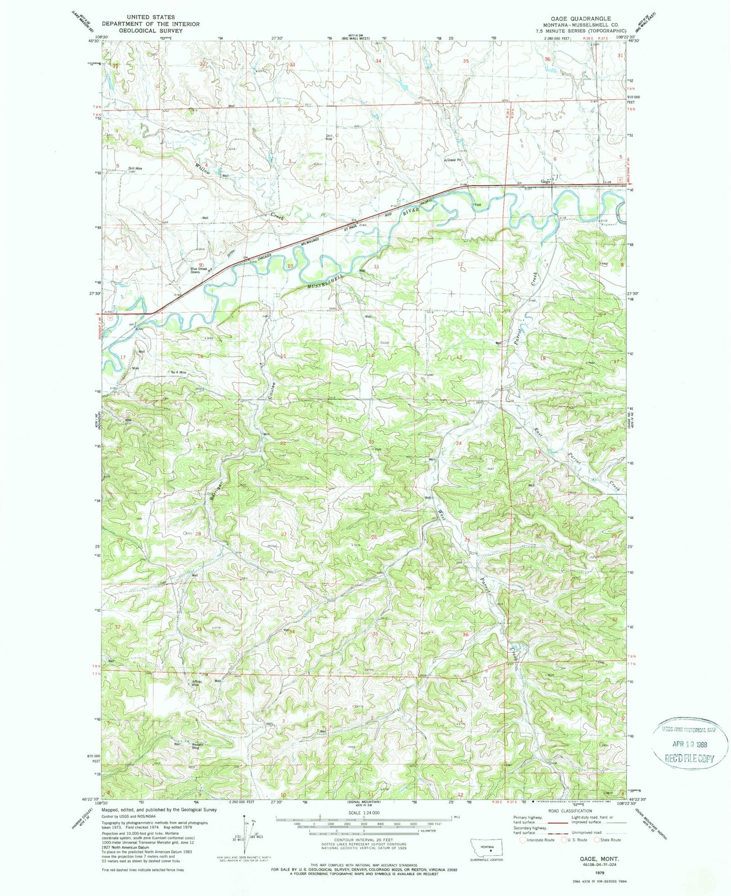
Classic USGS Gage Montana 7.5'x7.5' Topo Map
Couldn't load pickup availability
Historical USGS topographic quad map of Gage in the state of Montana. Map scale may vary for some years, but is generally around 1:24,000. Print size is approximately 24" x 27"
This quadrangle is in the following counties: Musselshell.
The map contains contour lines, roads, rivers, towns, and lakes. Printed on high-quality waterproof paper with UV fade-resistant inks, and shipped rolled.
Contains the following named places: 07N26E02ADCB01 Well, 07N26E03DADA01 Well, 07N26E03DBDA01 Well, 07N26E04AABC01 Well, 07N26E04CDBA01 Well, 07N27E06CBBB01 Well, 07N27E06CCB_01 Well, 07N27E06DCBC01 Well, 07N27E06DDDD01 Well, 08N26E10BBBB01 Well, 08N26E25BACC01 Well, 08N26E25BBDA01 Well, 08N26E25CA__01 Spring, 08N26E25DB__01 Well, 08N26E26DBAD01 Well, 08N26E26DCC_01 Spring, 08N26E27BA__01 Well, 08N26E28CD__01 Well, 08N26E28CDCA01 Well, 08N26E28DB__01 Spring, 08N26E32AAAA01 Well, 08N26E34AC__01 Spring, 08N26E34ADA_01 Spring, 08N26E34ADB_01 Well, 08N26E34CAA_01 Well, 08N26E34DDC_01 Well, 08N26E35BBA_01 Spring, 08N27E29BCA_01 Spring, 08N27E31CCBD01 Well, 08N27E32CDB_01 Spring, Barrigan Coulee, Blue Streak Downs, Davisten, East Parrot Creek, Gage, Gage Post Office, Jeffries Mine, Musselshell County, N-F Ditch, Number 4 Mine, Parrot Creek, West Parrot Creek, Western Mine, Willow Creek