MyTopo
Classic USGS Gagetown Michigan 7.5'x7.5' Topo Map
Couldn't load pickup availability
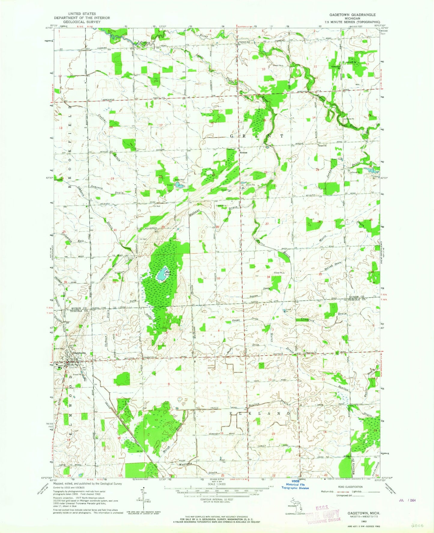
Historical USGS topographic quad map of Gagetown in the state of Michigan. Map scale may vary for some years, but is generally around 1:24,000. Print size is approximately 24" x 27"
This quadrangle is in the following counties: Huron, Tuscola.
The map contains contour lines, roads, rivers, towns, and lakes. Printed on high-quality waterproof paper with UV fade-resistant inks, and shipped rolled.
Contains the following named places: Battle Drain, Boulton Drain, Canboro Post Office, Canboro School, Church of the Nazarene, Columbia Exit, Cooley Drain, Crawford Drain, Elkland Post Office, Elmwood Township Cemetery, Gagetown, Gagetown - Elmwood Township Fire Department, Gagetown Police Department, Gagetown Post Office, Gagetown Public School, Gagetown Station, Gagetown United Methodist Church, Gagetown Village Hall, Grant Cemetery, Grant Church, Greenwood School, Huron Drain, Jameson Drain, Jordan Drain, Knight Drain, Little Pigeon River, Marsh Drain, Mathews Drain, McComb Drain, Moore Drain, Mud Lake, Muntz Drain, Owendale Speedway, Puroy Drain, Rawson Drain, Reorganized Church of Jesus Christ of Latter Days Saints, Rescue, Rescue Post Office, Saint Agatha's Cemetery, Saint Agatha's Church, Shebeon Drain, Sherwood on the Hill Golf Course, Township of Elkland, Township of Grant, Village of Gagetown, Westerby Drain, ZIP Code: 48754