MyTopo
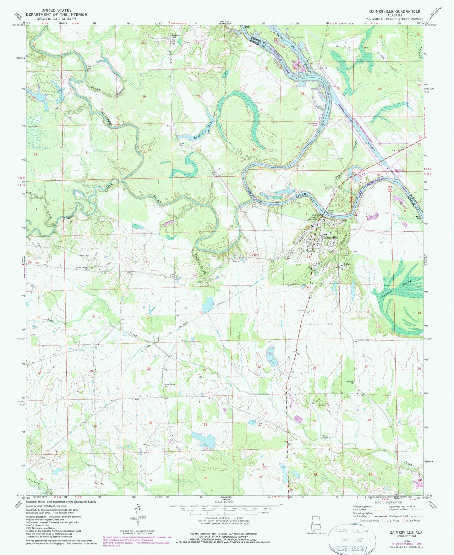
Classic USGS Gainesville Alabama 7.5'x7.5' Topo Map
Couldn't load pickup availability
Historical USGS topographic quad map of Gainesville in the state of Alabama. Map scale may vary for some years, but is generally around 1:24,000. Print size is approximately 24" x 27"
This quadrangle is in the following counties: Greene, Sumter.
The map contains contour lines, roads, rivers, towns, and lakes. Printed on high-quality waterproof paper with UV fade-resistant inks, and shipped rolled.
Contains the following named places: Antioch Church, Archie Institute School, Barns Lake, Barns Pond, Black Belt Community Health Center, Bodka Creek, Buchanan Dam, Buchannon Lake, Caney Creek, Cedar Creek, Chambers Bar, Cherry Bluff, Colgins Island, Cypress Swamp, Daisy Falls Dam, Daisy Falls Lake, Damsite East Bank Public Use Area, Damsite West Bank Public Use Area, Folsum Branch, Forrest Memorial, Gainesville, Gainesville Access Area, Gainesville Bar, Gainesville Division, Gainesville Ferry, Gainesville Headstart School, Gainesville Historic District, Gainesville Post Office, Gainesville Volunteer Fire Department, Gibbs Pond, Hill Ranch Dam, Hill Ranch Pond, Holts Bar, Lower Chicken Cock Bar, Main-Yankee Street Historic District, Negro Slough, New Bethel Baptist Church, New Bethel Cemetery, Nichols Fish Farm, Norwoods Pond, Noxubee Bar, Noxubee River, Nubbin Bend, Odd Fellows Cemetery, Old Cemetery, P M Norwood Dam, Saint Albans Church, Scuma Creek, Smiths Bar, Smiths Ferry, Spring Valley Baptist Church, Springhill Church, Sumter Farm and Stock Company Dam, Sumter Recreation Area, Tennessee-Tombigbee Waterway, Town of Gainesville, Turkey Paw Branch, Tutwiler Bridge, Upper Chicken Cock Bar, Whitsetts Bluff, Whitsetts Ferry, Whitsetts Old Ford Bar, Whitsitts Bar, Woodward Lakes, ZIP Code: 35464