MyTopo
Classic USGS Gaither Arkansas 7.5'x7.5' Topo Map
Couldn't load pickup availability
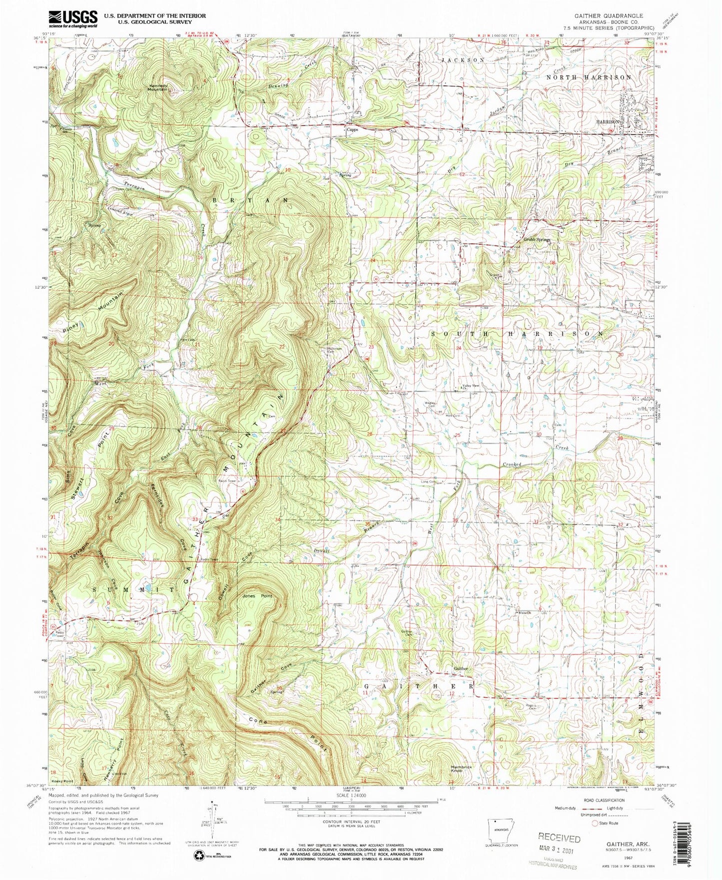
Historical USGS topographic quad map of Gaither in the state of Arkansas. Map scale may vary for some years, but is generally around 1:24,000. Print size is approximately 24" x 27"
This quadrangle is in the following counties: Boone.
The map contains contour lines, roads, rivers, towns, and lakes. Printed on high-quality waterproof paper with UV fade-resistant inks, and shipped rolled.
Contains the following named places: Batavia Census Designated Place, Beaver Lodge Lake, Beaver Lodge Lake Dam, Capps, Capps - Batavia Fire Department Station 1, Capps Presbyterian Church, Capps Road Church of Christ, Coker Cemetery, Cone Point, Dowell Branch, Dowell Cove, East Fork Terrapin Creek, Fernsides Cove, Gaither, Gaither Baptist Church, Gaither Cemetery, Gaither Cove, Gaither Mountain, Gaither Prairie, Grubb Springs, Grubb Springs Baptist Church, Hambrick Knob, Harrison High School, Hill Top Fire Department Station 2, Holt Cemetery, Johnson Cove, Jones Point, Kennedy Mountain, Kosky Point, Krooked Kreek Fire Station Gaither, Long Cemetery, Piney Mountain, Plumly School, Robinson Cemetery, Rogers Cemetery, Sims Cove, Stewart Point, Terrapin Cove, Township of Bryan, Township of Crooked Creek, Township of Gaither, Township of South Harrison, Valley View United Methodist Church, Wagley Cemetery, West Fork Terrapin Creek, White Church