MyTopo
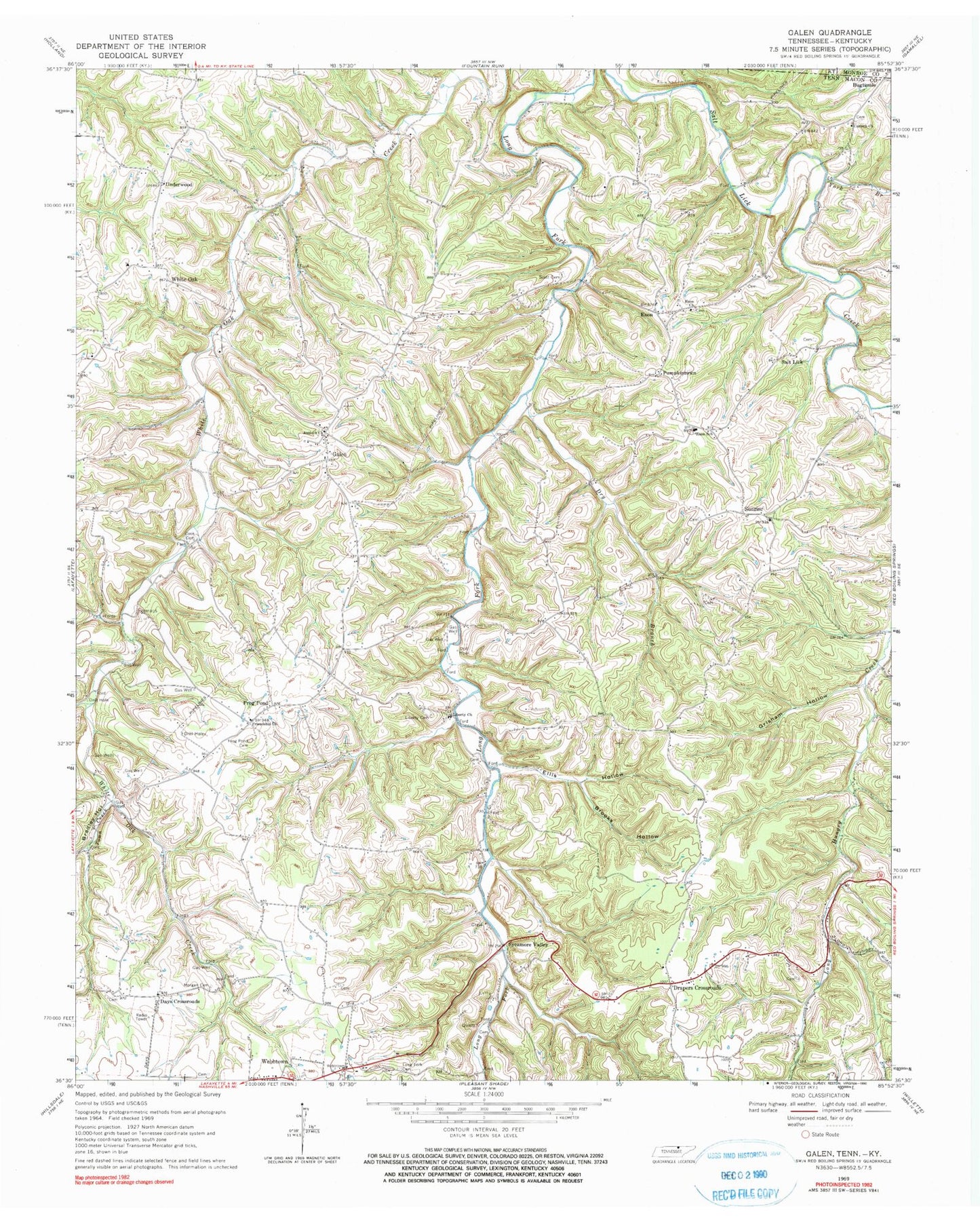
Classic USGS Galen Tennessee 7.5'x7.5' Topo Map
Couldn't load pickup availability
Historical USGS topographic quad map of Galen in the state of Tennessee. Map scale may vary for some years, but is generally around 1:24,000. Print size is approximately 24" x 27"
This quadrangle is in the following counties: Macon, Monroe.
The map contains contour lines, roads, rivers, towns, and lakes. Printed on high-quality waterproof paper with UV fade-resistant inks, and shipped rolled.
Contains the following named places: Antioch Baptist Church, Beech Grove School, Bradley Hollow, Brooks Hollow, Commissioner District 19, Commissioner District 3, Commissioner District 4, Cook Cemetery, Corinth Church, Corinth School, Cornith Gardens Cemetery, Day Cemetery, Days Crossroads, Days Crossroads Baptist Church, Dickens Cemetery, Drapers Crossroads, Drapers School, Dry Branch, Elias McDonald Cemetery, Ellis Hollow, Enon, Enon Cemetery, Enon Church, Enon School, Friendship Church, Frog Pond, Frog Pond Cemetery, Frog Pond School, Galen, Galen School, Grisham Hollow, Highland School, Irving Meador Cemetery, John Brandon Cemetery, Liberty Baptist Church, Liberty Cemetery, Long Fork Cemetery, Long Fork Church, Morgan - Pirtle Cemetery, Moss Hollow, Pleasant Grove Church, Poney McDonald Cemetery, Pumpkintown, Roarks Store, Salt Lick, Scott Cemetery, Sunrise, Sunrise School, Sycamore Valley, Sycamore Valley School, Town Creek, Underwood, Underwood Church, Webbtown, White Oak, Whiteoak Church, York Branch