MyTopo
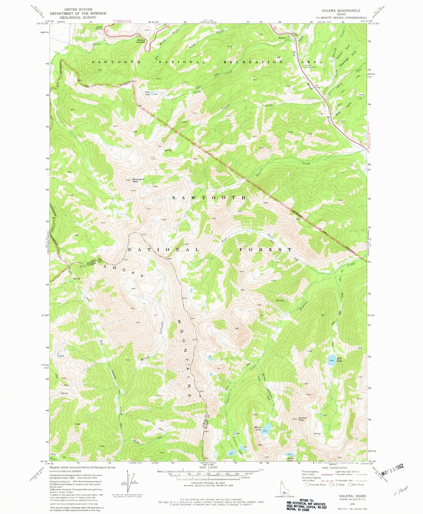
Classic USGS Galena Idaho 7.5'x7.5' Topo Map
Couldn't load pickup availability
Historical USGS topographic quad map of Galena in the state of Idaho. Typical map scale is 1:24,000, but may vary for certain years, if available. Print size: 24" x 27"
This quadrangle is in the following counties: Blaine, Camas.
The map contains contour lines, roads, rivers, towns, and lakes. Printed on high-quality waterproof paper with UV fade-resistant inks, and shipped rolled.
Contains the following named places: Blind Canyon, Bromaghin Peak, Cherry Creek, Copenbarger Gulch, Coyote Creek, Galena Overlook, Galena Pioneer Cemetery, Gladiator Creek, King Creek, Mill Creek, Mill Lake, Miner Canyon, Miner Lake, North Cherry Creek, Norton Lakes, Owl Creek, Prairie Lakes, Quinnlin Gulch, Royal Gorge, Senate Creek, South Cherry Creek, Spring Creek, Titus Creek, Titus Lake, West Fork Prairie Creek, Galena, Galena Summit, Norton Peak, Spring Creek