MyTopo
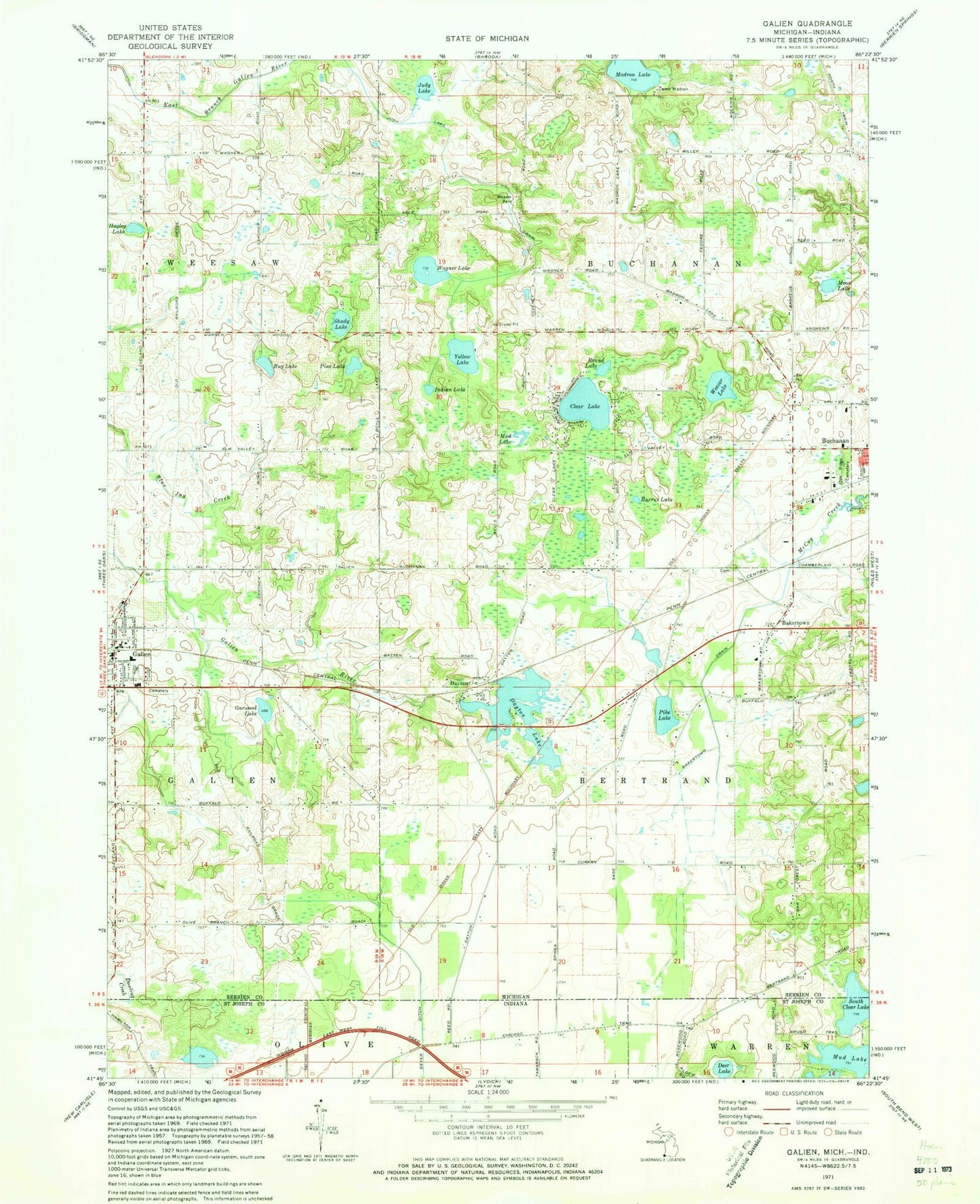
Classic USGS Galien Michigan 7.5'x7.5' Topo Map
Couldn't load pickup availability
Historical USGS topographic quad map of Galien in the states of Michigan, Indiana. Map scale may vary for some years, but is generally around 1:24,000. Print size is approximately 24" x 27"
This quadrangle is in the following counties: Berrien, St. Joseph.
The map contains contour lines, roads, rivers, towns, and lakes. Printed on high-quality waterproof paper with UV fade-resistant inks, and shipped rolled.
Contains the following named places: Bakertown, Bakertown Cemetery, Bakertown Drain, Bertrand Township Fire Department Station 1 Headquarters, Burrus Lake, Camp Madron, Church of the Nazarene, Clear Lake, Dayton, Dayton Cemetery, Dayton Lake, Dayton Post Office, Dayton Station, Deer Lake, East Clear Lake Campground, Galien, Galien High School, Galien Police Department, Galien Post Office, Galien Public Library, Galien Station, Galien Township Cemetery, Galien Township Hall, Galien United Methodist Church, Garwood Lake, Hagley Lake, Hancock Airport, Indian Lake, Judy Lake, Madron Lake, McGowan Cemetery, Moon Lake, Mud Lake, Mud Lake Bog, Oak Ridge Cemetery, Olive Branch Methodist Church, Pike Lake, Pine Lake, Round Lake, Rug Lake, Saint Peters Evangelical Church, Shady Lake, South Clear Lake, Stevens Farm Cemetery, Township of Buchanan, Village of Galien, Wagner Lake, Weaver Lake, Weaver Park, Yellow Lake, ZIP Code: 49107