MyTopo
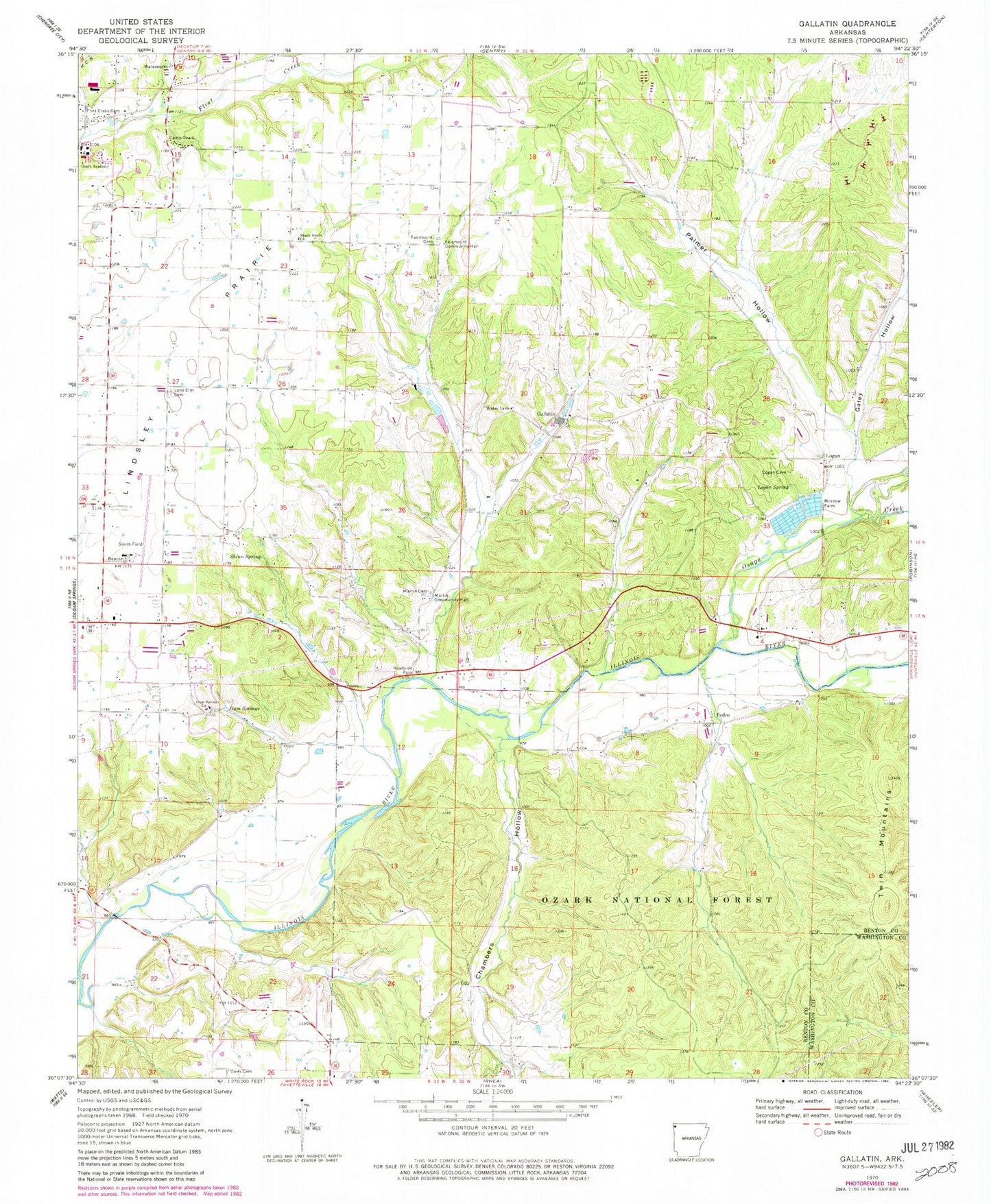
Classic USGS Gallatin Arkansas 7.5'x7.5' Topo Map
Couldn't load pickup availability
Historical USGS topographic quad map of Gallatin in the state of Arkansas. Typical map scale is 1:24,000, but may vary for certain years, if available. Print size: 24" x 27"
This quadrangle is in the following counties: Benton, Washington.
The map contains contour lines, roads, rivers, towns, and lakes. Printed on high-quality waterproof paper with UV fade-resistant inks, and shipped rolled.
Contains the following named places: Township of Ball (historical), Township of Felker (historical), Township of Logan (historical), Township of Yell (historical), Camp Ozark, Davis Cemetery, Fairmount Cemetery, Fairmount Community Hall, Flint Creek Cemetery, Gallatin, Logan, Logan Spring, Lone Elm Cemetery, Martin Cemetery, Martin Community Hall, Ozark Academy, Palmer Hollow, Pedro, Shinn Spring, Twin Mountains, Weddington Hiking Trail, Belview School (historical), Chambers Spring Branch, Fairmount, Fairmount Baptist Church (historical), Fairmount School (historical), Felker (historical), Fisher Ford, Fisher Ford Bridge, Flint (historical), Gum Springs Hollow, Illinois Valley School (historical), Logan Cemetery, Logan Church (historical), Logan Mill (historical), Logan School (historical), Lone Elm (historical), Lone Elm Church (historical), Lone Elm School (historical), Lower Round Top, Martin, Martin School (historical), Martin Valley, Mason School (historical), Mount Pleasant School (historical), Pleasant Grove School (historical), Upper Round Top, Chambers Hollow, Galey Hollow, Gum Springs, Gum Springs Baptist Church, Lindsley Prairie, Osage Creek, Shady Grove Baptist Church, Smith Field, Township 13, Gallatin Fire Department, Logan Cave National Wildlife Refuge