MyTopo
Classic USGS Gallup City Montana 7.5'x7.5' Topo Map
Regular price
$16.95
Regular price
Sale price
$16.95
Unit price
per
Couldn't load pickup availability
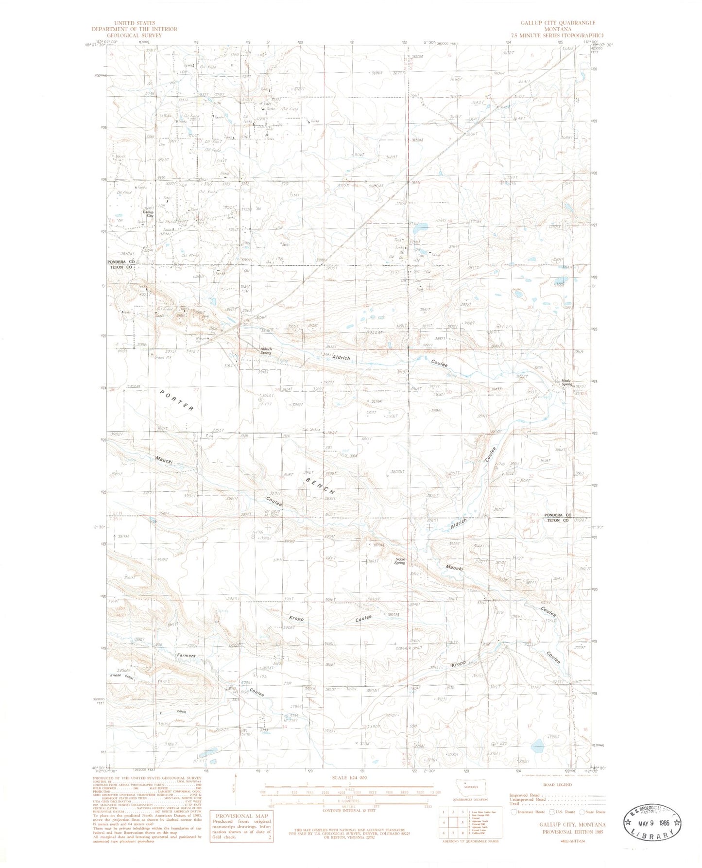
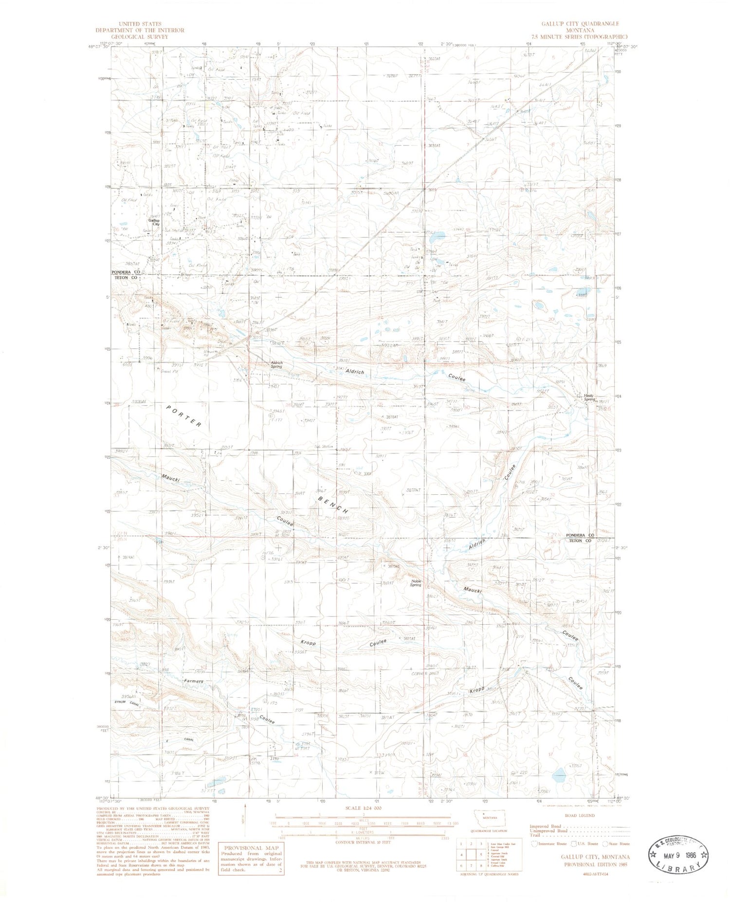
Historical USGS topographic quad map of Gallup City in the state of Montana. Map scale may vary for some years, but is generally around 1:24,000. Print size is approximately 24" x 27"
This quadrangle is in the following counties: Pondera, Teton.
The map contains contour lines, roads, rivers, towns, and lakes. Printed on high-quality waterproof paper with UV fade-resistant inks, and shipped rolled.
Contains the following named places: 26N04W15D___01 Well, Aldrich Coulee, Aldrich Spring, E Canal, Erickson, Erickson School, Gallup City, Gallup City Post Office, Healy Spring, Healy Springs, Maucki Coulee, Morhardt School, Noble Spring, Rowe Kamp School