MyTopo
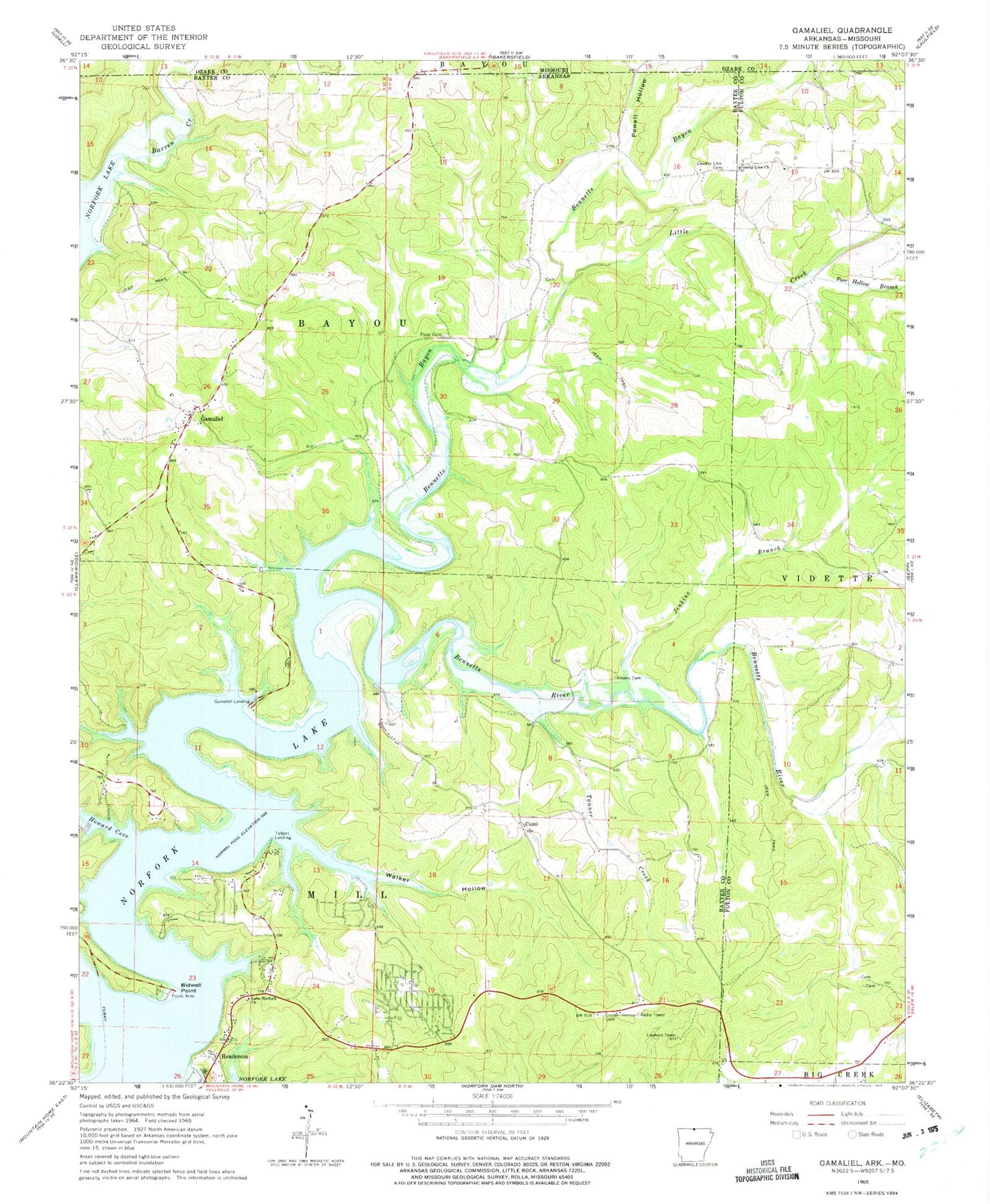
Classic USGS Gamaliel Arkansas 7.5'x7.5' Topo Map
Couldn't load pickup availability
Historical USGS topographic quad map of Gamaliel in the states of Arkansas, Missouri. Map scale may vary for some years, but is generally around 1:24,000. Print size is approximately 24" x 27"
This quadrangle is in the following counties: Baxter, Fulton, Ozark.
The map contains contour lines, roads, rivers, towns, and lakes. Printed on high-quality waterproof paper with UV fade-resistant inks, and shipped rolled.
Contains the following named places: Athens Cemetery, Barren Creek, Bennetts, Bennetts Bayou, Bennetts River, Bidwell Point, Bidwell Point Use Area, Biven Hollow, County Line, County Line Cemetery, County Line Church, County Line School, Cumi, Custer, Custer - Herron Cemetery, Fluty Cemetery, Gamaliel, Gamaliel Cemetery, Gamaliel Census Designated Place, Gamaliel Landing, Gamaliel Post Office, Gamaliel School, Gamaliel Use Area, Henderson, Henderson Census Designated Place, Henderson Post Office, Henderson Volunteer Fire Department, Howard Cove, Howard Cove Use Area, Jenkins Branch, Lake Norfork Church, Little Creek, Norfork Lake Estates, Poor Hollow Branch, Powell Hollow, Talbert Landing, Talbert Use Area, Tanner Creek, Township of Bayou, Township of Mill, Turkey Knob, Walker Branch, Walker Hollow, ZIP Codes: 72537, 72544