MyTopo
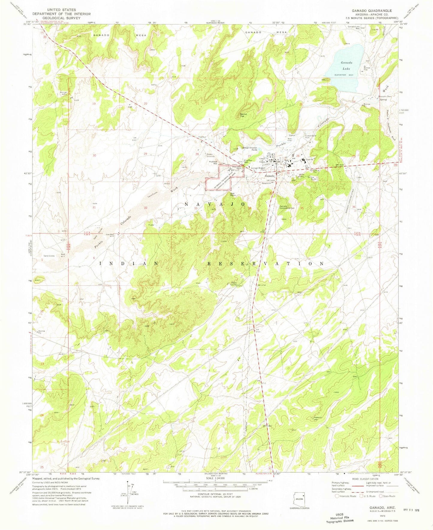
Classic USGS Ganado Arizona 7.5'x7.5' Topo Map
Couldn't load pickup availability
Historical USGS topographic quad map of Ganado in the state of Arizona. Map scale may vary for some years, but is generally around 1:24,000. Print size is approximately 24" x 27"
This quadrangle is in the following counties: Apache.
The map contains contour lines, roads, rivers, towns, and lakes. Printed on high-quality waterproof paper with UV fade-resistant inks, and shipped rolled.
Contains the following named places: College of Ganado, Cottonwood Park, Ella Mae Well, Ganado, Ganado Airport, Ganado Ambulance Service, Ganado Census Designated Place, Ganado Community Cemetery, Ganado Dam, Ganado Fire Department, Ganado Intermediate School, Ganado Lake, Ganado Lake Campground, Ganado Lake Well, Ganado Middle School, Ganado Mission Cemetery, Ganado Post Office, Ganado Primary School, Ganado Trading Post, Hubbell Hill, Hubbell Trading Post National Historic Site, Joes Well, Naakai N Daachaahi Wash, Red Point, Round Top, Round Top Trading Post, Sage Memorial Hospital