MyTopo
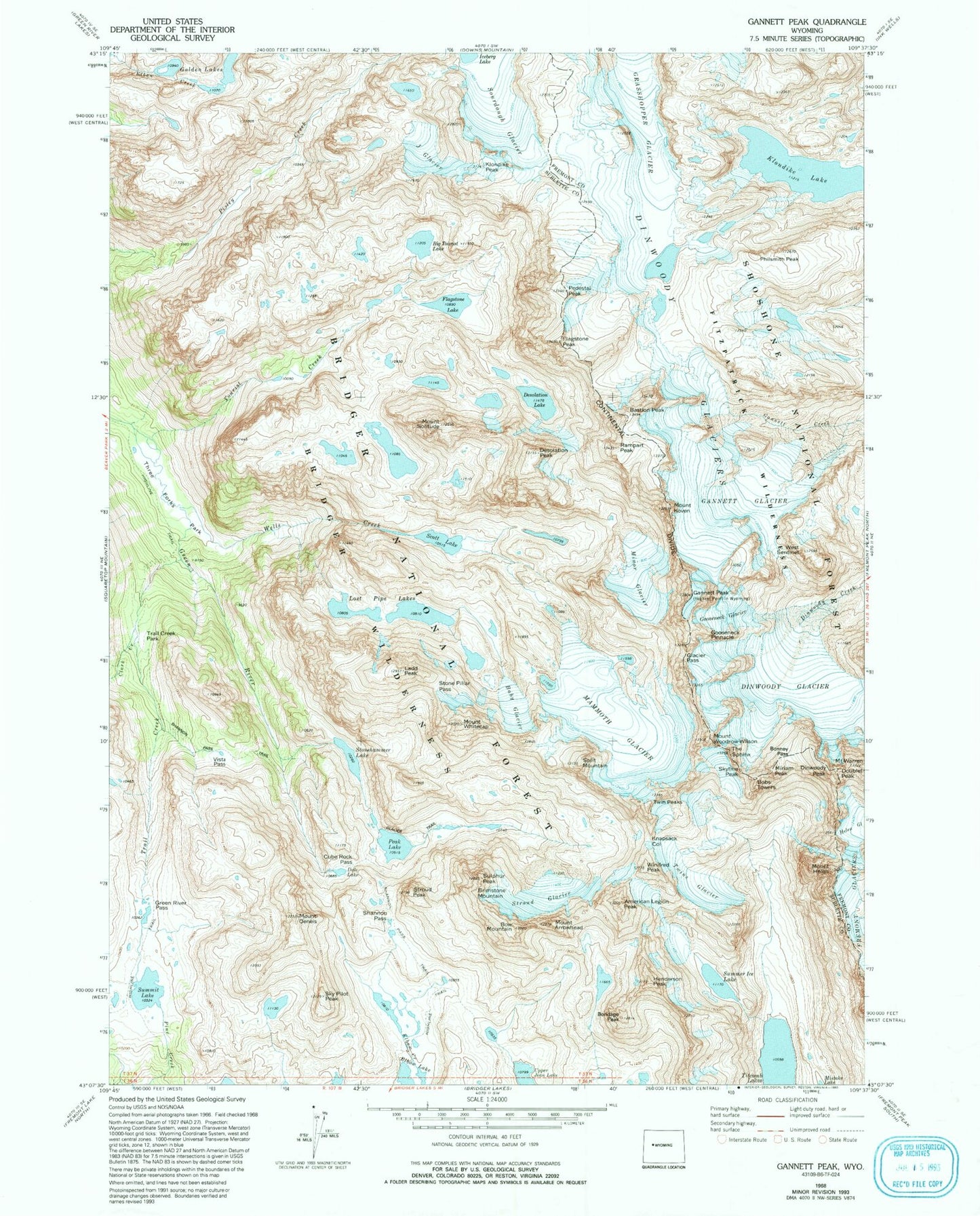
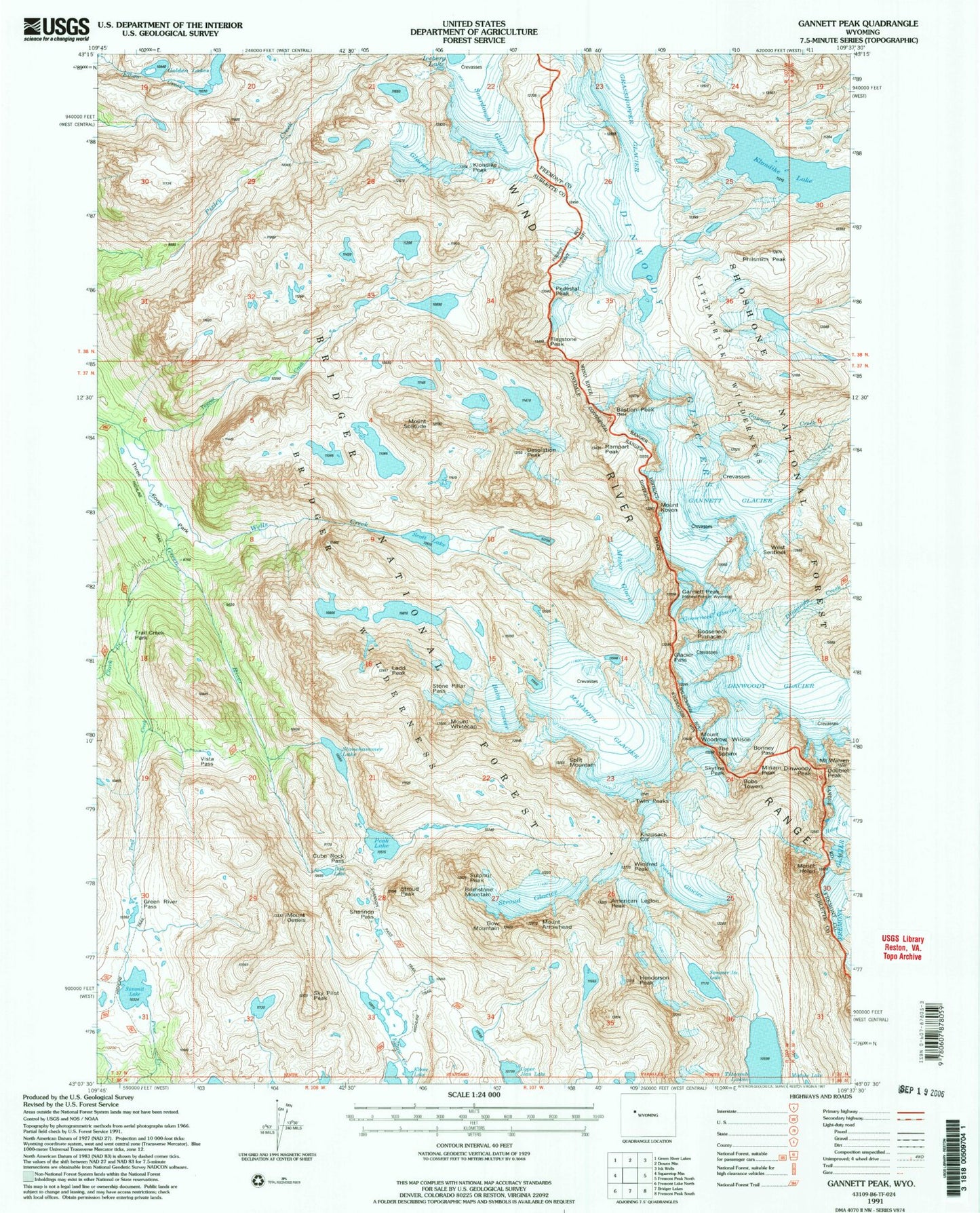
USGS Classic Gannett Peak Wyoming 7.5'x7.5' Topo Map
Couldn't load pickup availability
Historical USGS topographic quad map of Gannett Peak in the state of Wyoming. Scale: 1:24000. Print size: 24" x 27"
This quadrangle is in the following counties: Fremont, Sublette.
The map contains contour lines, roads, rivers, towns, lakes, and grids including latitude / longitude and UTM / MGRS. Printed on high-quality waterproof paper with UV fade-resistant inks.
Contains the following named places: American Legion Peak, Mount Arrowhead, Baby Glacier, Bastion Peak, Bobs Towers, Bow Mountain, Brimstone Mountain, Clark Creek, Cube Rock Pass, Dale Lake, Desolation Peak, Dinwoody Glacier, Dinwoody Glaciers, Doublet Peak, Gannett Glacier, Gannett Peak, Glacier Pass, Golden Lakes, Gooseneck Glacier, Gooseneck Pinnacle, Grasshopper Glacier, Green River Pass, Mount Helen, Henderson Peak, J Glacier, Klondike Lake, Klondike Peak, Knapsack Col, Mount Koven, Ladd Peak, Mammoth Glacier, Miriam Peak, Mount Oeneis, Peak Lake, Pedestal Peak, Philsmith Peak, Rampart Peak, Scott Lake, Shannon Pass, Shannon Pass Trail, Sky Pilot Peak, Skyline Peak, Mount Solitude, Sourdough Glacier, Split Mountain, Stone Pillar Pass, Stonehammer Lake, Stroud Glacier, Stroud Peak, Sulphur Peak, Summer Ice Lake, Summit Lake, The Sphinx, Three Forks Park, Tourist Creek, Trail Creek, Trail Creek Park, Twin Peaks, Twins Glacier, Upper Jean Lake, Vista Pass, Mount Warren, Wells Creek, West Sentinel, Mount Whitecap, Winifred Peak, Mount Woodrow Wilson, Minor Glacier, Dinwoody Peak, Glacier Trail, Flagstone Peak, Bonney Pass, Big Tourist Lake, Flagstone Lake, Desolation Lake, Lost Pipe Lakes