MyTopo
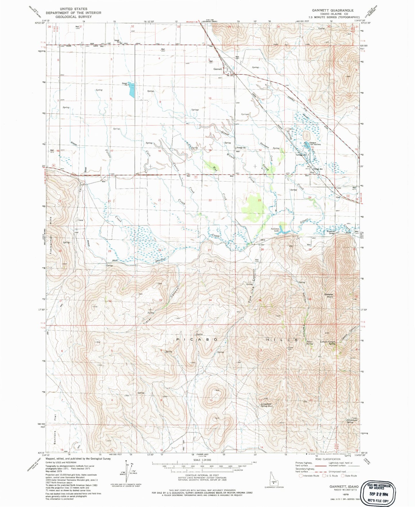
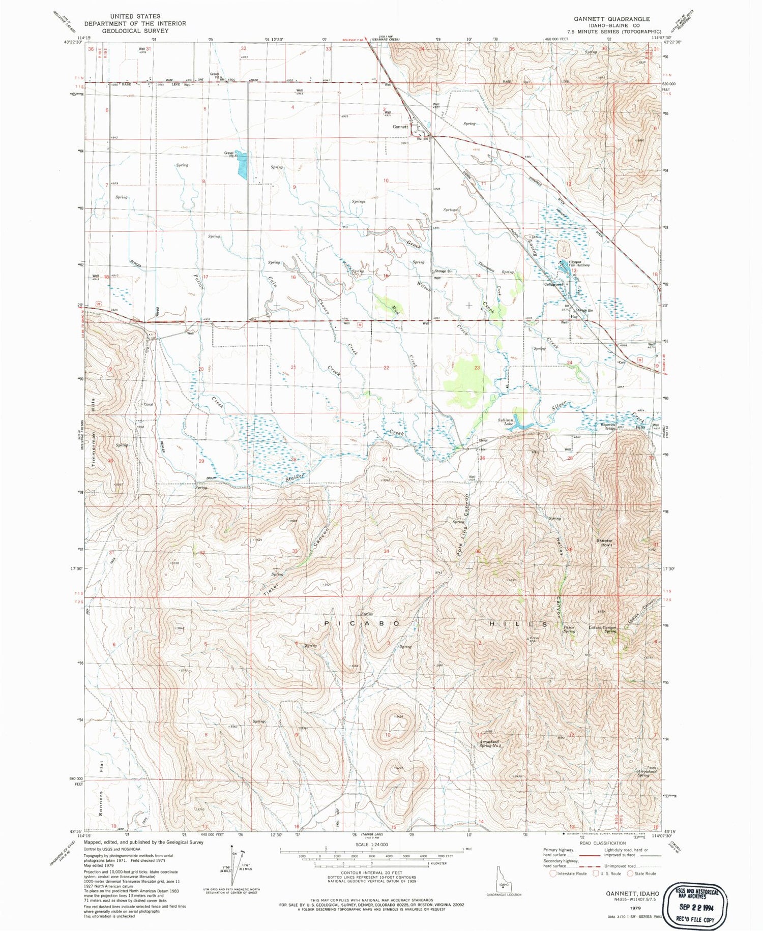
Classic USGS Gannett Idaho 7.5'x7.5' Topo Map
Couldn't load pickup availability
Historical USGS topographic quad map of Gannett in the state of Idaho. Map scale may vary for some years, but is generally around 1:24,000. Print size is approximately 24" x 27"
This quadrangle is in the following counties: Blaine.
The map contains contour lines, roads, rivers, towns, and lakes. Printed on high-quality waterproof paper with UV fade-resistant inks, and shipped rolled.
Contains the following named places: Albrethsen Dam, Arrowhead Spring, Arrowhead Spring Number Two, Buhler Drain, Butte Creek, Cain Creek, Chaney Creek, Gannett, Gannett Census Designated Place, Grove Creek, Hailey Canyon, Hayspur Fish Hatchery, Highline Ditch, Kilpatrick Bridge, Leduck Canyon Spring, Loving Creek, Mud Creek, Pasco Spring, Patton Creek, Picabo Hills, Pole Line Canyon, Skeeter Point, Stalker Creek, Stanfield Ditch, Sullivan Lake, Thompson Creek, Tieter Canyon, Wilson Creek