
MyTopo
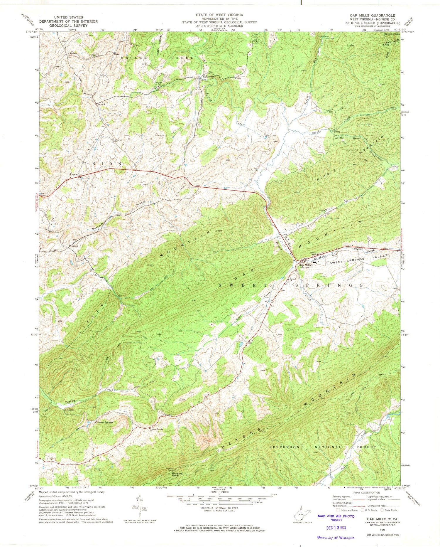
Classic USGS Gap Mills West Virginia 7.5'x7.5' Topo Map
Couldn't load pickup availability
Historical USGS topographic quad map of Gap Mills in the state of West Virginia. Map scale may vary for some years, but is generally around 1:24,000. Print size is approximately 24" x 27"
This quadrangle is in the following counties: Monroe.
The map contains contour lines, roads, rivers, towns, and lakes. Printed on high-quality waterproof paper with UV fade-resistant inks, and shipped rolled.
Contains the following named places: Amana Christian Day School, Back Creek, Big Branch, Browns Chapel, Bruffeys Memorial United Methodist Church, Carmel Presbyterian Church, Central Church, Cove Mountain, Crescent School, Crimson Spring Church, Crimson Springs, Devil Creek, Dorr, Dry Run, Eastern District, Elk Knob, Fairview Church, Forest Run, Gap Mills, Gap Mills Cemetery, Gap Mills Elem/Jr High School, Gap Mills Ruritan Memorial Bridge, Gap Mills Spring, Gap Mills United Methodist Church, Gates, Hanging Rock, Hanging Rock Lookout, Hanging Rock Lookout Tower, Hillsdale, Hillsdale Church, Hollywood, Hull School, Keenan, Kitchen Creek, Little Devil Creek, McGlone, Oak Grove Baptist Church, Red Mill, Schley School, Second Creek Spring, Spring Hill School, Sweet Springs District, Turkey Creek Spring, Turkey Creek Springs, Union Community Volunteer Fire Department Gap Mills Station, Woodland School, Zenith School


