MyTopo
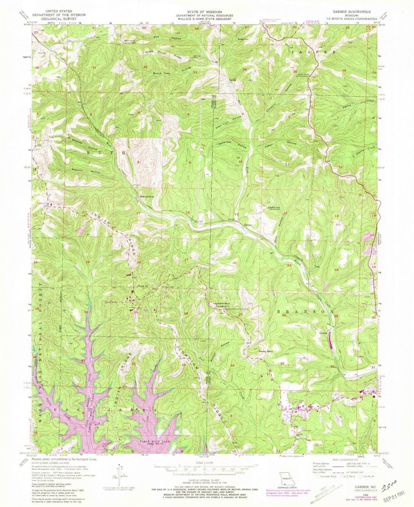
Classic USGS Garber Missouri 7.5'x7.5' Topo Map
Couldn't load pickup availability
Historical USGS topographic quad map of Garber in the state of Missouri. Map scale may vary for some years, but is generally around 1:24,000. Print size is approximately 24" x 27"
This quadrangle is in the following counties: Stone, Taney.
The map contains contour lines, roads, rivers, towns, and lakes. Printed on high-quality waterproof paper with UV fade-resistant inks, and shipped rolled.
Contains the following named places: Board Tree Hollow, Boston Center Community Building, Branson Fire Department Station 2, Branson Fire Department Station 3, Branson Memorial Airport, Branson West, Branson West Post Office, Cedar Hollow, City of Branson, Clifford and Lavon, Compton Ridge, Coxs Bald, Deer Lick Hollow, Dewey Bald, Dewey Cove, Dewey Grove School, Doe Hollow, East Fork Roark Creek, Evergreen Cemetery, Garber, Garber Bald, Garber School, Grape Rough Ridge, Gretna, Gretna Cemetery, Indian Point, Indian Point Park, Indian Point Public Use Area, Indian Ridge, Inspiration Point, Inspiration Tower, Irma, Jack Justus Park, Jim Lane Cabin, John the Diver Airport, Keeter Park, KLFC-FM (Branson), Lakeview, Ledgestone Golf Course, Lewallen Cemetery, Limekiln Hollow, Little North Indian Creek, Long Bald, Marvel Cave, Marvel Cave School, McDonald Lake, Mills Hollow, Mutton Hollow, Notch, Notch Community Church, Oakland School, Old Matts Cabin, Possum Haw Hollow, Reeds Spring Lookout Tower, Reeds Spring Tunnel, Rock Lane Lodge Marina, Ruth and Paul Henning Conservation Area, Sawmill Hollow, Shepherd of the Hills Historical Society Dam, Shepherd of the Hills Homestead, Silver Dollar City, South Coxs Bald, Southern Stone County Fire Protection District Station 1, Southern Stone County Fire Protection District Station 10, Sycamore Log Church, Table Rock Heliport, Thelma, This Gospel Tabernacle, Thousand Hills Golf Course, Township of Branson, Township of Ruth C, Township of Ruth C Rural, Township of Sunset Cove, Uncle Ikes Post Office, Village of Indian Point, Waterfall Hollow, West Fork Roark Creek, Western Taney County Fire Protection District Station 10, White Cedar Bald, White River Balds Natural Area, Wildcat Hollow, ZIP Code: 65737