MyTopo
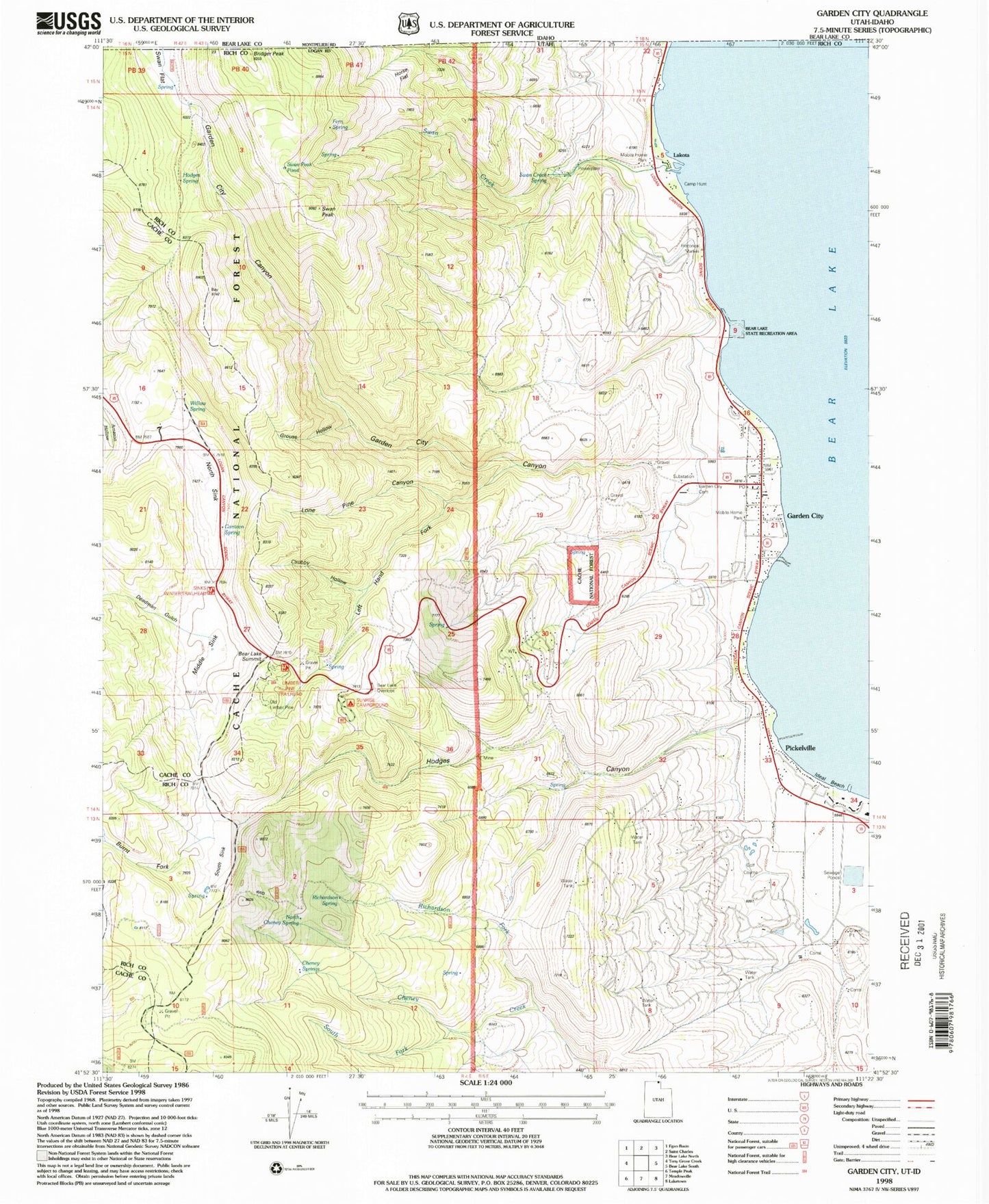
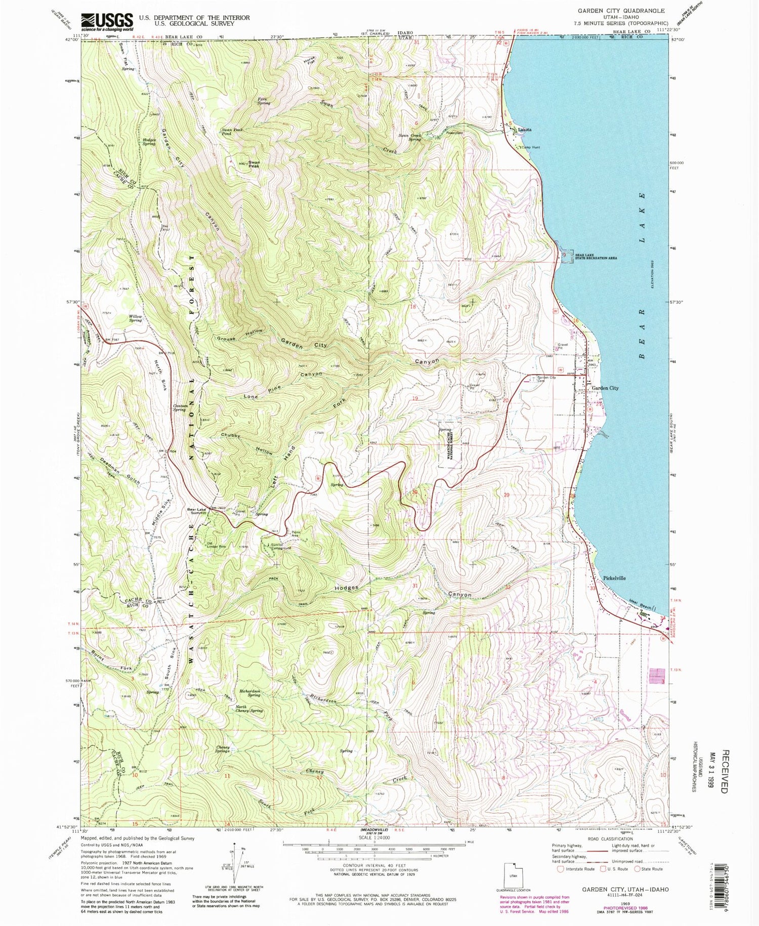
Classic USGS Garden City Utah 7.5'x7.5' Topo Map
Couldn't load pickup availability
Historical USGS topographic quad map of Garden City in the state of Utah. Map scale may vary for some years, but is generally around 1:24,000. Print size is approximately 24" x 27"
This quadrangle is in the following counties: Bear Lake, Cache, Rich.
The map contains contour lines, roads, rivers, towns, and lakes. Printed on high-quality waterproof paper with UV fade-resistant inks, and shipped rolled.
Contains the following named places: Bear Lake Marina Campground, Bear Lake Overlook, Bear Lake State Park, Bear Lake Summit, Bridger Peak, Burnt Fork, Camp Hunt, Canteen Spring, Cheney Springs, Chubby Hollow, Deadman Gulch, Fays Trailer Park, Fern Spring, Garden, Garden Census Designated Place, Garden City, Garden City Canyon, Garden City Cemetery, Garden City Fire Department, Garden City Post Office, Grouse Hollow, Hodges Canyon, Hodges Spring, Horse Flat, Ideal Beach, Lake-Air Airport, Lakota, Left Hand Fork Lone Pine Canyon, Limber Pine Trail, Limber Pine Trail Head, Lone Pine Canyon, Middle Sink, North Cheney Spring, North Sink, Old Limber Pine, Pickelville, Rich County Ambulance Mobile Unit - Garden City, Richardson Fork, Richardson Spring, South Fork Cheney Creek, South Sink, Sunrise Campground, Swan Creek, Swan Creek Spring, Swan Flat, Swan Peak, Swan Peak Pond, The Church of Jesus Christ of Latter Day Saints, Town of Garden City, Willow Spring, ZIP Code: 84028