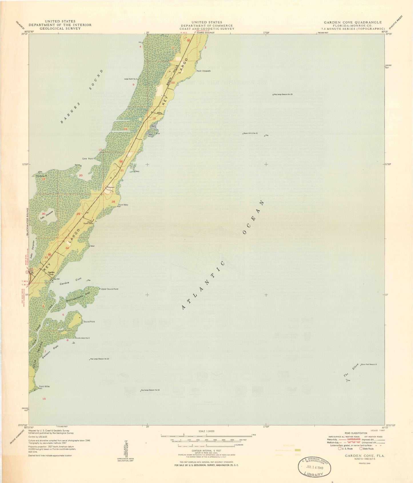
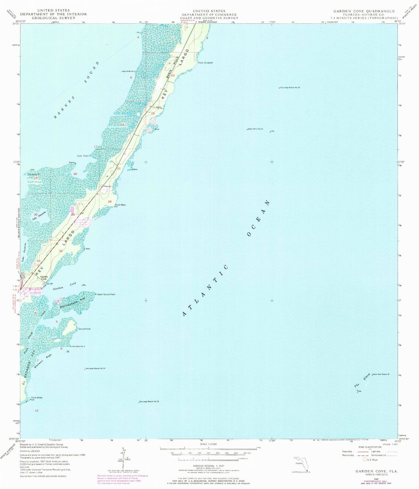
MyTopo
Classic USGS Garden Cove Florida 7.5'x7.5' Topo Map
Couldn't load pickup availability
Historical USGS topographic quad map of Garden Cove in the state of Florida. Map scale may vary for some years, but is generally around 1:24,000. Print size is approximately 24" x 27"
This quadrangle is in the following counties: Monroe.
The map contains contour lines, roads, rivers, towns, and lakes. Printed on high-quality waterproof paper with UV fade-resistant inks, and shipped rolled.
Contains the following named places: Basin Hill Light Number 31, Basin Hills, Captain Roys Reef, Cove Point, Crocodile Lake National Wildlife Refuge, Elbow Reef Beacon B, Elbow Reef Light 6, Garden Cove, Garden Cove Marina, Higdons Reef, Key Largo, Key Largo Baptist Church, Key Largo Beacon Number 22, Key Largo Beacon Number 29, Key Largo Beacon Number 33, Key Largo Volunteer Fire Rescue Station 25, Lake Simmons, North Dry Rocks, North North Dry Rocks, North Sound Creek, Point Elizabeth, Point Mary, Point Willie, Rattlesnake Key, Sound Point, The Elbow, Thursday Point, Upper Sound Point, Whitmore Bight