MyTopo
Classic USGS Garden Valley Oregon 7.5'x7.5' Topo Map
Couldn't load pickup availability
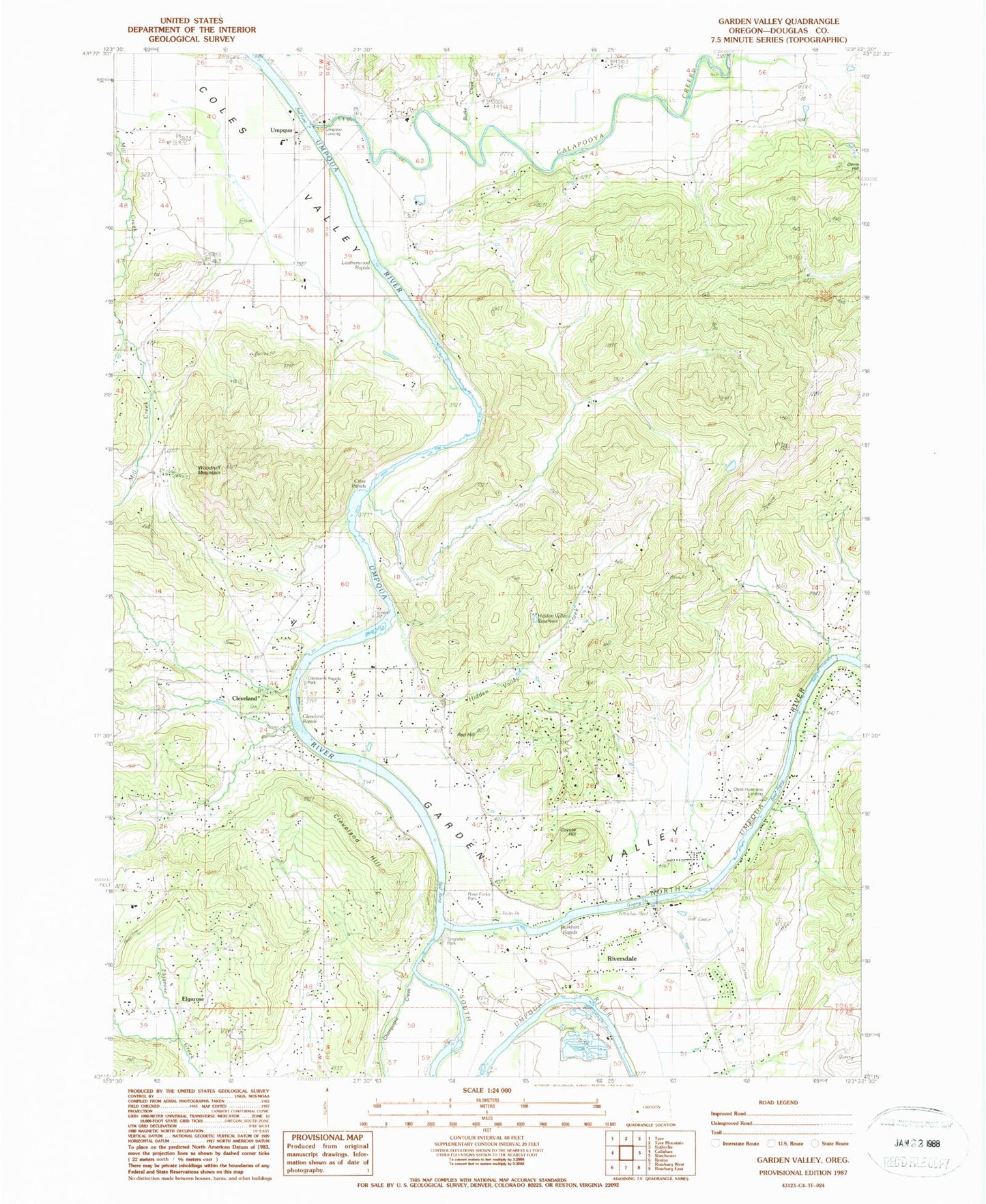
Historical USGS topographic quad map of Garden Valley in the state of Oregon. Map scale may vary for some years, but is generally around 1:24,000. Print size is approximately 24" x 27"
This quadrangle is in the following counties: Douglas.
The map contains contour lines, roads, rivers, towns, and lakes. Printed on high-quality waterproof paper with UV fade-resistant inks, and shipped rolled.
Contains the following named places: Archambeaux Family Cemetery, Browns Bridge, Burke Creek, Burkhart Rapids, Calapooya Creek, Champagne Creek, Champagne Creek Valley, Champaigne Family Cemetery, Cleveland, Cleveland Cemetery, Cleveland Hill, Cleveland Post Office, Cleveland Rapids, Cleveland Rapids County Park Boat Ramp, Coles Valley Cemetery, Coles Valley Creek, Coyote Hill, Crow Rapids, Doerner Reservoir, Douglas County Fire District 2, Douglas County Fire District 2 Station 5, Eden Cemetery, Elgarose, Elgarose Post Office, French Settlement Post Office, Garden Valley, Garden Valley School, Harmon Airport, Hestness Landing County Park Boat Ramp, Hestness Park, Hidden Valley Creek, Hidden Valley Reservoir, La Brie Family Cemeteries, Laraut Post Office, Melrose Census Designated Place, North Umpqua River, Pitchford Boys Ranch, Red Hill, River Forks County Park, River Forks County Park Boat Ramp, Riversdale, Singleton Park, South Umpqua River, Sutherlin Creek, Twin Rivers Campground, Umpqua, Umpqua Basin Water Association Water Treatment Plant, Umpqua Landing, Umpqua Landing County Park Boat Ramp, Umpqua Post Office, Willow Creek, Winniford Post Office, Woodruff Mountain


