MyTopo
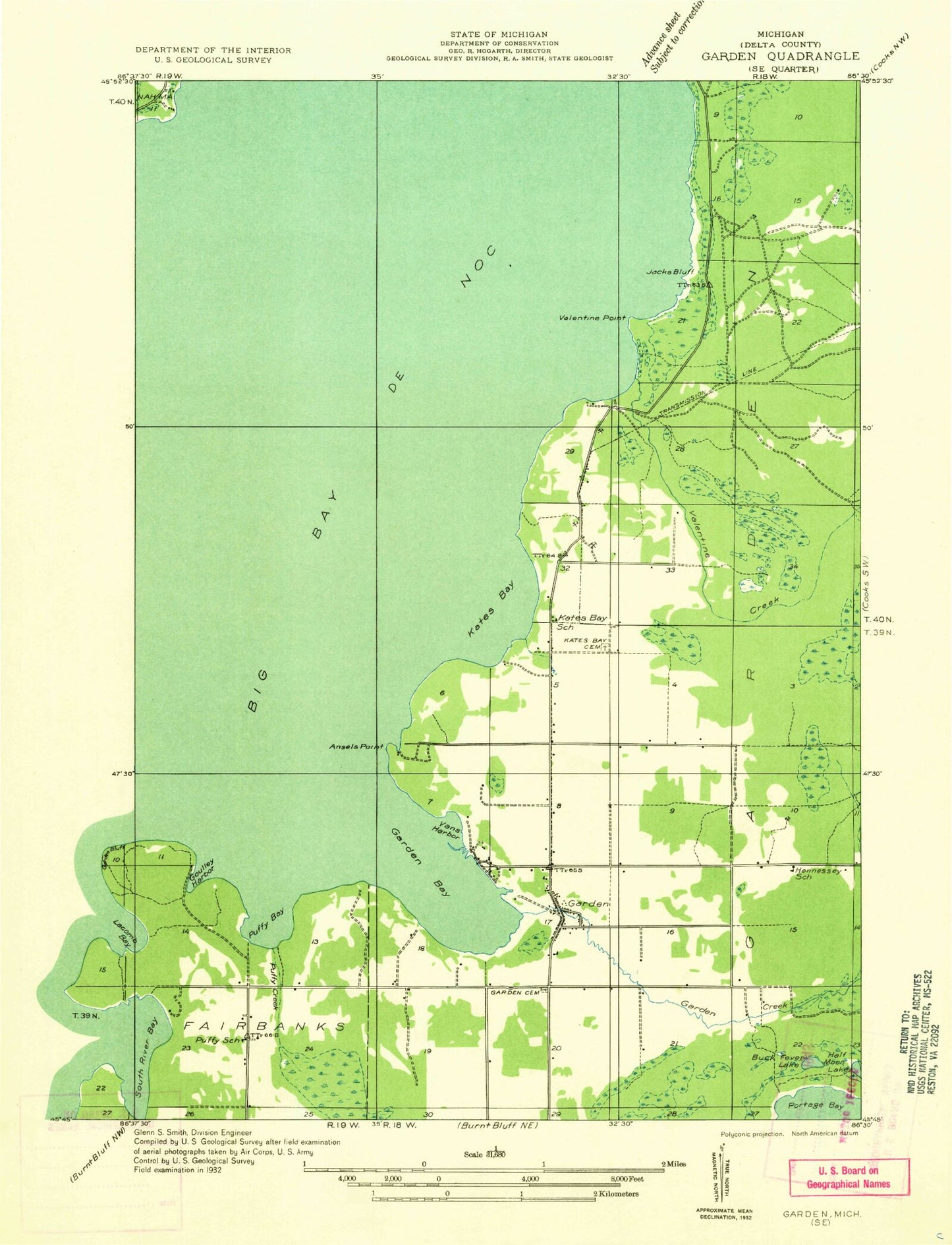
Classic USGS Garden Michigan 7.5'x7.5' Topo Map
Couldn't load pickup availability
Historical USGS topographic quad map of Garden in the state of Michigan. Map scale may vary for some years, but is generally around 1:24,000. Print size is approximately 24" x 27"
This quadrangle is in the following counties: Delta.
The map contains contour lines, roads, rivers, towns, and lakes. Printed on high-quality waterproof paper with UV fade-resistant inks, and shipped rolled.
Contains the following named places: Ansels Point, Bailey Family Cemetery, Biddle House Historical Marker, Big Bay de Noc School, Buck Fever Lake, Cousineau - Potvin Family Cemetery, Garden, Garden Area Catholic Churches, Garden Bay, Garden Congregational Church, Garden Creek, Garden Post Office, Garden Township Volunteer Fire Department, Goully Harbor, Jacks Bluff, Kates Bay, Kates Bay Cemetery, New Garden Cemetery, Old Garden Cemetery, Puffy Bay, Puffy Creek, Tristar Emergency Medical Services Station 1, Tri-Valley Golf Course, Valentine Creek, Valentine Point, Vans Harbor, Vans Harbor Post Office, Village of Garden