MyTopo
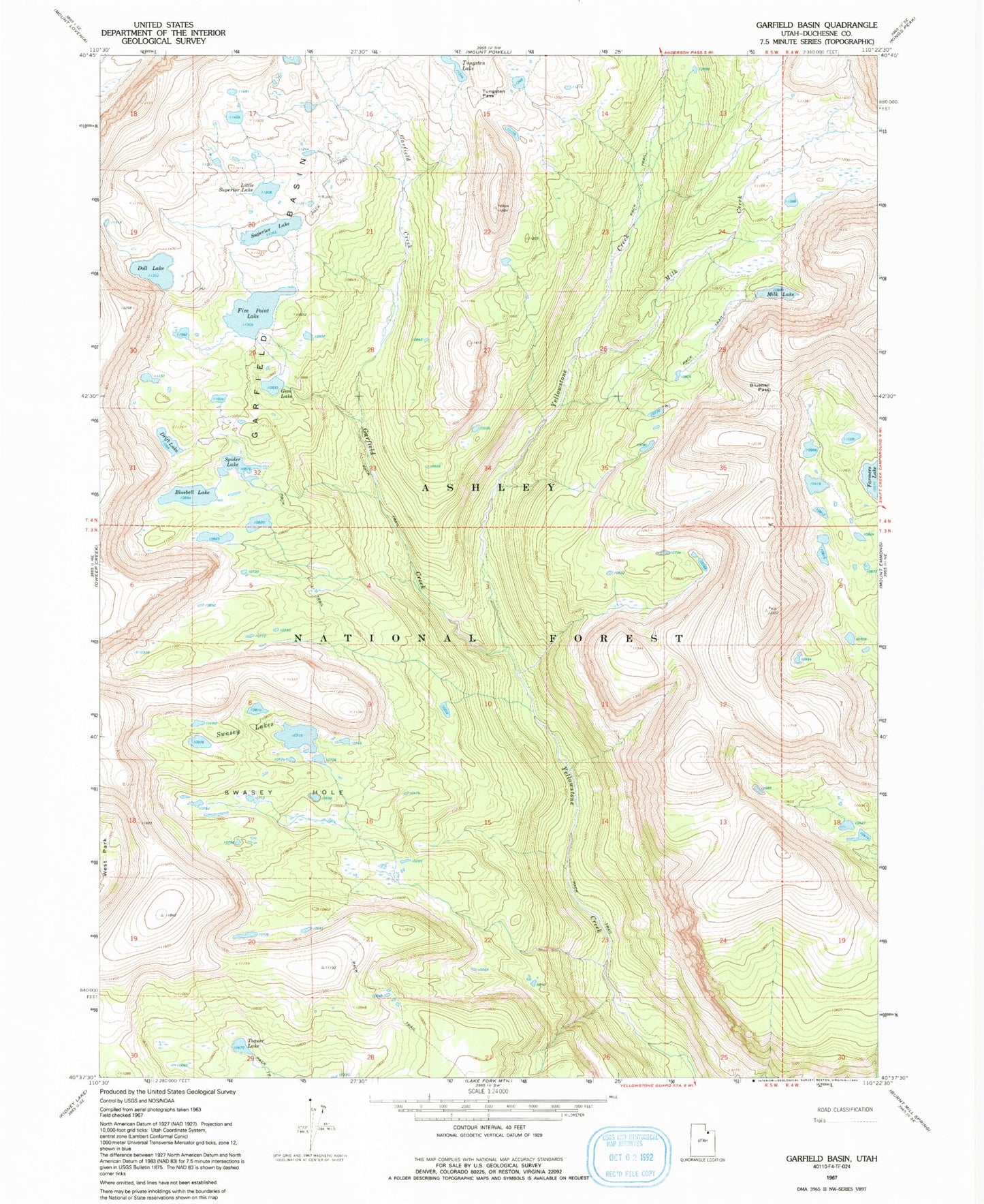
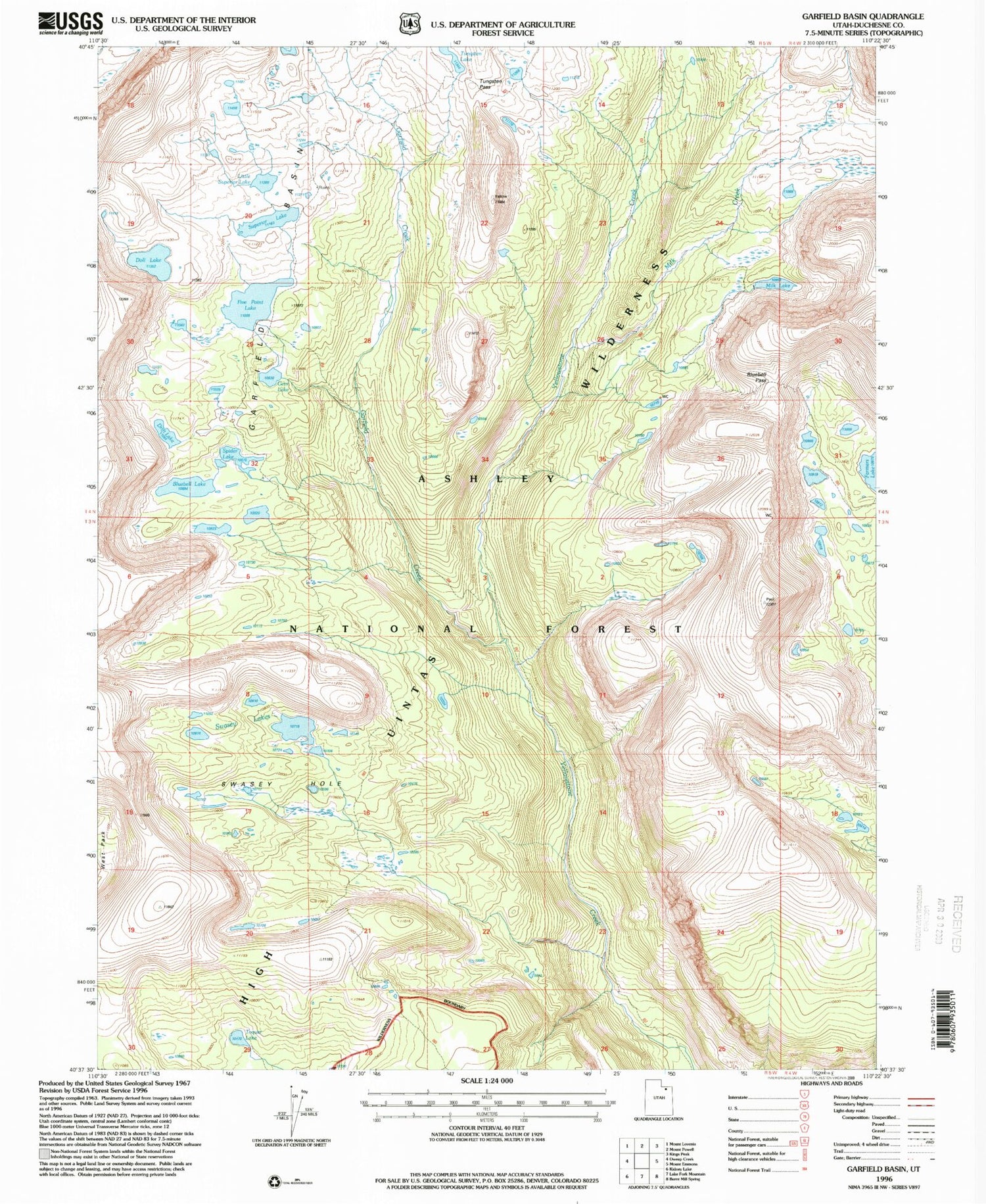
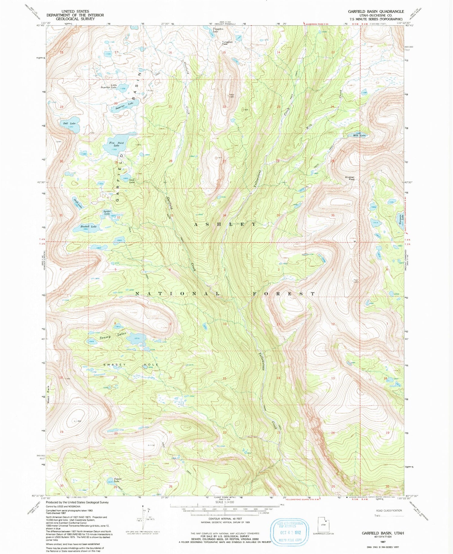
Classic USGS Garfield Basin Utah 7.5'x7.5' Topo Map
Couldn't load pickup availability
Historical USGS topographic quad map of Garfield Basin in the state of Utah. Typical map scale is 1:24,000, but may vary for certain years, if available. Print size: 24" x 27"
This quadrangle is in the following counties: Duchesne.
The map contains contour lines, roads, rivers, towns, and lakes. Printed on high-quality waterproof paper with UV fade-resistant inks, and shipped rolled.
Contains the following named places: Bluebell Lake, Bluebell Pass, Doll Lake, Drift Lake, Five Point Lake, Gem Lake, Little Superior Lake, Milk Lake, Spider Lake, Superior Lake, Swasey Hole, Swasey Lakes, Toquer Lake, Tungsten Pass, Drift Lake Dam, Five Point Lake Dam, Milk Lake Dam, Superior Lake Dam, Farmers Lake, Garfield Basin, Garfield Creek, Milk Creek, Five Point Forest Service Station, North Duchesne Division, High Uintas Wilderness