MyTopo
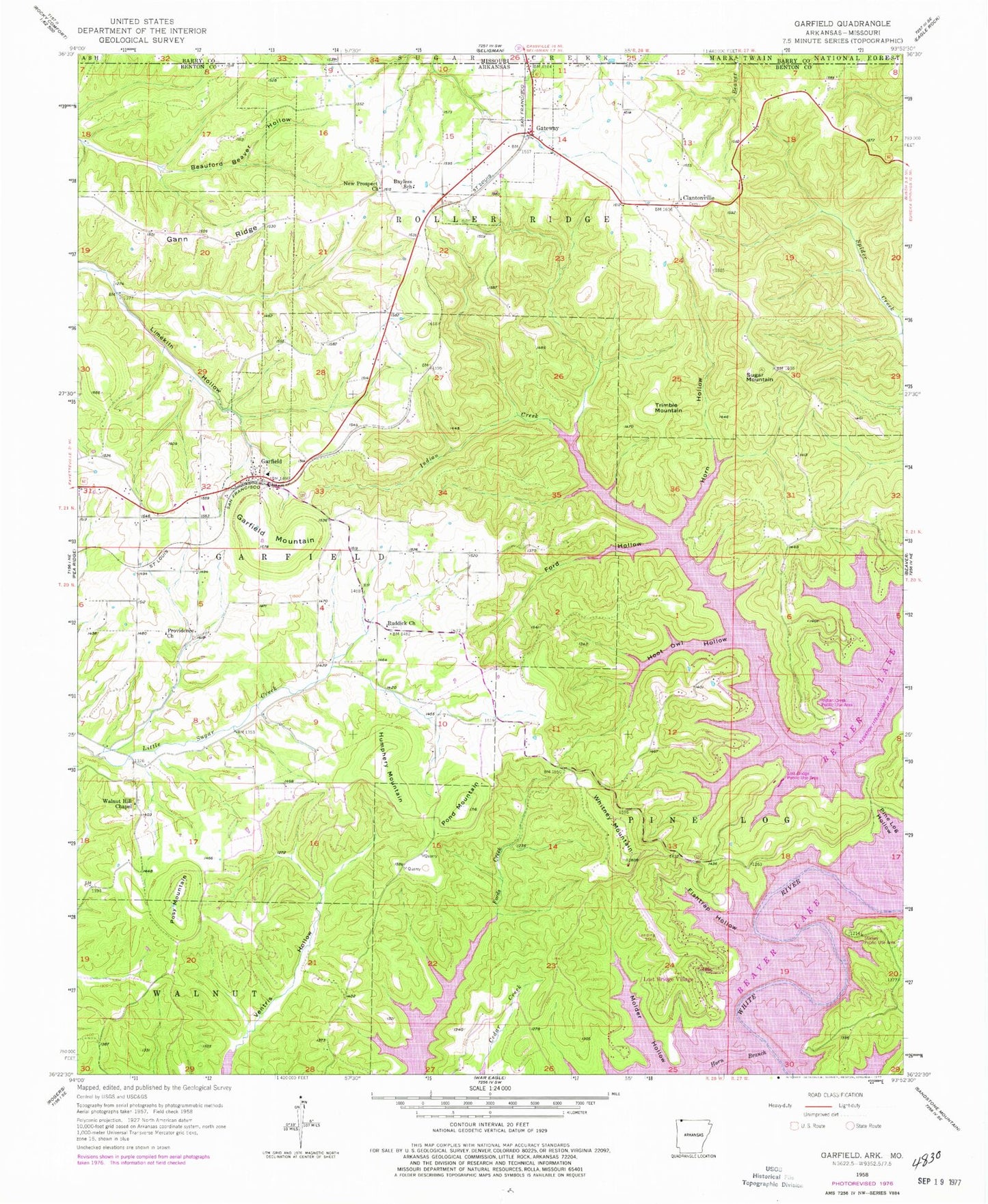
Classic USGS Garfield Arkansas 7.5'x7.5' Topo Map
Couldn't load pickup availability
Historical USGS topographic quad map of Garfield in the state of Arkansas. Typical map scale is 1:24,000, but may vary for certain years, if available. Print size: 24" x 27"
This quadrangle is in the following counties: Barry, Benton, Carroll.
The map contains contour lines, roads, rivers, towns, and lakes. Printed on high-quality waterproof paper with UV fade-resistant inks, and shipped rolled.
Contains the following named places: Beauford Beaver Hollow, Ford Hollow, Hoot Owl Hollow, Horn Branch, Horn Hollow, Pond Mountain, Gateway, Lost Bridge Village, Trimble Mountain, Township of Garfield (historical), Township of Pine Log (historical), Township of Roller Ridge (historical), Bayless Cemetery, Clantonville Cemetery, Clantonville School (historical), Devils Eye Brow, Devils Eyebrow, Fishtrap Ford (historical), Garfield Baptist Church, Garfield Church of Christ, Garfield Elementary School, Gateway Assembly of God Church, Glasscock Mountain, Henry Mountain, Hill Top, Hurd (historical), Gentry Mountain, Lost Bridge (historical), Osborn (historical), Providence School (historical), Rich Mountain, Ruddick School (historical), Starkey Hollow, Taylor Branch, Vista Shores, Walnut Hill, Walnut Hill School (historical), Williams Mountain, Walnut Hill Cemetery, Bayless School, Clantonville, Fishtrap Hollow, Gann Ridge, Garfield, Garfield Mountain, Humphery Mountain, Indian Creek Public Use Area, Limekiln Hollow, Lost Bridge Public Use Area, Molder Hollow, New Prospect Baptist Church, Posy Mountain, Providence Primitive Baptist Church, Reddick Assembly of God Church, Starkey Public Use Area, Sugar Mountain, Walnut Hill Chapel Baptist Church, Whitney Mountain, Gateway Post Office, KISK-FM (Lowell), KAMO-FM (Rogers), KJEM-FM (Seligman) (historical), Township 1, Nebco Fire Department, Nebco Fire Department Station 4, Northeast Benton County Fire Department Station 2, Northeast Benton County Fire Department Station 3, Volunteer Ambulance Service Northeast Benton County, Town of Garfield, Town of Gateway, Lost Bridge Village Census Designated Place, Lost Bridge Village Airport, Gateway Cemetery, Garfield Post Office