MyTopo
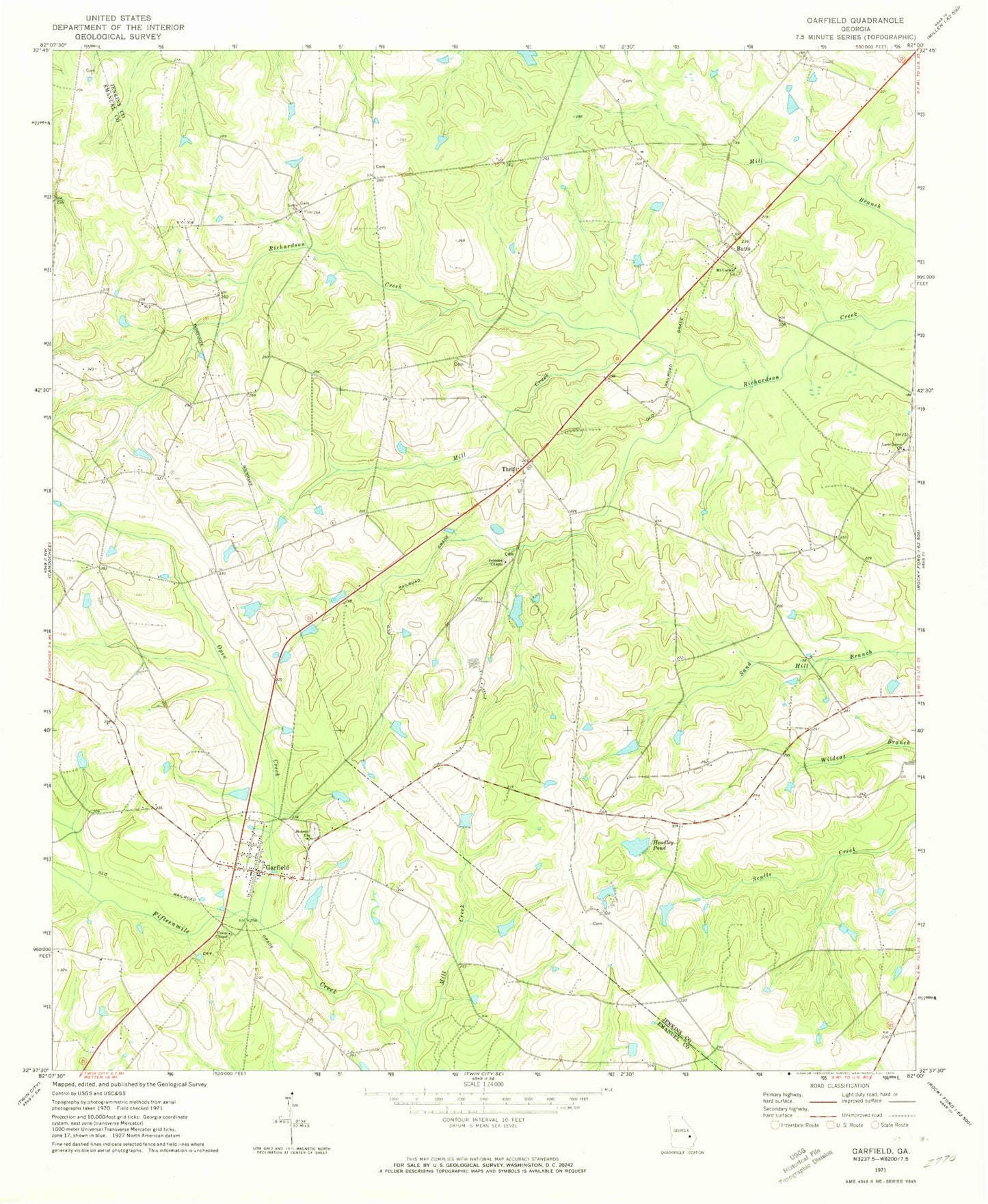
Classic USGS Garfield Georgia 7.5'x7.5' Topo Map
Couldn't load pickup availability
Historical USGS topographic quad map of Garfield in the state of Georgia. Map scale may vary for some years, but is generally around 1:24,000. Print size is approximately 24" x 27"
This quadrangle is in the following counties: Emanuel, Jenkins.
The map contains contour lines, roads, rivers, towns, and lakes. Printed on high-quality waterproof paper with UV fade-resistant inks, and shipped rolled.
Contains the following named places: Butts, City of Garfield, Emanuel County Fire Department Garfield Station, Garfield, Garfield Police Department, Garfield Post Office, Garfield Volunteer Fire Department, Gay Lake, Gay Lake Dam, Hacienda de Gay Airstrip, Hebron Cemetery, Hebron Church, Hendley Pond, Johnson Chapel, Lane Grove Church, Lewis School, Long Branch Church of God, Louis Church, Mill Creek, Mount Carmel Church, Norwood School, Open Creek, South Jenkins Division, Thrift, Union Chapel, Union Chapel Cemetery, ZIP Code: 30425