MyTopo
Classic USGS Garland Arkansas 7.5'x7.5' Topo Map
Couldn't load pickup availability
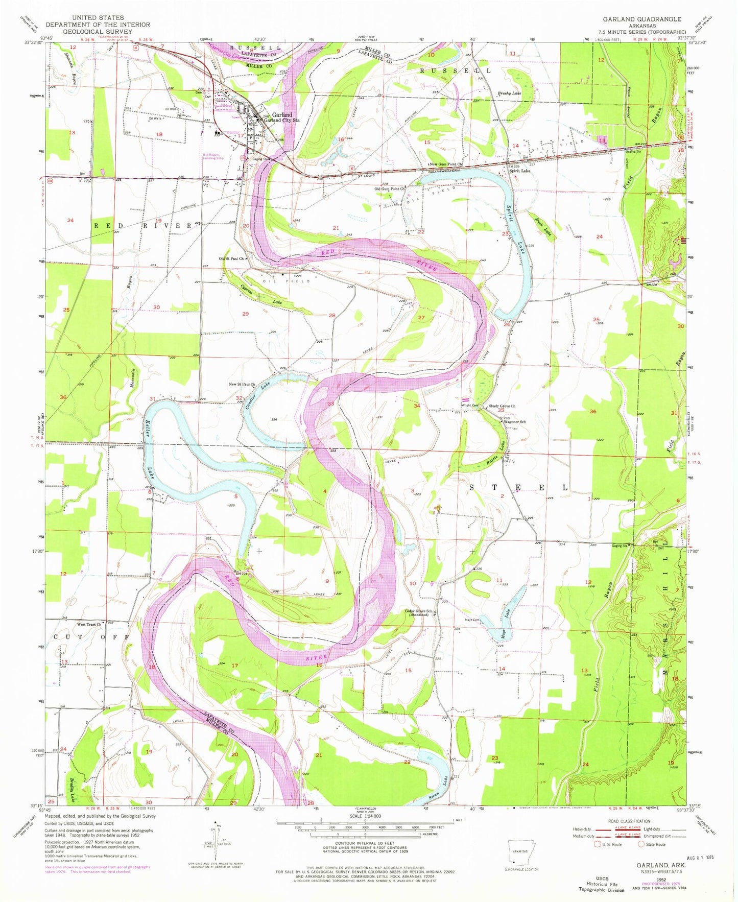
Historical USGS topographic quad map of Garland in the state of Arkansas. Map scale may vary for some years, but is generally around 1:24,000. Print size is approximately 24" x 27"
This quadrangle is in the following counties: Lafayette, Miller.
The map contains contour lines, roads, rivers, towns, and lakes. Printed on high-quality waterproof paper with UV fade-resistant inks, and shipped rolled.
Contains the following named places: Battle Lake, Bill Rogers Airport, Bradley Lake, Brushy Lake, Candler Lake, Cargill Pond, Cargill Pond Dam, Cedar Grove School, Cypress Lake, Cypress Lake Oil and Gas Field, Duck Lake, Field Bayou Ditch, Garland, Garland City Fire Department, Garland City Post Office, Garland Elementary School, Garland High School, Keller Lake, Mays Cemetery, Mays Lake, New Gum Point Church, New Saint Paul Church, Old Gum Point Church, Old Saint Paul Church, Red River Bridge, Reed-Joseph Land Company Airport, Shady Grove Church, Spirit Lake, Spirit Lake Oil and Gas Field, Swan Lake, Town of Garland, Township of Steel, Wagoner School, West Tract Church, Wright Cemetery, ZIP Codes: 71839, 71845