
MyTopo
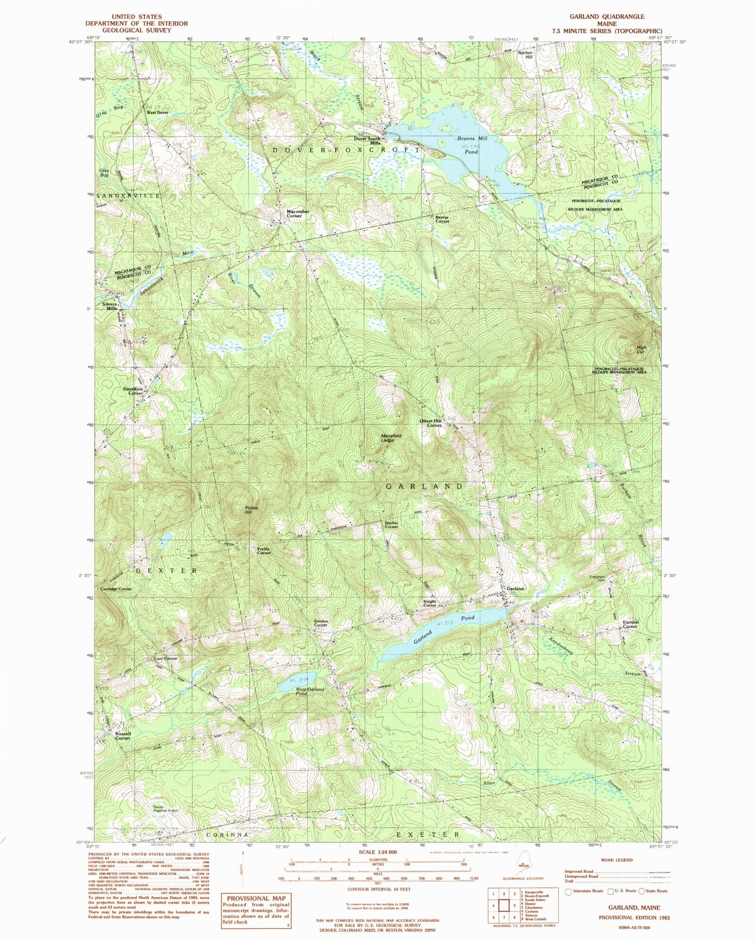
Classic USGS Garland Maine 7.5'x7.5' Topo Map
Couldn't load pickup availability
Historical USGS topographic quad map of Garland in the state of Maine. Map scale may vary for some years, but is generally around 1:24,000. Print size is approximately 24" x 27"
This quadrangle is in the following counties: Penobscot, Piscataquis.
The map contains contour lines, roads, rivers, towns, and lakes. Printed on high-quality waterproof paper with UV fade-resistant inks, and shipped rolled.
Contains the following named places: Berrys Corner, Branns Mill Pond, Branns Pond Dam, Bud Leavitt Wildlife Management Area, Burnham Cemetery, Burnham School, Carr Corner, Center School, Coolidge Corner, Dexter Regional Airport, Dover South Mills, Durbin Corner, Earnest Corner, Evergreen Cemetery, Garland, Garland Elementary School, Garland Pond, Garland Pond Dam, Garland Post Office, Garland Volunteer Fire Department, Gordon Corner, Greeley Cemetery, Haseltine Corner, Haseltine School, High Cut, Knight Corner, Macomber School, Mansfield Ledge, Maplewood Cemetery, Norton Hill, Oliver Hill Corner, Pine Grove Cemetery, Preble Corner, Preble Hill, Russell Corner, Silvers Mills, South Ridge School, Town of Garland, West Dover, West Garland Cemetery, West Garland Pond, West Garland School, WGUY-FM (Dexter), WQCB-FM (Brewer), ZIP Code: 04939