MyTopo
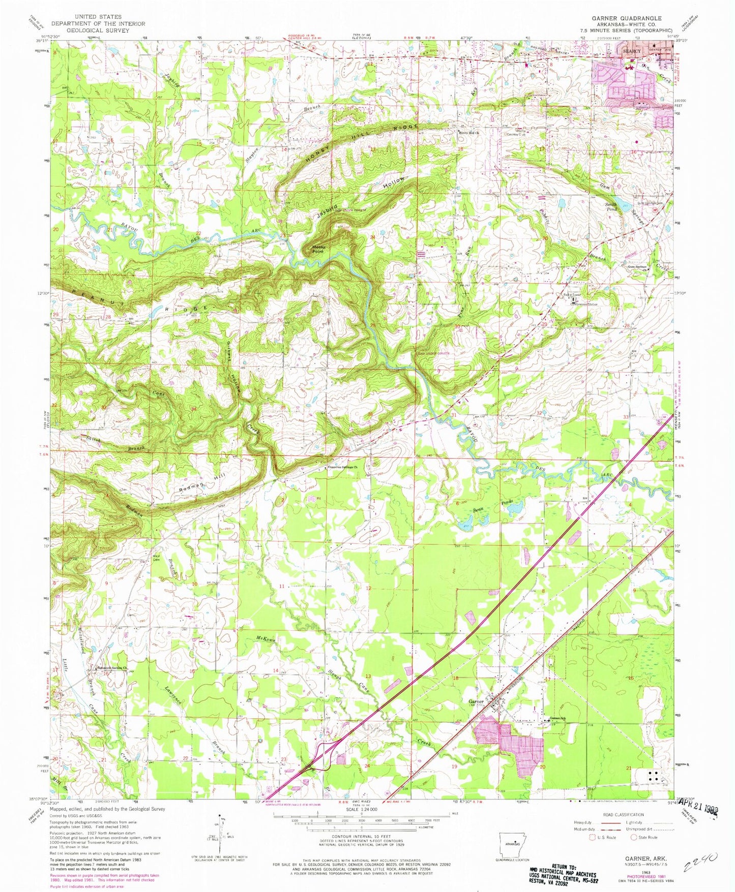
Classic USGS Garner Arkansas 7.5'x7.5' Topo Map
Couldn't load pickup availability
Historical USGS topographic quad map of Garner in the state of Arkansas. Map scale may vary for some years, but is generally around 1:24,000. Print size is approximately 24" x 27"
This quadrangle is in the following counties: White.
The map contains contour lines, roads, rivers, towns, and lakes. Printed on high-quality waterproof paper with UV fade-resistant inks, and shipped rolled.
Contains the following named places: Cobbite Branch, Copperas Springs Church, Fly "N" K Airport, Garner, Garner Post Office, Garner School, Garner Volunteer Fire Department, Gilbert Hollow, Gum Springs Cemetery, Gum Springs United Methodist Church, Gum Springs Volunteer Fire Department, Hazelwood Branch, Honey Hill Church, Honey Hill Heliport, Honey Hill Ridge, Jarta, Jaybird Branch, Jaybird Hollow, Lercher Lake Number One, Lercher Lake Number One Dam, McKown Slough, Mossy Point, Northstar Emergency Medical Service - Searcy Station 2, Peanut Ridge, Pine Run, Rodman Branch, Rodman Hill, Schroeder Lake, Schroeder Lake Two Dam, Searcy Country Club, Searcy Fire Department Station 3, Second Baptist Church, Shiloh Branch, Sixteenth Section Church, Slayton Branch, Smith Pond, Swan Ponds, Town of Garner, Township of Cane, Township of Gum Springs, Weir Cemetery, Westside Elementary School, ZIP Code: 72102