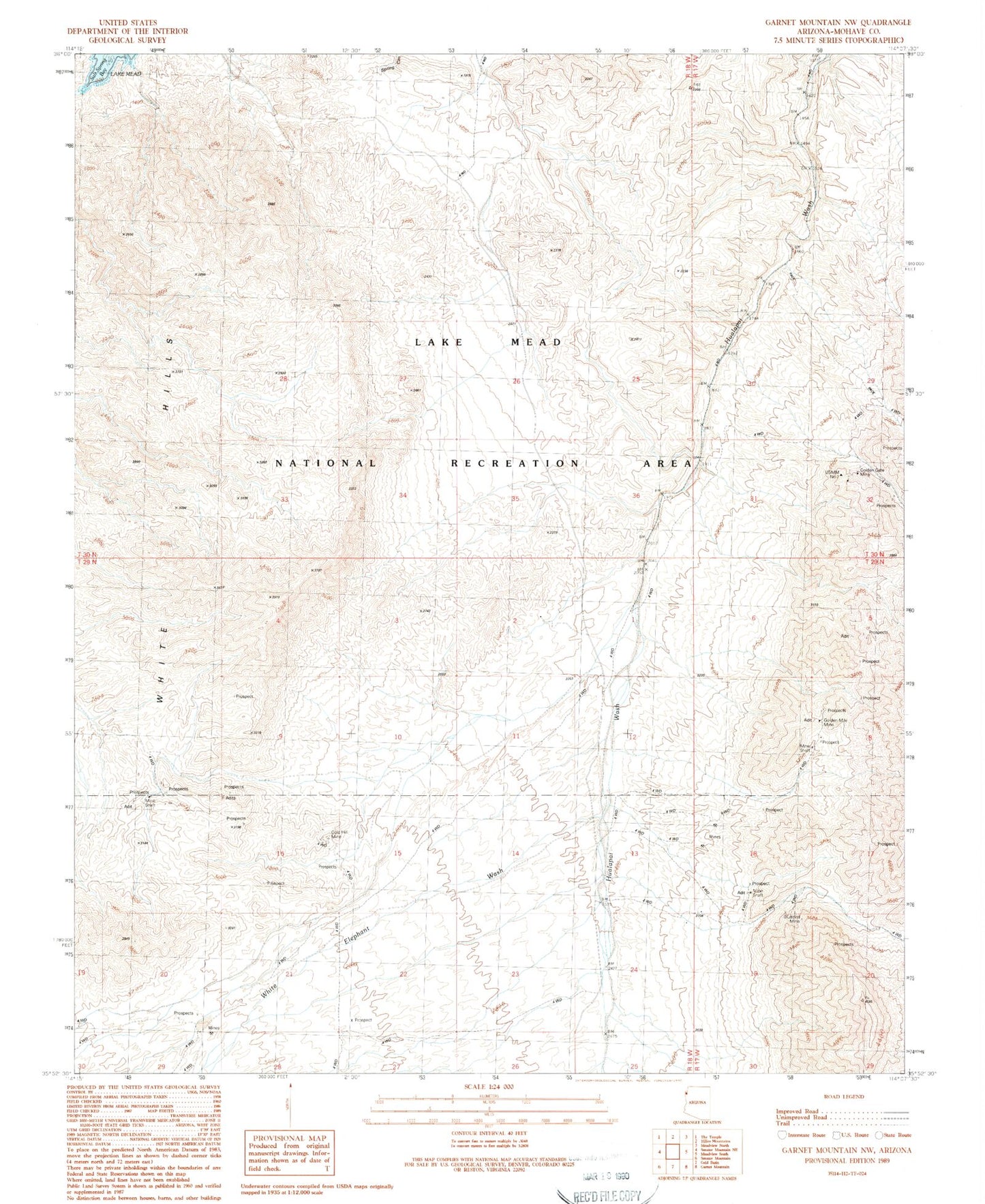
MyTopo
Classic USGS Garnet Mountain NW Arizona 7.5'x7.5' Topo Map
Regular price
$16.95
Regular price
Sale price
$16.95
Unit price
per
Couldn't load pickup availability
Historical USGS topographic quad map of Garnet Mountain NW in the state of Arizona. Map scale may vary for some years, but is generally around 1:24,000. Print size is approximately 24" x 27"
This quadrangle is in the following counties: Mohave.
The map contains contour lines, roads, rivers, towns, and lakes. Printed on high-quality waterproof paper with UV fade-resistant inks, and shipped rolled.
Contains the following named places: Bluebird Mine, Gold Hill Mine, Golden Gate Mine, Golden Mile Mine, Lake Mead National Recreation Area, Salt Spring Wash, White Elephant Wash