MyTopo
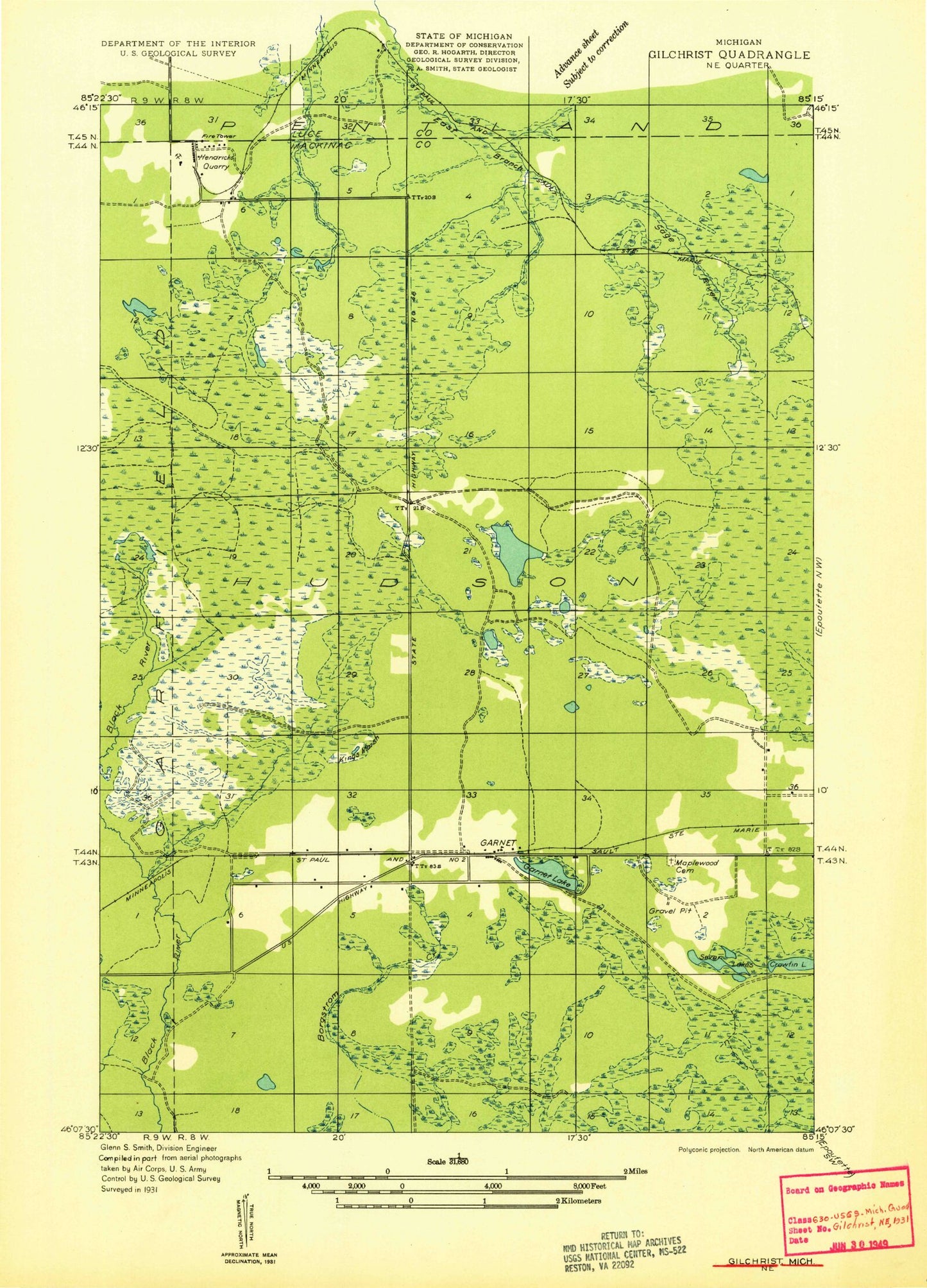
Classic USGS Garnet Michigan 7.5'x7.5' Topo Map
Couldn't load pickup availability
Historical USGS topographic quad map of Garnet in the state of Michigan. Map scale may vary for some years, but is generally around 1:24,000. Print size is approximately 24" x 27"
This quadrangle is in the following counties: Luce, Mackinac.
The map contains contour lines, roads, rivers, towns, and lakes. Printed on high-quality waterproof paper with UV fade-resistant inks, and shipped rolled.
Contains the following named places: Bark Creek, Big Dollar Lake, Brennan Lake, Crawfin Lake, Finn Lake, Garnet, Garnet Lake, Garnet Lake Campground, Garnet Post Office, Garnet Station, Hendricks Quarry Post Office, Hudson Township Fire Department, Hudson Township Park, Kings Marsh, Little Dollar Lake, Maplewood Cemetery, Seven Lakes, Silver Creek, Strickler Pond, Township of Hudson