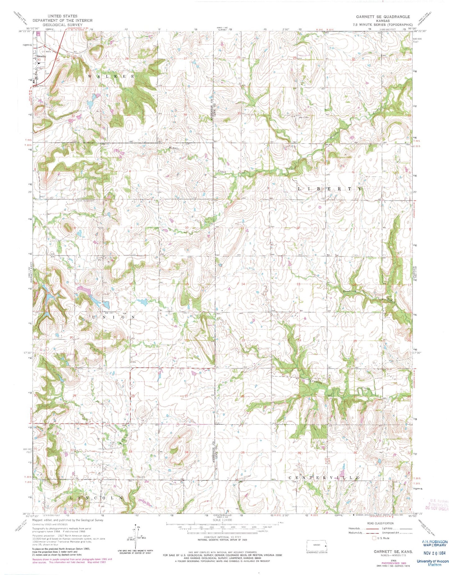
MyTopo
Classic USGS Garnett SE Kansas 7.5'x7.5' Topo Map
Regular price
$16.95
Regular price
Sale price
$16.95
Unit price
per
Couldn't load pickup availability
Historical USGS topographic quad map of Garnett SE in the state of Kansas. Map scale may vary for some years, but is generally around 1:24,000. Print size is approximately 24" x 27"
This quadrangle is in the following counties: Anderson, Linn.
The map contains contour lines, roads, rivers, towns, and lakes. Printed on high-quality waterproof paper with UV fade-resistant inks, and shipped rolled.
Contains the following named places: Greeley Elementary School, Greeley Municipal Wastewater Treatment Facility, Saint John's Catholic Church, Sugarvale, Sutton Valley Cemetery, Township of Union, Township of Walker, Wait Cemetery, ZIP Code: 66033