MyTopo
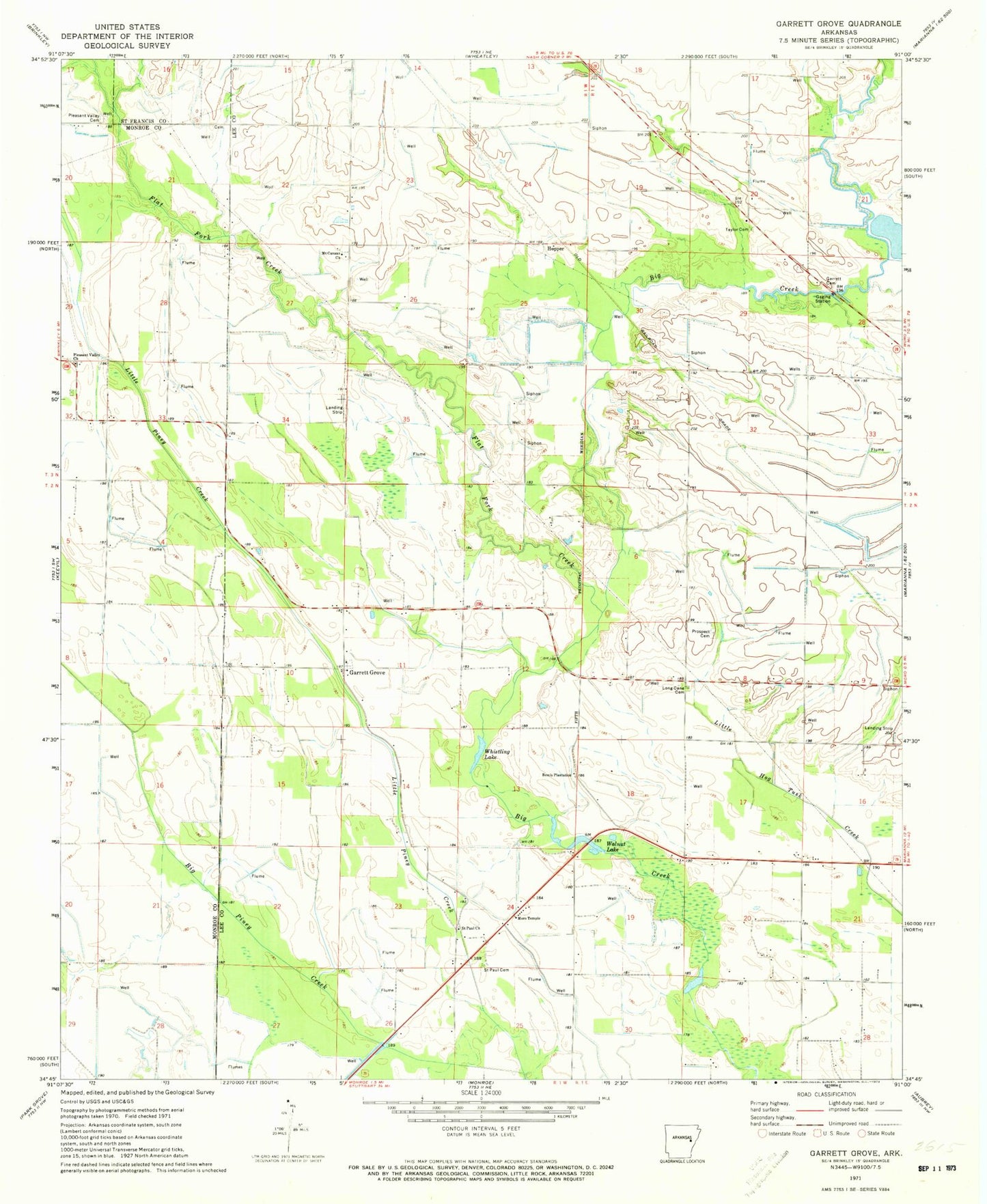
Classic USGS Garrett Grove Arkansas 7.5'x7.5' Topo Map
Couldn't load pickup availability
Historical USGS topographic quad map of Garrett Grove in the state of Arkansas. Map scale may vary for some years, but is generally around 1:24,000. Print size is approximately 24" x 27"
This quadrangle is in the following counties: Lee, Monroe, St. Francis.
The map contains contour lines, roads, rivers, towns, and lakes. Printed on high-quality waterproof paper with UV fade-resistant inks, and shipped rolled.
Contains the following named places: Bemis Plantation, Big Piney Creek, Flat Fork Creek, Garrett Cemetery, Garrett Grove, Hopper, Little Piney Creek, Little Prairie, Long Cane Cemetery, Moro Temple, Mount Canaan Church, Mount Jerdan Church, Pleasant Valley Cemetery, Pleasant Valley Church, Prospect Cemetery, Saint Paul Cemetery, Saint Paul Church, Taylor Cemetery, Township of Fleener, Township of Hampton, Walnut Lake, Whistling Lake, ZIP Code: 72368