MyTopo
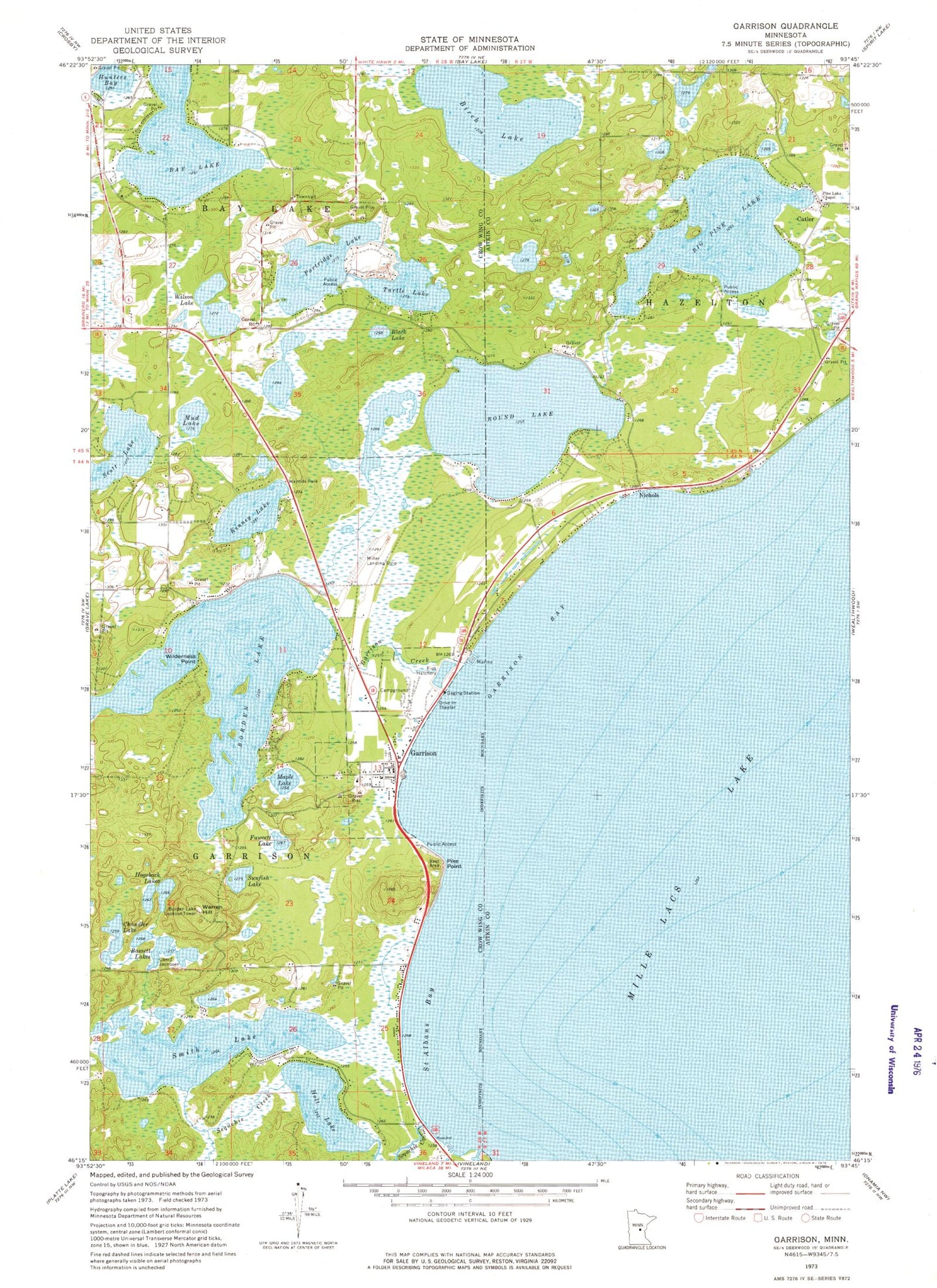
Classic USGS Garrison Minnesota 7.5'x7.5' Topo Map
Couldn't load pickup availability
Historical USGS topographic quad map of Garrison in the state of Minnesota. Map scale may vary for some years, but is generally around 1:24,000. Print size is approximately 24" x 27"
This quadrangle is in the following counties: Aitkin, Crow Wing.
The map contains contour lines, roads, rivers, towns, and lakes. Printed on high-quality waterproof paper with UV fade-resistant inks, and shipped rolled.
Contains the following named places: Bassett Lakes, Big Pine Lake, Birch Lake, Black Lake, Bob's Trailer Park, Borden Lake, Borden Lake Dam, Borden Lake Lookout Tower, Camp Jacobsen, Chandler Lake, City of Garrison, Community Alliance Church, Cutler, Fawcett Lake, Garrison, Garrison Bay, Garrison Cemetery, Garrison Concourse Wayside Park, Garrison Creek, Garrison Fire and Rescue Department, Garrison Golf Course, Garrison Post Office, Garrison Rest Area, Garrison Trailer Park, Geology of the Lake Mille Lacs Geological Marker, Hogsback Lakes, Holt Lake, Holt Lake Dam, Hunters Bay, Kenney Lake, Kenney Lake Overlook, Light of the Cross Lutheran Church, Maple Lake, Mille Lacs Lake Airport, Mud Lake, Nichols, Nichols Post Office, Our Lady of Fatima Church, Partridge Lake, Pike Point, Pine Lake Chapel, Rosackers Number 2 Seaplane Base, Round Lake, Saint Albans Bay, Scott Lake, Sequchie Creek, Shepherd of the Lake Lutheran Church, Smith Lake, Sunfish Lake, Township of Bay Lake, Township of Garrison, Turtle Lake, Warren Hill, Wilderness Point, Wilson Lake