MyTopo
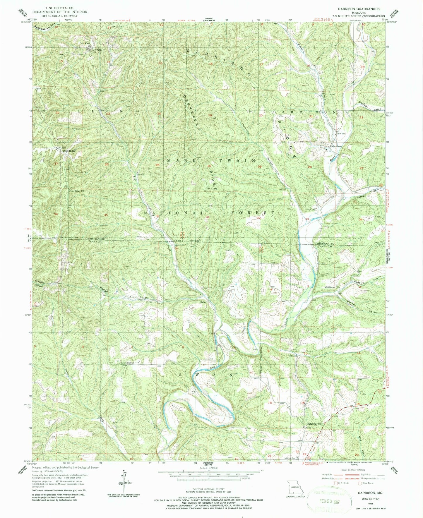
Classic USGS Garrison Missouri 7.5'x7.5' Topo Map
Couldn't load pickup availability
Historical USGS topographic quad map of Garrison in the state of Missouri. Map scale may vary for some years, but is generally around 1:24,000. Print size is approximately 24" x 27"
This quadrangle is in the following counties: Christian, Taney.
The map contains contour lines, roads, rivers, towns, and lakes. Printed on high-quality waterproof paper with UV fade-resistant inks, and shipped rolled.
Contains the following named places: Ameera, Barbers Creek, Blue Creek, Devreaux Ridge, Garrison, Garrison Branch, Garrison Ridge, Garrison School, Helphrey Cemetery, Helphrey Hill, Helphry School, Hodge Hollow, Lone Star Church, Low Gap, Middleton Church, Oak Wood Church, Oakwood School, Peace Cemetery, Pine Ridge, Pine Ridge Church, Pine Ridge School, Poague Hollow, Saunders, Sto, Surratt Creek, Surratt Hollow, Swan, Swan Cemetery, Township of Garrison, Township of South Linn, Turkey Creek, Warren Hollow, ZIP Codes: 65657, 65759