MyTopo
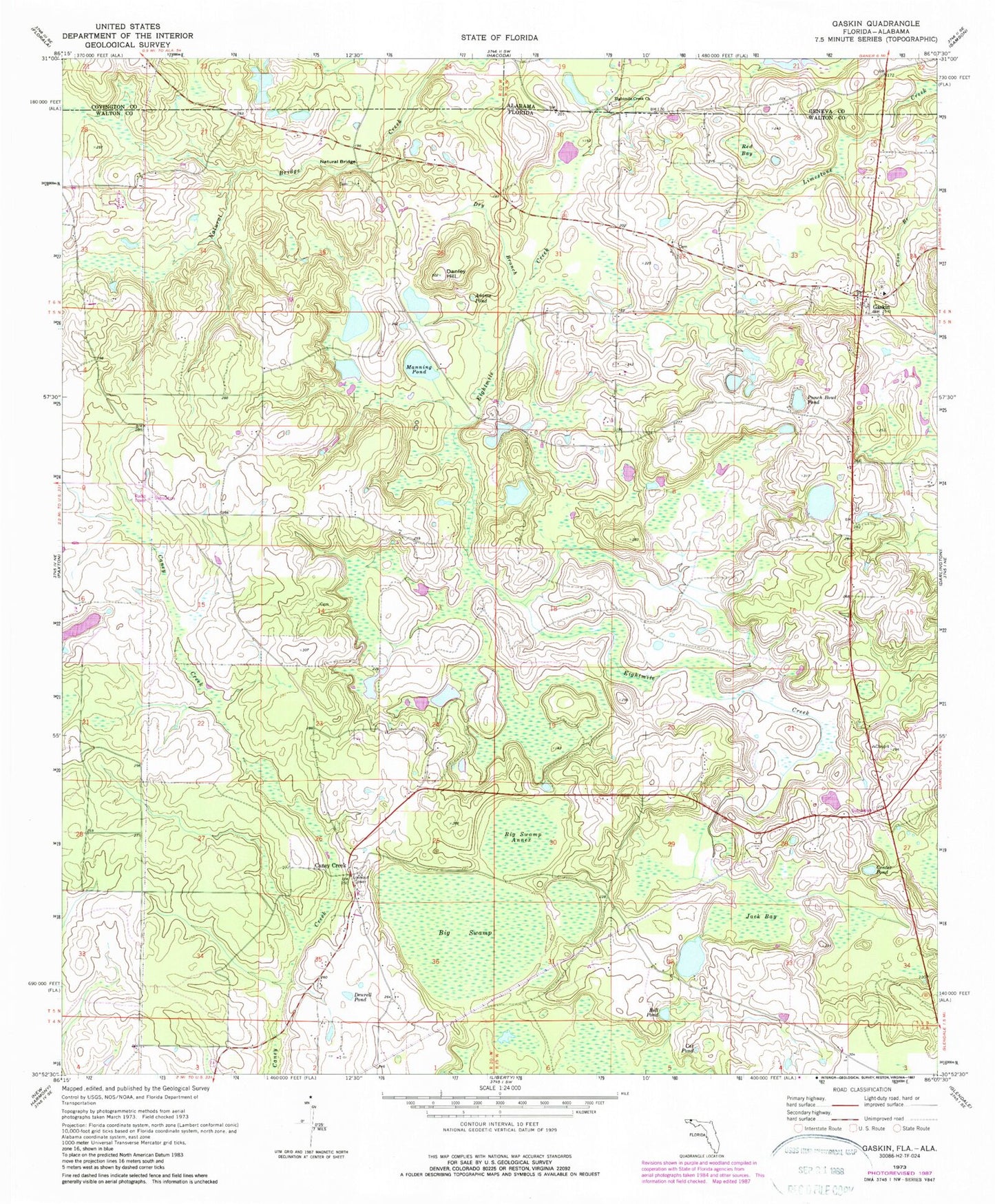
Classic USGS Gaskin Florida 7.5'x7.5' Topo Map
Couldn't load pickup availability
Historical USGS topographic quad map of Gaskin in the states of Florida, Alabama. Map scale may vary for some years, but is generally around 1:24,000. Print size is approximately 24" x 27"
This quadrangle is in the following counties: Covington, Geneva, Walton.
The map contains contour lines, roads, rivers, towns, and lakes. Printed on high-quality waterproof paper with UV fade-resistant inks, and shipped rolled.
Contains the following named places: Adams Pond, Bell Pond, Big Swamp, Big Swamp Annex, Bunge Farm Airport, Caney Creek, Cat Pond, Center Pond, Danley Hill, Deurell Pond, Dry Branch, E H Myers Pond, Eightmile Creek Church, Gaskin, Jack Bay, Jackson Still Tower, Manning Pond, Melanie's Airport, Natural Bridge, Paxton-Darlington Division, Punch Bowl Pond, Red Bay, Walton County Fire Rescue Station 3 Dalington - Gaskin Fire Rescue