MyTopo
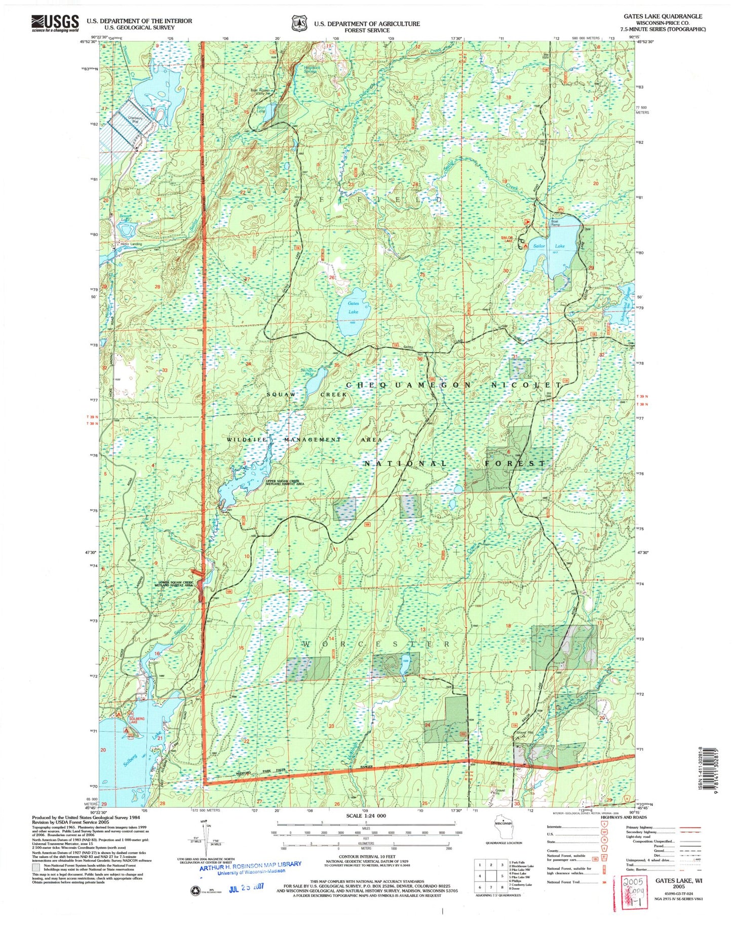
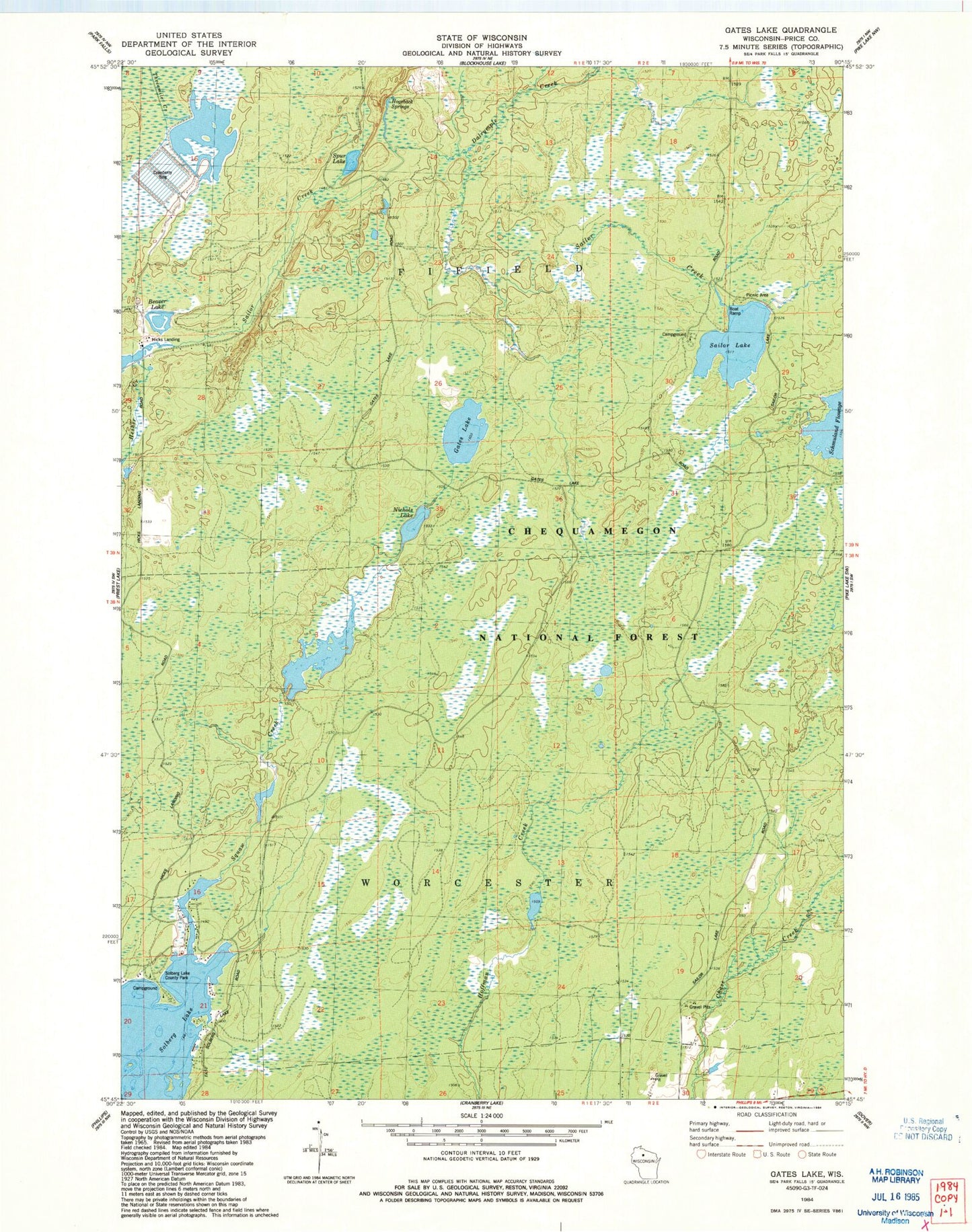
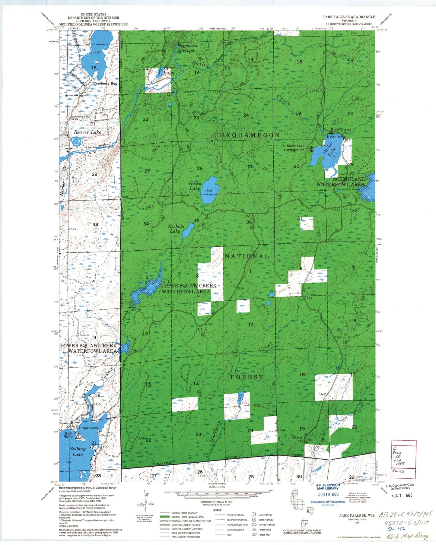
Classic USGS Gates Lake Wisconsin 7.5'x7.5' Topo Map
Couldn't load pickup availability
Historical USGS topographic quad map of Gates Lake in the state of Wisconsin. Typical map scale is 1:24,000, but may vary for certain years, if available. Print size: 24" x 27"
This quadrangle is in the following counties: Price.
The map contains contour lines, roads, rivers, towns, and lakes. Printed on high-quality waterproof paper with UV fade-resistant inks, and shipped rolled.
Contains the following named places: Beaver Lake, Dalrymple Creek, Gates Lake, Hesher Creek, Hogsback Springs, Nichols Lake, Solberg Lake County Park, Sailor Lake, Schmuland Flowage, Solberg Lake, Spur Lake, Schmuland Waterfowl Area, Sailor Lake Recreation Site, Lower Squaw Creek Waterfowl Area, Upper Squaw Creek Waterfowl Area, Squaw Creek Wildlife Flowage 2WP2459 Dam, Lower Squaw Creek Flowage, Squaw Creek D31.18 Dam, Squaw Creek Flowage 6, Hicks Landing, Beaver Lake, Dalrymple Creek, Gates Lake, Hesher Creek, Hogsback Springs, Nichols Lake, Solberg Lake County Park, Sailor Lake, Schmuland Flowage, Solberg Lake, Spur Lake, Schmuland Waterfowl Area, Sailor Lake Recreation Site, Lower Squaw Creek Waterfowl Area, Upper Squaw Creek Waterfowl Area, Squaw Creek Wildlife Flowage 2WP2459 Dam, Lower Squaw Creek Flowage, Squaw Creek D31.18 Dam, Squaw Creek Flowage 6, Hicks Landing