MyTopo
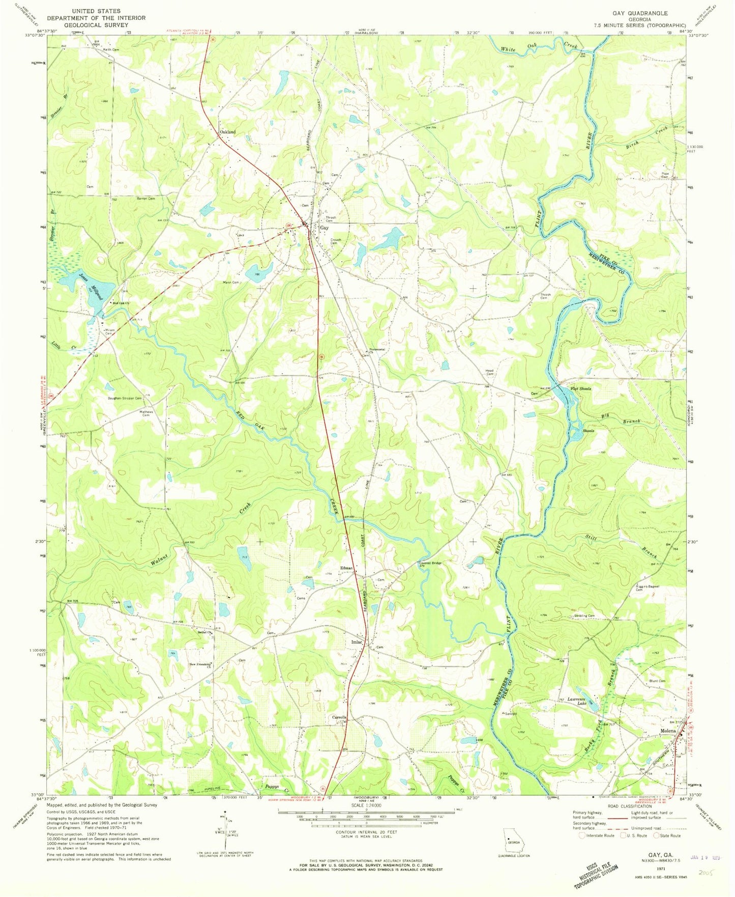
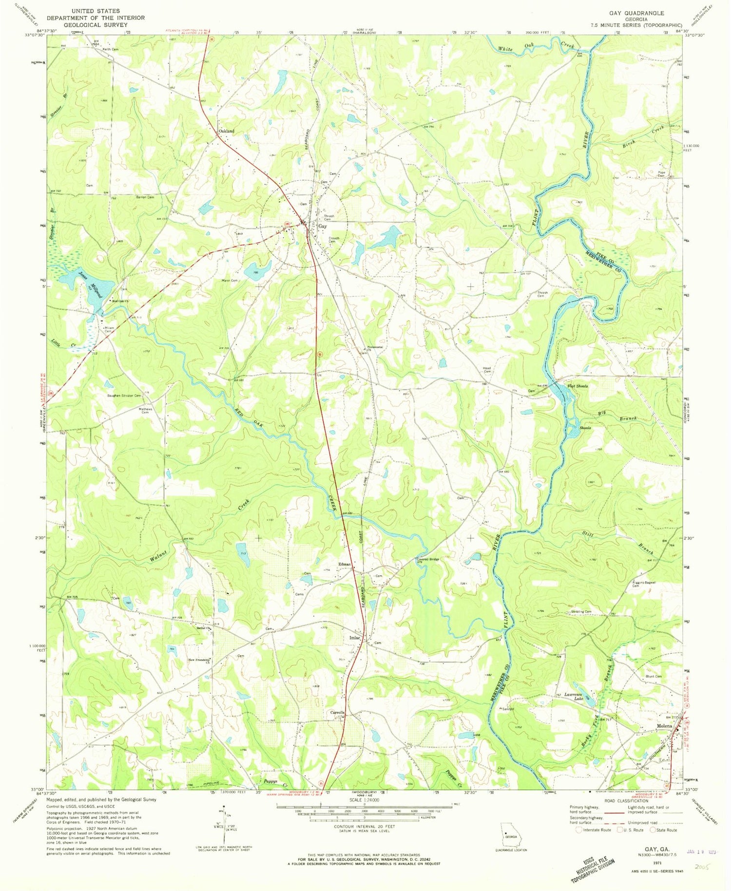
Classic USGS Gay Georgia 7.5'x7.5' Topo Map
Couldn't load pickup availability
Historical USGS topographic quad map of Gay in the state of Georgia. Typical map scale is 1:24,000, but may vary for certain years, if available. Print size: 24" x 27"
This quadrangle is in the following counties: Meriwether, Pike.
The map contains contour lines, roads, rivers, towns, and lakes. Printed on high-quality waterproof paper with UV fade-resistant inks, and shipped rolled.
Contains the following named places: Barron Cemetery, Big Branch, Birch Creek, Blunt Cemetery, Crouch Cemetery, Flat Shoals, Head Cemetery, Jones Millpond, Keith Cemetery, Lawrence Lake, Little Creek, Mann Cemetery, Mathews Cemetery, Milam Cemetery, Molena, New Friendship Church, Pentecostal Church, Red Oak Church, Red Oak Creek, Riggins - Bagwell Cemetery, Rocky Ford Branch, Still Branch, Stribling Cemetery, Strozier Branch, Thrash Cemetery, Thrash Cemetery, Walnut Creek, White Oak Creek, Carrolls, Edman, Imlac, Oakland, Ganoname769 Dam, Quercus Farms Lake Dam, Quercus Farms Lake, Estes Lake Dam, Estes Lake, Jones Millpond Dam, Estes Dam, Estes Lake, Weaver Dam, Weaver Lake, Neely Lake Dam North, Neely Lake North, Neely Lake Dam South, Neely Lake South, Lawrence Lake Dam, David Knott Bridge, Molena Baptist Church, Molena Methodist Church, Double Bridges, Enon Primitive Baptist Church, Jones Mill (historical), Keiths Store (historical), Oakland Baptist Church, Powell Bridge (historical), Red Oak Cemetery, Red Oak Creek Covered Bridge, Twin Lakes, Baughan - Strozier Cemetery, Bethel Church, Cowtail Branch, Gay, City of Molena, Town of Gay, Molena Volunteer Fire Department, Meriwether County Volunteer Fire Department Station 7, Meriwether County Volunteer Fire Department Station 6, Molena Police Department, Gay Post Office, Red Oak Grove Baptist Church Cemetery