MyTopo
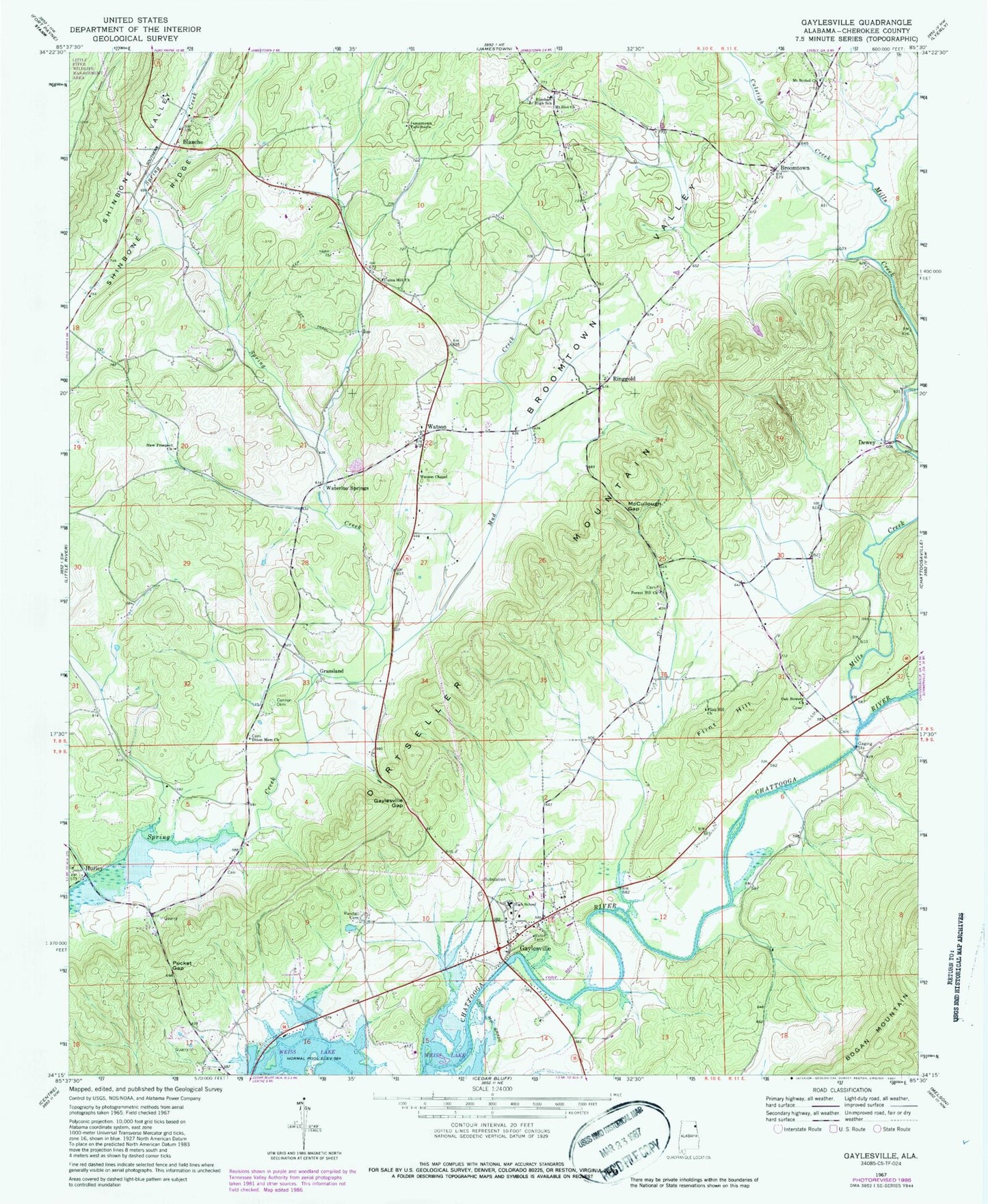
Classic USGS Gaylesville Alabama 7.5'x7.5' Topo Map
Couldn't load pickup availability
Historical USGS topographic quad map of Gaylesville in the state of Alabama. Map scale may vary for some years, but is generally around 1:24,000. Print size is approximately 24" x 27"
This quadrangle is in the following counties: Cherokee.
The map contains contour lines, roads, rivers, towns, and lakes. Printed on high-quality waterproof paper with UV fade-resistant inks, and shipped rolled.
Contains the following named places: Blanche, Blanche Methodist Church, Broomtown, Broomtown - Rinehart Volunteer Fire Department, Broomtown Census Designated Place, Broomtown Valley, Cannon Cemetery, Cedar Bluff-Gaylesville Division, Chattooga River, Culstigh Creek, Davis Church Cemetery, Dewey, Dirtseller Mountain, Dixon Memorial Church, Dixons Chapel Cemetery, Erwin Spring, Faith Church, Flint Hill, Flint Hill Church, Forest Hill Cemetery, Forest Hill Church, Freedom Church, Gaylesville, Gaylesville Baptist Church, Gaylesville Gap, Gaylesville High School, Gaylesville Post Office, Gaylesville Volunteer Fire Department, Grassland, Hurley, Jamestown Tabernacle Church, McCullough Gap, Mills Creek, Mount Bethel Cemetery, Mount Bethel Missionary Baptist Church, Mount Zion Cemetery, Mount Zion Wesleyan Methodist Church, Mountain Acres, Mud Creek, New Prospect Church, Oak Bowery Church Cemetery, Oak Bowery Methodist Church, Pucket Gap, Randall Cemetery, Rhinehart, Rinehart Junior High School, Ringgold, Stories Cemetery, Town of Gaylesville, Union Hill Cemetery, Union Hill Methodist Church, Unity Missionary Baptist Church, Waterloo Spring, Waterloo Springs, Watson, Watson Chapel, ZIP Code: 35973


