MyTopo
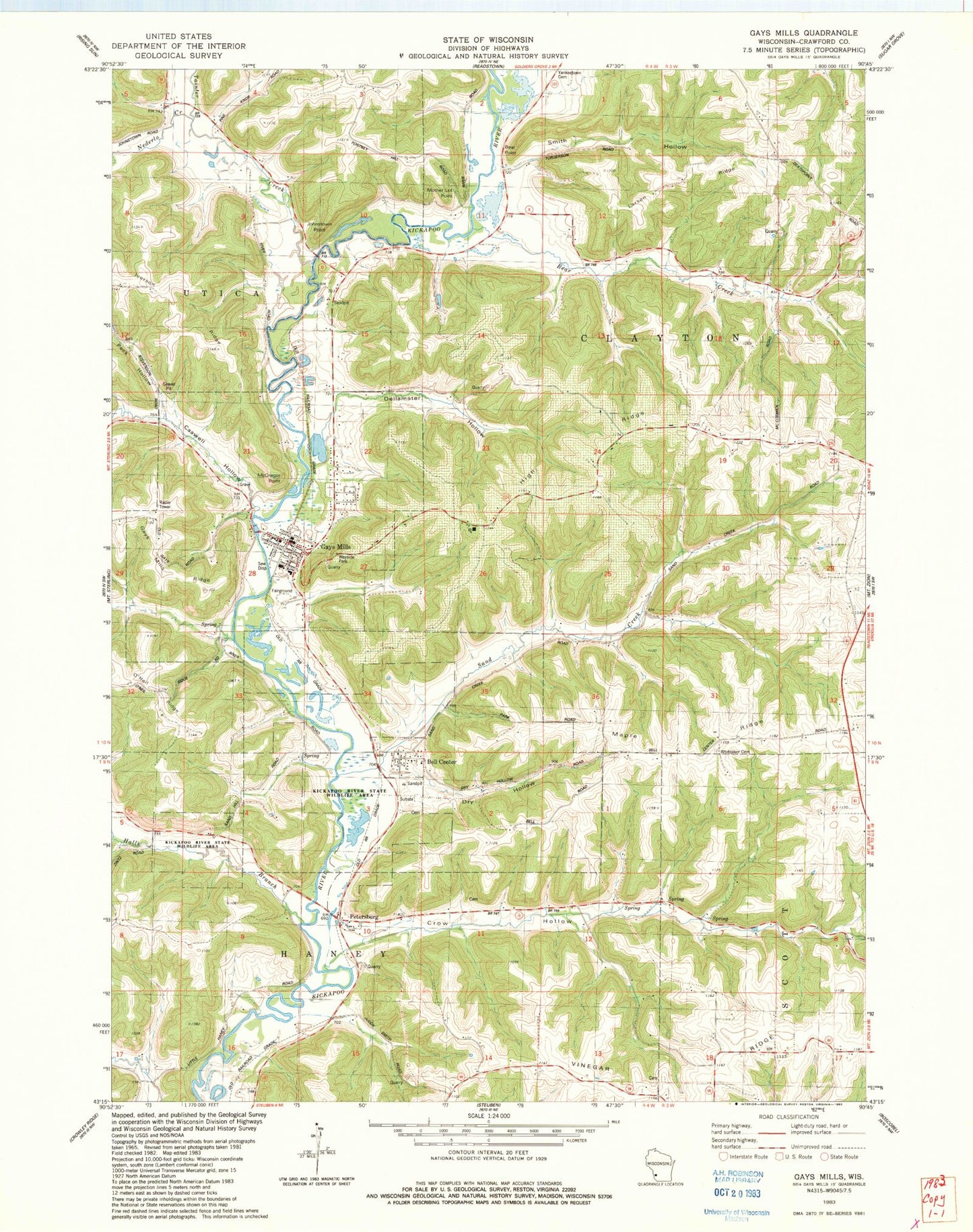
Classic USGS Gays Mills Wisconsin 7.5'x7.5' Topo Map
Couldn't load pickup availability
Historical USGS topographic quad map of Gays Mills in the state of Wisconsin. Map scale may vary for some years, but is generally around 1:24,000. Print size is approximately 24" x 27"
This quadrangle is in the following counties: Crawford.
The map contains contour lines, roads, rivers, towns, and lakes. Printed on high-quality waterproof paper with UV fade-resistant inks, and shipped rolled.
Contains the following named places: 0.26 Reservoir, 54631, 54655, Bear Creek, Bear Creek School, Bear Point, Bell Center, Bell Center Cemetery, Caswell Hollow, Coleman - Whiteaker Cemetery, Crow Creek Cemetery, Crow Hollow, Crow Hollow School, Dellamater Hollow, Dry Hollow, Gays Mills, Gays Mills Cemetery, Gays Mills Fire Department, Gays Mills Post Office, Halls Branch, High Ridge, Iverson Ridge, Johnstown, Johnstown Point, Johnstown School, Johnstown Valley, Kickapoo River State Wildlife Area, Larsen Ridge, Lourie G9297 Dam, Maple Ridge, McGregor Point, Mill Creek, Mother Lot Point, North Crawford Elementary School, North Crawford Junior - High School, Ocooch Mountain Emergency Medical Service, Peck Hollow, Petersburg, Rolling Ground School, Sand Creek, Sand Creek School, Smith Hollow, Starry Ridge Orchard, Summit School, Sunrise Orchards, Taft School, Tainter Creek, Turkey Ridge Orchard, Village of Bell Center, Village of Gays Mills, Vinegar Ridge, Whitaker Church