MyTopo
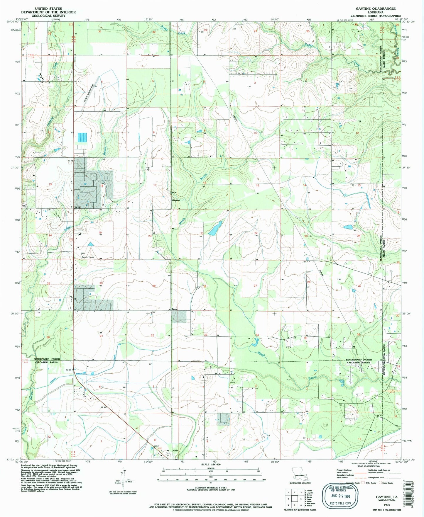
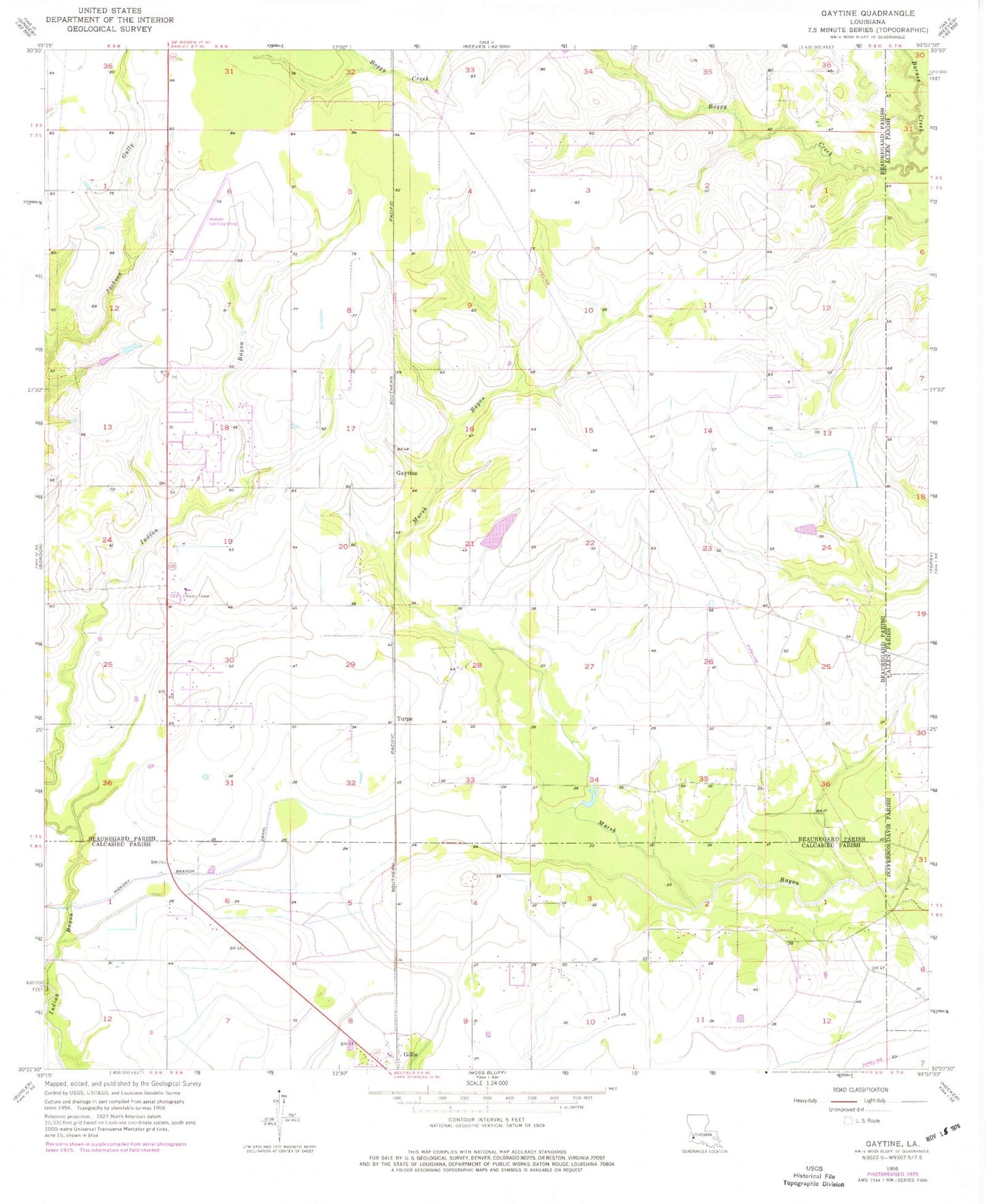
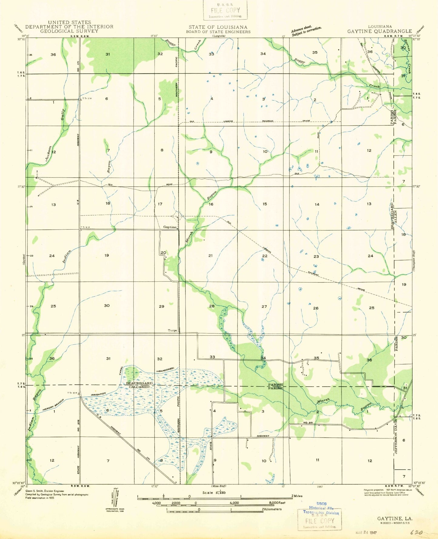
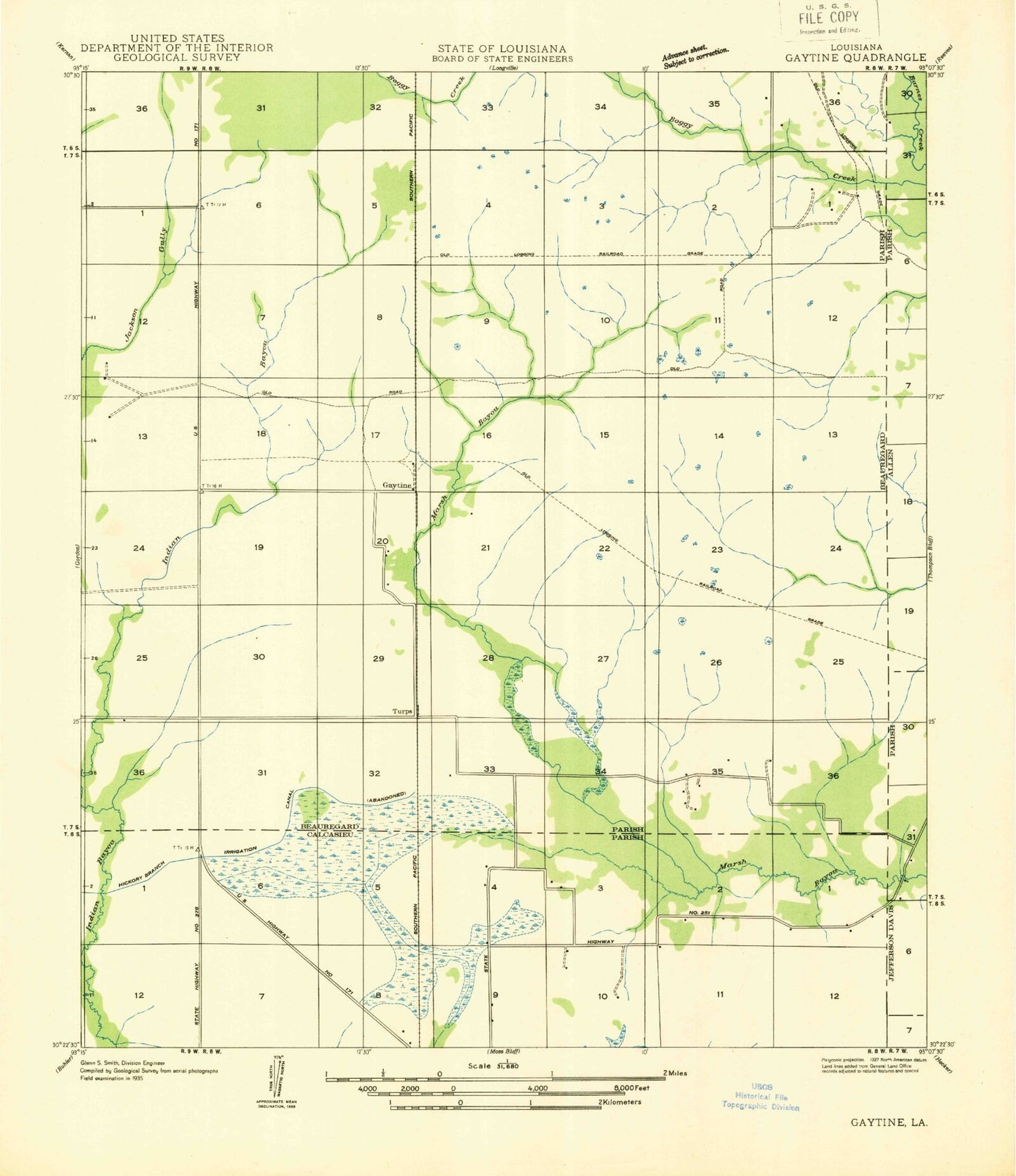
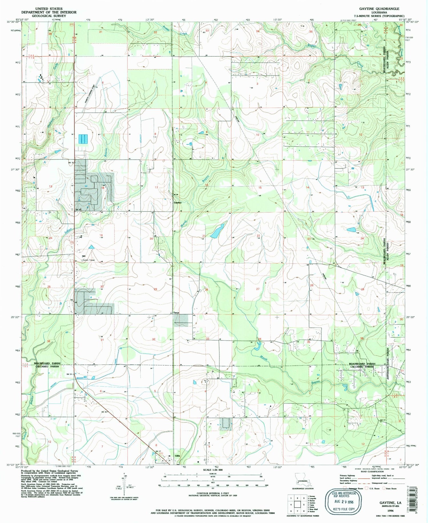
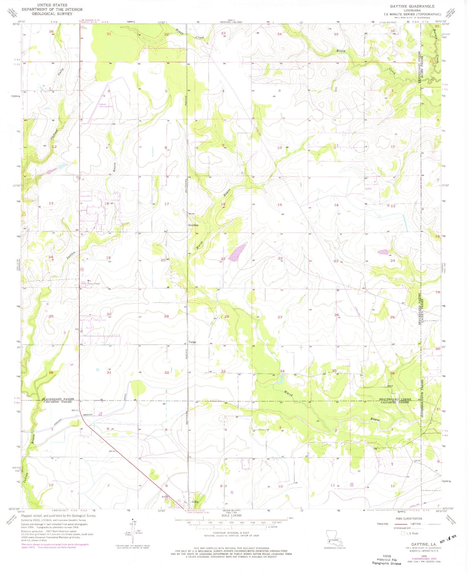
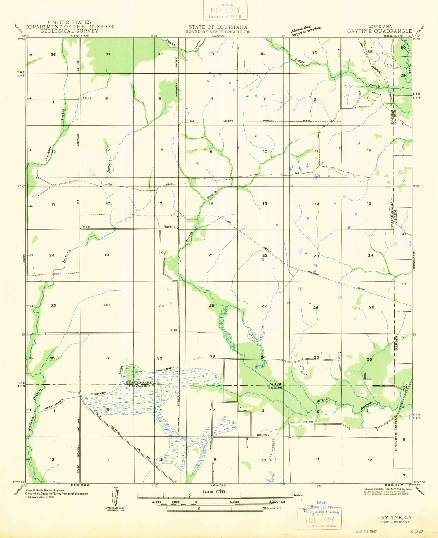
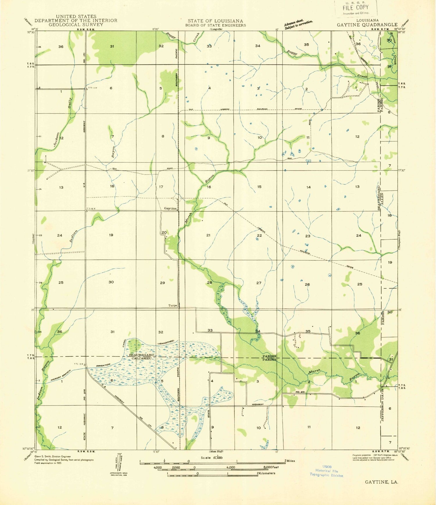
Classic USGS Gaytine Louisiana 7.5'x7.5' Topo Map
Couldn't load pickup availability
Historical USGS topographic quad map of Gaytine in the state of Louisiana. Map scale may vary for some years, but is generally around 1:24,000. Print size is approximately 24" x 27"
This quadrangle is in the following counties: Allen, Beauregard, Calcasieu, Jefferson Davis.
The map contains contour lines, roads, rivers, towns, and lakes. Printed on high-quality waterproof paper with UV fade-resistant inks, and shipped rolled.
Contains the following named places: Beauregard Volunteer Fire District 2 Meadow Village Station, Beauregard Volunteer Fire Protection District 2 Texas Eastern Station, Gaytine, Gaytine Census Designated Place, Gillis Census Designated Place, Habetz Airport, Hickory Branch Canal, New Life Pentecostal Church, Saint Pius X Catholic Church, South Fulton Oil Field, Topsy Baptist Church, Turps, Ward Six