MyTopo
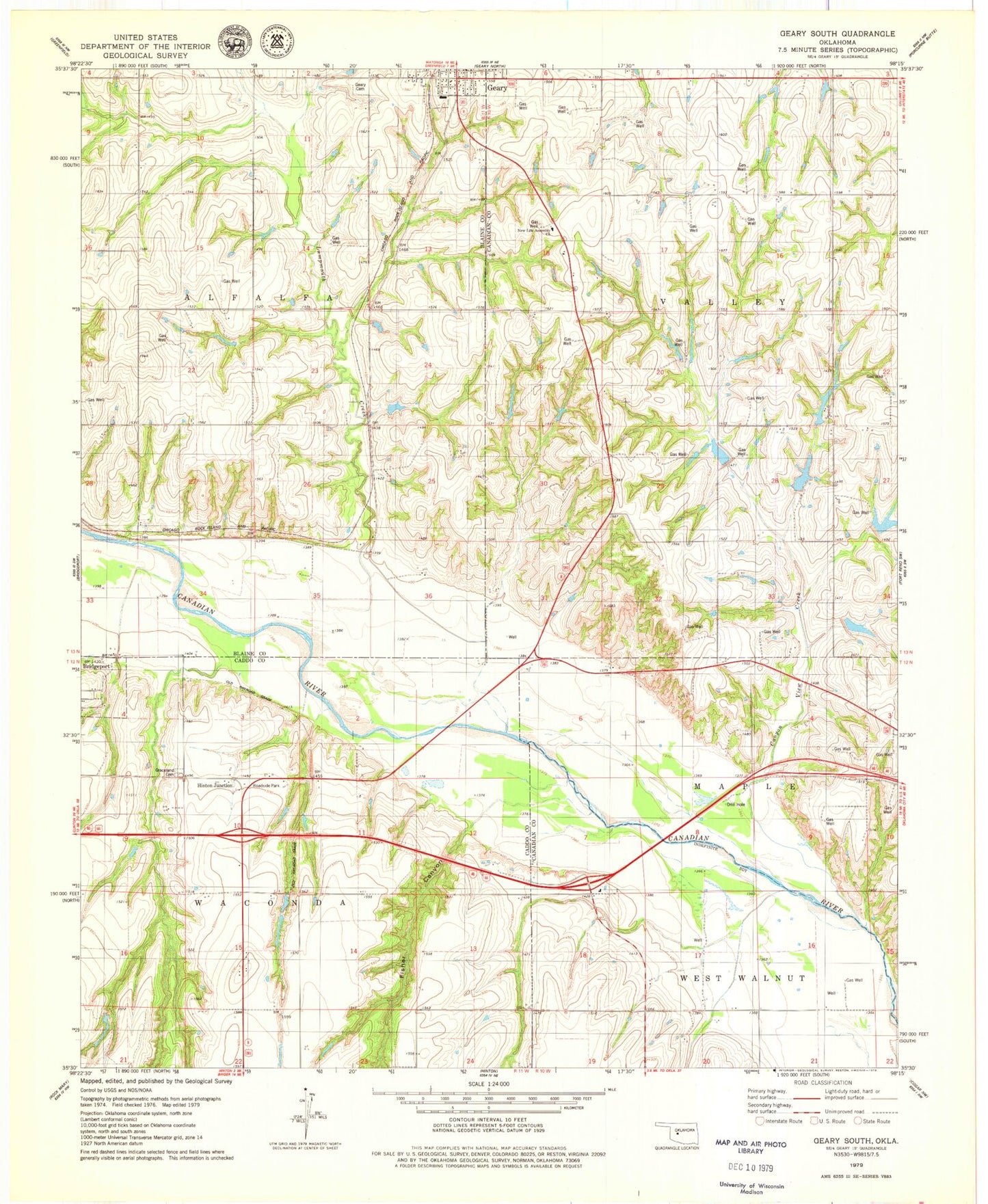
Classic USGS Geary South Oklahoma 7.5'x7.5' Topo Map
Couldn't load pickup availability
Historical USGS topographic quad map of Geary South in the state of Oklahoma. Map scale may vary for some years, but is generally around 1:24,000. Print size is approximately 24" x 27"
This quadrangle is in the following counties: Blaine, Caddo, Canadian.
The map contains contour lines, roads, rivers, towns, and lakes. Printed on high-quality waterproof paper with UV fade-resistant inks, and shipped rolled.
Contains the following named places: Canyon View School, Canyon View Site 1 Dam, Canyon View Site 1 Reservoir, Canyon View Site 2 Dam, Canyon View Site 2 Reservoir, Canyon View Site 3 Dam, Canyon View Site 3 Reservoir, Canyon View Site 4 Dam, Canyon View Site 4 Reservoir, City of Geary, Fairview School, Fisher Canyon, Free Methodist Church, Garland Brooks Dam, Garland Brooks Reservoir, Geary Cemetery, Good Hope School, Graceland Cemetery, Hinton Municipal Airport, Independence School, John Shawyer Dam, John Shawyer Reservoir, Lumpmouth Creek, Riverview School, Township of Alfalfa, Township of Waconda, Victory School, Walnut Grove School