
MyTopo
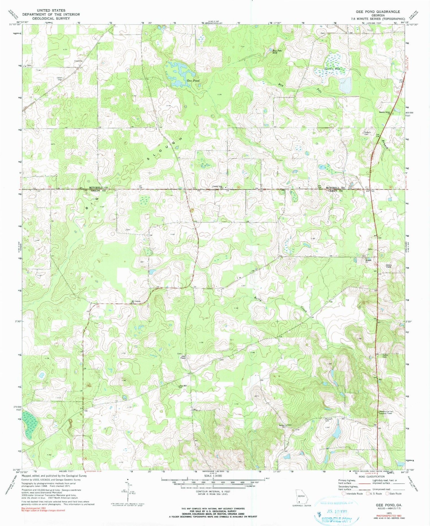
Classic USGS Gee Pond Georgia 7.5'x7.5' Topo Map
Couldn't load pickup availability
Historical USGS topographic quad map of Gee Pond in the state of Georgia. Map scale may vary for some years, but is generally around 1:24,000. Print size is approximately 24" x 27"
This quadrangle is in the following counties: Grady, Mitchell.
The map contains contour lines, roads, rivers, towns, and lakes. Printed on high-quality waterproof paper with UV fade-resistant inks, and shipped rolled.
Contains the following named places: Allen Chapel, Barrow Plantation, Bay Pole Branch, Bay Pole Sink, Beauty Grove Church, Bethel Church, Chambless Sink, County Line Church, County Line School, Devils Den, Dollar Cemetery, Freewill Church, Gee Pond, Glory Hole, Godwin Cemetery, Grady County Volunteer Fire Department County Line Station, Harrells Still, Hawthorne Trail Lookout Tower, Kelly Creek, Maxwell Cemetery, Mizpah Cemetery, Mizpah Church, Mount Vernon Church, Northwest Grady Division, Pawnee, Pine Hill Church, Saint Paul Church, Union Cemetery, Union Church, Waterfall Sink, Whigham Lake, Whigham Lake Dam, Wilder Cemetery


