MyTopo
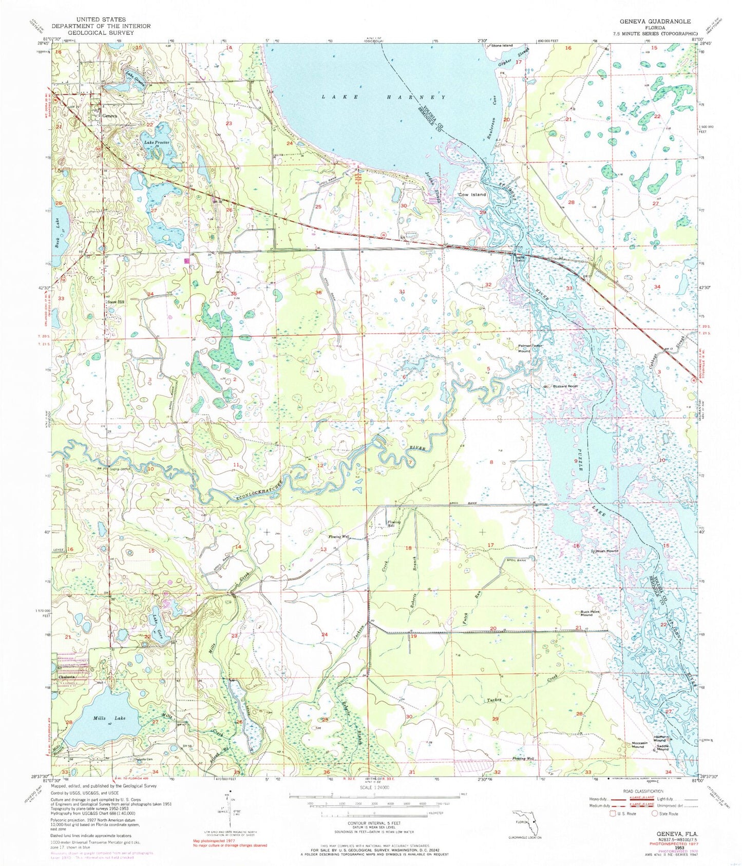
Classic USGS Geneva Florida 7.5'x7.5' Topo Map
Couldn't load pickup availability
Historical USGS topographic quad map of Geneva in the state of Florida. Typical map scale is 1:24,000, but may vary for certain years, if available. Print size: 24" x 27"
This quadrangle is in the following counties: Seminole, Volusia.
The map contains contour lines, roads, rivers, towns, and lakes. Printed on high-quality waterproof paper with UV fade-resistant inks, and shipped rolled.
Contains the following named places: Chuluota, Buck Lake, Buck Point Mound, Buzzard Roost, Chuluota Cemetery, Cow Island, Futch Run, Geneva, Geneva Cemetery, Lake Geneva, Lake Gore, Heiffer Mound, Jackson Creek, Jordan Slough, Mill Lake, Mills Branch, Mills Creek, Moccasin Mound, Noah Mound, Palmer-Taylor Mound, Puzzle Lake, Raulerson Cove, Roberts Branch, Saddle Mound, Silcox Branch, Snow Hill, Turkey Creek, Econlockhatchee River, Geneva Elementary School, First Baptist Church of Geneva, Buda, Lake Proctor, Taylor Lake, Little Run, Big Run, Moran Lake, Still Lake, Long Lake, Fort Lane (historical), Big Oaks Ranch Airport, Southerland Strip, Volusia County Fire Services Station 37 Harney, Seminole County Fire Department Fire Station 42, Geneva Census Designated Place, Chuluota Census Designated Place, Geneva Post Office