MyTopo
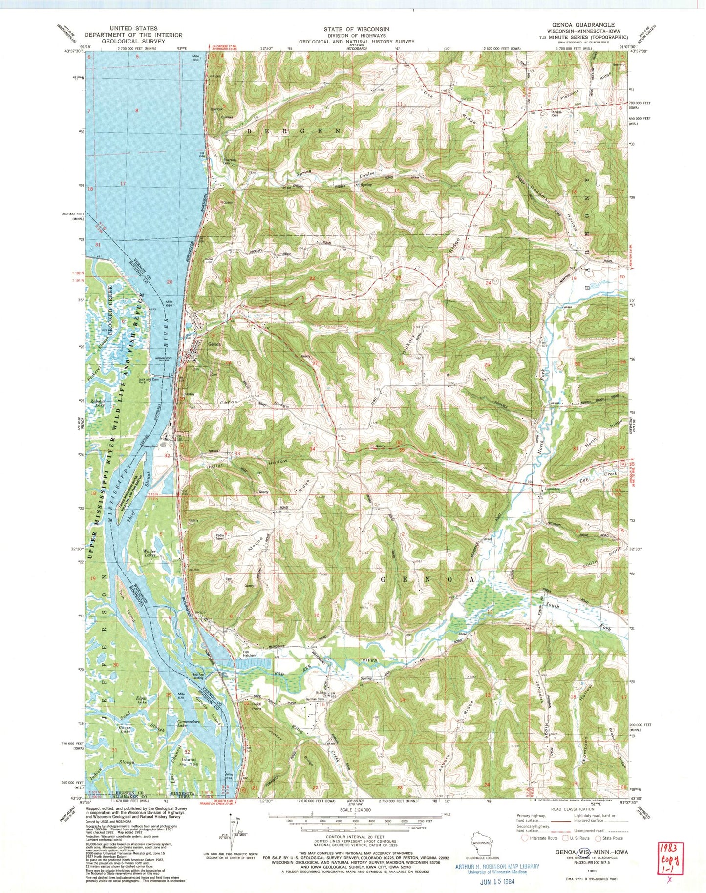
Classic USGS Genoa Wisconsin 7.5'x7.5' Topo Map
Couldn't load pickup availability
Historical USGS topographic quad map of Genoa in the states of Wisconsin, Minnesota. Map scale may vary for some years, but is generally around 1:24,000. Print size is approximately 24" x 27"
This quadrangle is in the following counties: Allamakee, Houston, Vernon.
The map contains contour lines, roads, rivers, towns, and lakes. Printed on high-quality waterproof paper with UV fade-resistant inks, and shipped rolled.
Contains the following named places: Bad Axe Landing, Bad Axe River, Bad Axe Valley School, Commodore Lake, Cox Creek, Deadman Hollow, Elgar Lake, Genoa, Genoa - Harmony Fire and Rescue, Genoa Fish Hatchery Pond 3 Dam, Genoa Fish Hatchery Pond One Dam, Genoa Generating Station, Genoa National Fish Hatchery, Genoa Post Office, Genoa Ridge, German Cemetery, Gillette Island, Goose Lake, Heck Point, Hickory Ridge, Hickory Ridge School, Indian Slough, Island Number One Hundred Thirtyfive, Italian Hollow, Johnson Ridge, Krause Cemetery, Lepke School, Lock and Dam 8, Lock and Dam Number 8, Lost Channel, Mound Ridge, Mound Ridge School, North Fork Bad Axe River, Pond One 0, Pond Three 0, Pool 8, Riley Creek, Riverside Cemetery, Riverside School, Romance, Romance Prairie State Natural Area, Romance School, Saint Charles Elementary School, Saint Johns Church, South Fork Bad Axe River, Spring Coulee, Thief Slough, Thompson Hollow, Town of Genoa, Twin Island, Victory Ridge, Village of Genoa, Waller Lakes, Zabolio Lake, ZIP Code: 54632