MyTopo
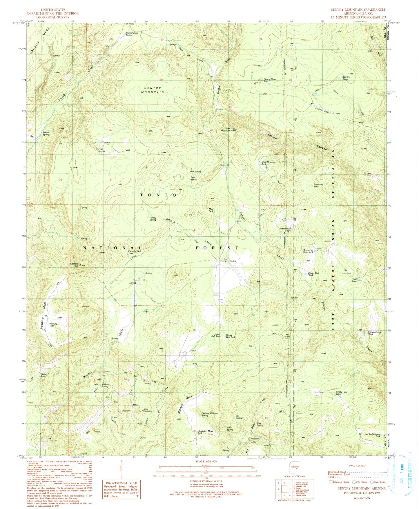
Classic USGS Gentry Mountain Arizona 7.5'x7.5' Topo Map
Couldn't load pickup availability
Historical USGS topographic quad map of Gentry Mountain in the state of Arizona. Map scale may vary for some years, but is generally around 1:24,000. Print size is approximately 24" x 27"
This quadrangle is in the following counties: Gila, Navajo.
The map contains contour lines, roads, rivers, towns, and lakes. Printed on high-quality waterproof paper with UV fade-resistant inks, and shipped rolled.
Contains the following named places: Allen Tank, Ashurst Creek, Bill Spring, Boundary Tank, Brewer Spring, Catholic Peak, Catholic Peak Tank, Charles Williams Spring, Clover Flat Tank, Clover Flat Tank Number 2, Cunningham Spring, Deer Tank, Ed Spring, Ellison Creek Tank, Flying V Ranch, Gentry Canyon Spring, Gentry Creek, Gentry Mesa Tank, Gentry Mountain, Gentry Tank, Joes Spring, Lower Bell Tank, Maxwell Spring, Maxwell Tank, Middleton Mesa, Middleton Mesa Tank, Mud Spring, Pine Spring, Q Ranch, Red Ledge Mesa Tank, Reservation Tank, Shell Mountain, Shell Mountain Tank, Stone Tank, Trail Tank, Turkey Spring, Upper Bell Tank, Vosburg Mesa, Vosburg Tank, Walnut Spring, West Prong Gentry Creek, Whiskey Tank, Windy Pass Tank, Wolf Spring