MyTopo
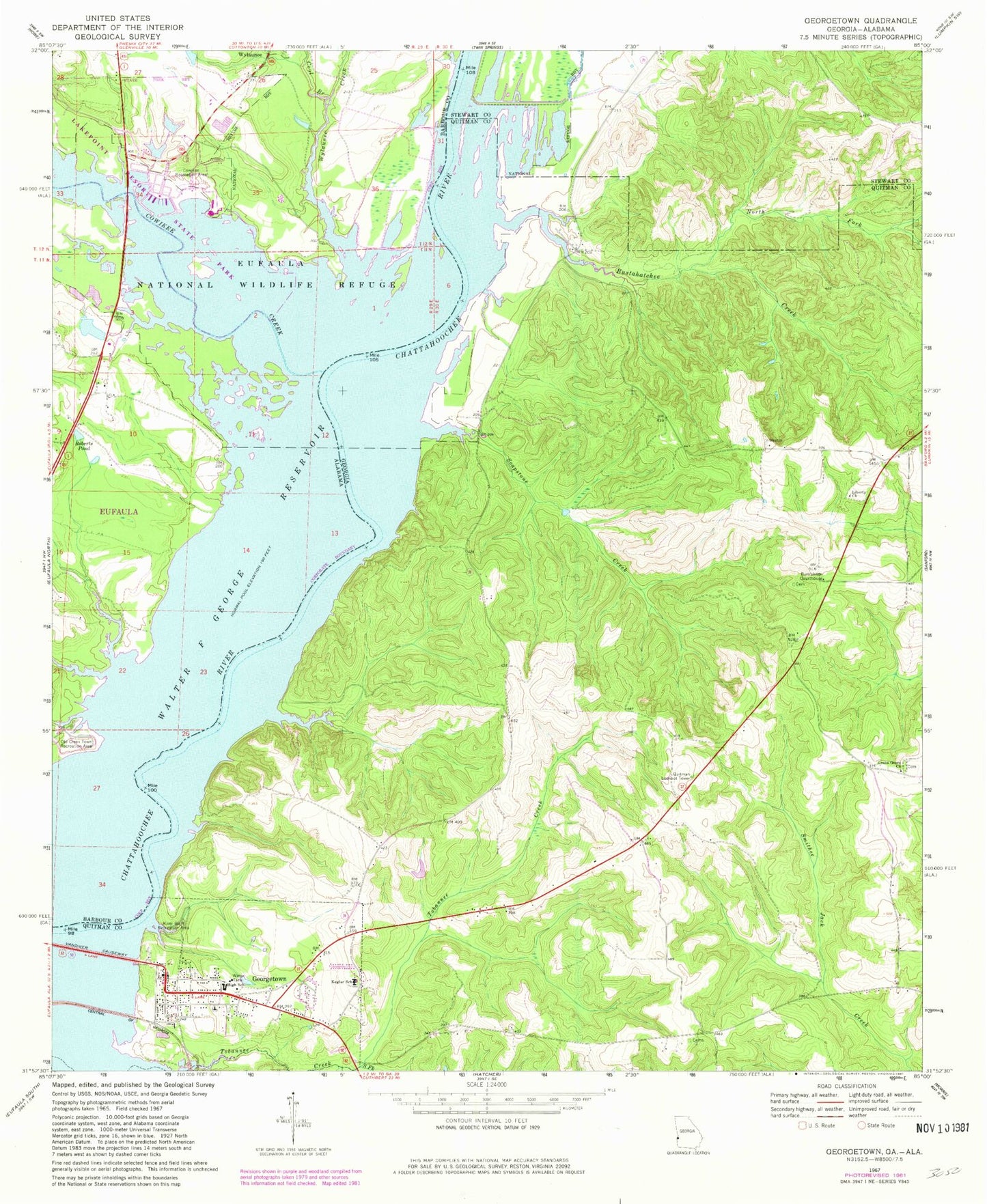
Classic USGS Georgetown Georgia 7.5'x7.5' Topo Map
Couldn't load pickup availability
Historical USGS topographic quad map of Georgetown in the states of Georgia, Alabama. Map scale may vary for some years, but is generally around 1:24,000. Print size is approximately 24" x 27"
This quadrangle is in the following counties: Barbour, Quitman, Stewart.
The map contains contour lines, roads, rivers, towns, and lakes. Printed on high-quality waterproof paper with UV fade-resistant inks, and shipped rolled.
Contains the following named places: Avreys Store, Bumbleton Courthouse, Bustahatchee Creek, City of Georgetown, Cool Branch, Cowikee Creek, Cowikee Recreation Area, Eufaula Fire and Rescue Northside Station, Eufaula National Wildlife Refuge, Georgetown, Georgetown Baptist Church, Georgetown Cemetery, Georgetown City Police Department, Georgetown North Division, Georgetown Post Office, Green Grove Church, Keglar School, Liberty Church, North Fork Bustahatchee Creek, Old Creek Town Recreation Area, Quitman County Elementary School, Quitman County Sheriff's Office, Quitman County Volunteer Fire Department Station 1, Quitman Lookout Tower, River Bluff Recreation Area, Roberts Pond, Rocky Mount Church, Soapstone Creek, South Fork Tobannee Creek, Tobannee Creek, Vandiver Causeway, Wylaunee, Wylaunee Creek