MyTopo
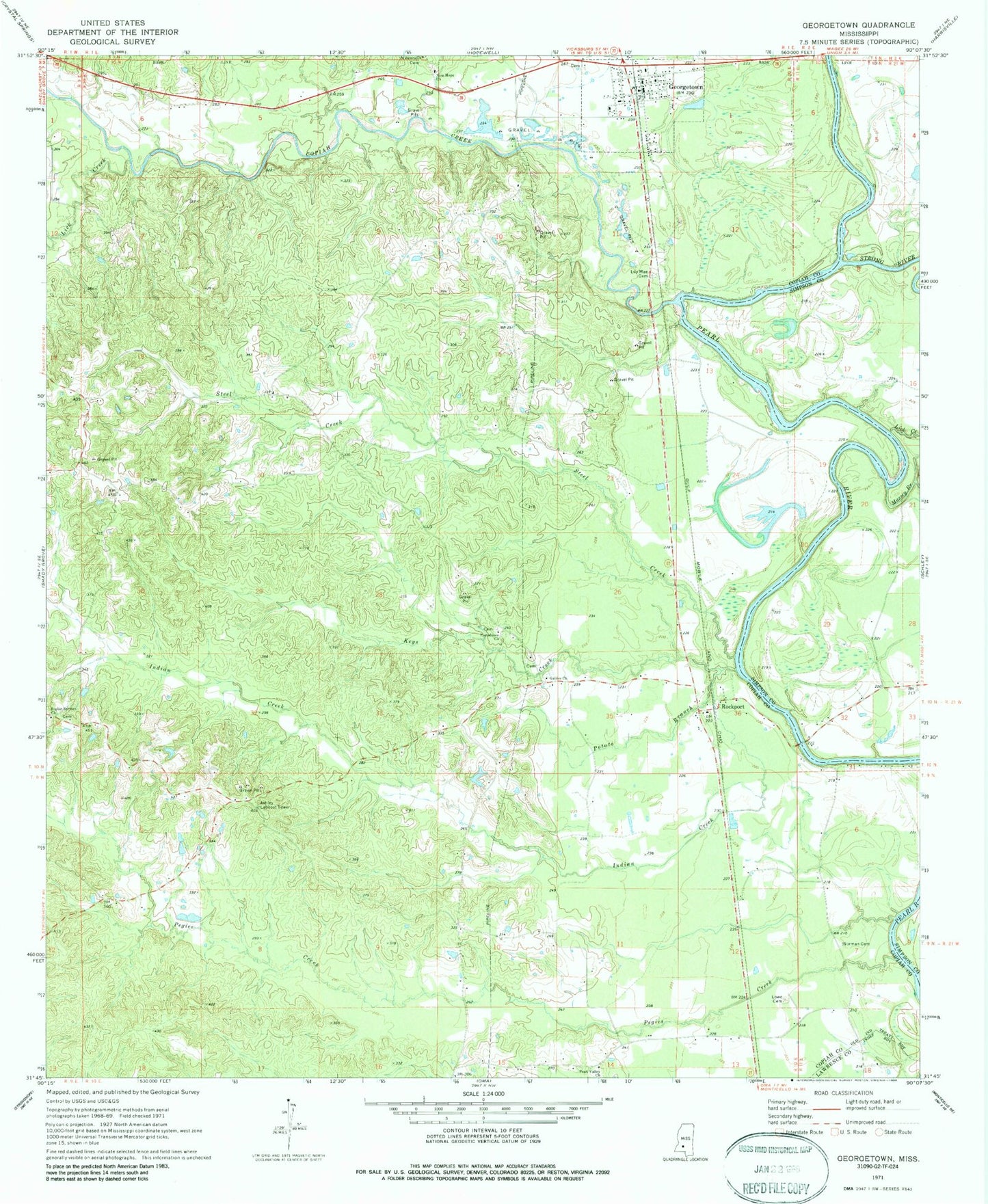
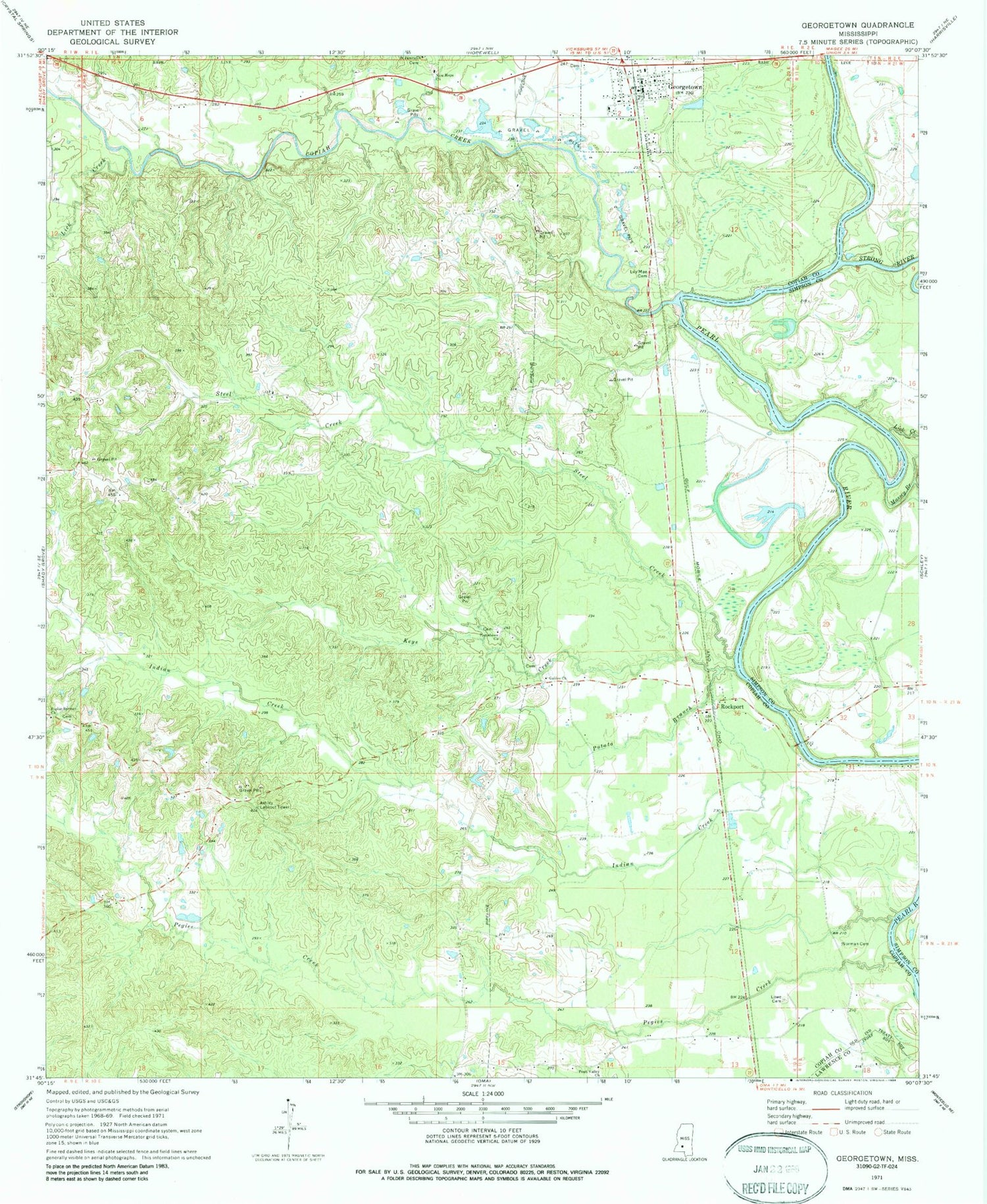
Classic USGS Georgetown Mississippi 7.5'x7.5' Topo Map
Couldn't load pickup availability
Historical USGS topographic quad map of Georgetown in the state of Mississippi. Map scale may vary for some years, but is generally around 1:24,000. Print size is approximately 24" x 27"
This quadrangle is in the following counties: Copiah, Lawrence, Simpson.
The map contains contour lines, roads, rivers, towns, and lakes. Printed on high-quality waterproof paper with UV fade-resistant inks, and shipped rolled.
Contains the following named places: Ashley Lookout Tower, Coaler, Copiah Creek, Cowanville, Durr Farm Pond Dam, Galilee Cemetery, Galilee Church, Georgetown, Georgetown Post Office, Georgetown Volunteer Fire Department, Indian Creek, Keys Creek, Kinnaird, Lick Creek, Lily Mae Cemetery, Lowe Cemetery, Massey Branch, New Hope Cemetery, New Hope Church, Norman Cemetery, Old Georgetown, Pearl Valley Baptist Church, Pegies Creek, Poplar Springs Cemetery, Poplar Springs Church, Potato Branch, Providence Cemetery, Providence Church, Rockport, Rockport Bridge, Steel Creek, Strong River, Town of Georgetown