MyTopo
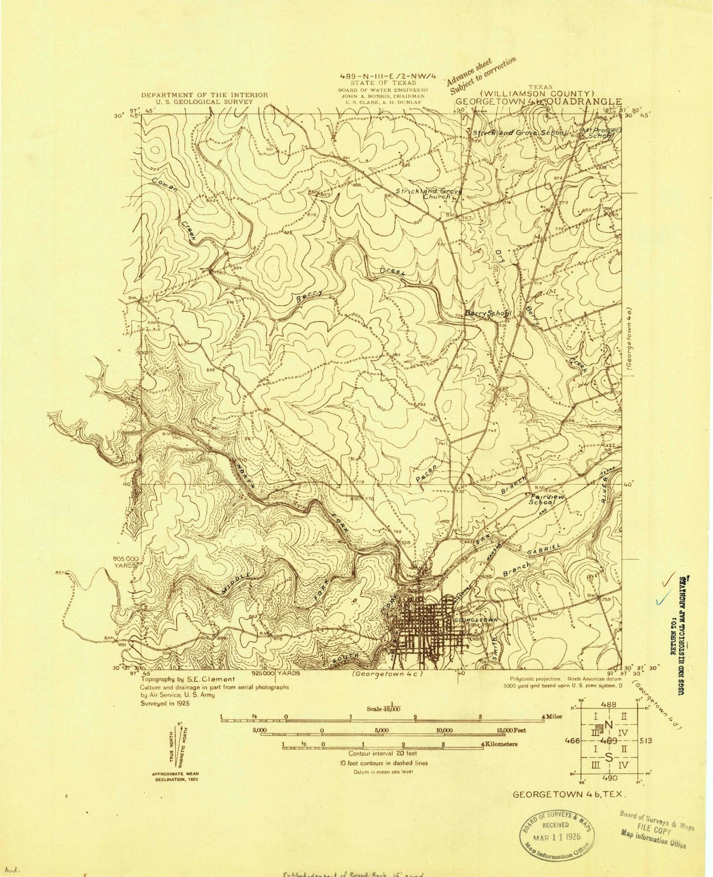
Classic USGS Georgetown Texas 7.5'x7.5' Topo Map
Couldn't load pickup availability
Historical USGS topographic quad map of Georgetown in the state of Texas. Typical map scale is 1:24,000, but may vary for certain years, if available. Print size: 24" x 27"
This quadrangle is in the following counties: Williamson.
The map contains contour lines, roads, rivers, towns, and lakes. Printed on high-quality waterproof paper with UV fade-resistant inks, and shipped rolled.
Contains the following named places: North Sam Gabriel Dam, Cowan Creek, Dry Berry Creek, Georgetown, Middle Fork San Gabriel River, Mount Prospect School, North Georgetown, Smith Branch, Strickland Grove Church, Strickland Grove School, West Fork Smith Branch, North Fork San Gabriel River, Smalley Branch, South Fork San Gabriel River, Lake Georgetown, KGTN-AM (Georgetown), KJWL-FM (Georgetown), Landry Airport, Georgetown Municipal Airport, North San Gabriel Dam, Serenada, Berry Springs, Georgetown Springs, William S Lott Juvenile Center, Raye McCoy Elementary School, The Village Elementary School, Frost Elementary School, Georgetown Alternative Center, Georgetown High School, Georgetown Ninth Grade School, Annie Purl Elementary School, Carver Elementary School, Chip Richarte Learning Center, Douglas Benold Middle School, Everett Williams Elementary School, Georgetown Firefighters Museum, Saint David's Georgetown Hospital, Harvest Baptist Church, Heritage Baptist Church, Gayhill Baptist Church, Church of Christ, Church of Christ - Strickland Grove, Grace Episcopal Church, Evangelical Free Church, Cross and Crown Lutheran Church, Faith Lutheran Church, Getzemani United Methodist Church, Saint Johns United Methodist Church, Georgetown Church of Jesus Christ of Latter Day Saints, First United Pentecostal Church, Grace Fellowship Church, Harvest Assembly of God Church, First Baptist Church, McMasters Athletics Complex, Eagle Field- Georgetown, B E Birkelbach Stadium, Cedar Breaks Park, Jim Hogg Park, San Gabriel Park, Mickler Park, Veterans of Foreign Wars Park, Mood Hall - Southwestern University Administration Building, Miller-Ellyson House, McKnight-Ebb House, McMurray House, M B and Annie Lockett House, M S Hewitt House, Martin C Amos House, Lane-Riley House, John J Dimmitt House, John Leavell House, Jesse and Sara Cooper House, Imhoff House, J H Reedy House, Harper-Chesser House, George Irvine House, Frank and Mellie Love House, E M Daughtrey House, E M Harris House, Doctor Robert Hyer House, D D Fowler House, D K and Inez Wilcox House, Casey House, Caswell House, Chesser-Morgan House, Burcham House, Bowlen House, Atkinson House, Arnold-Torbet House, A W Hawnen House, A W Sillure House, Moses Harrell House, Robert and Lula Stone House, R H and Martha Price House, Pegues House, Old Georgetown High School, Williamson County Courthouse Historical District, University Avenue-Elm Street Historic District, Belford Historic District, Railroad Produce Depot, Georgetown Light and Water Works, Wesley Chapel AME Church, Saint Johns Methodist Church, Grace Episcopal Church, First Methodist Church, Woodson and Margaret Patrick House, Wilcox-Graves House, Will and Mary Leake House, W C and Kate Vaden House, W K and Kate Makemson House, Tinnen House, Taylor-Cooper House, Saxon Motor Car Store, Sansom-Schmalenbeck House, Rouser House, S A Easley House, Falls of San Gabriel Trail, Good Water Trail, Pickett Trail, Serenada, Berrys Creek, Serenada Census Designated Place, City of Georgetown, Sun City, Georgetown Fire Department Station 2, Georgetown Fire Department Station 3, Georgetown Fire Department Station 4, Williamson County Emergency Medical Services Georgetown, Aero Jet Medical, Central Texas Emergency Medical Servie, Williamson County Emergency Medical Services, Williamson County Emergency Medical Service, Williamson County Jail, Georgetown Police Department, Williamson County Sheriff's Office, Southwestern University Police Department, Georgetown City Hall


