MyTopo
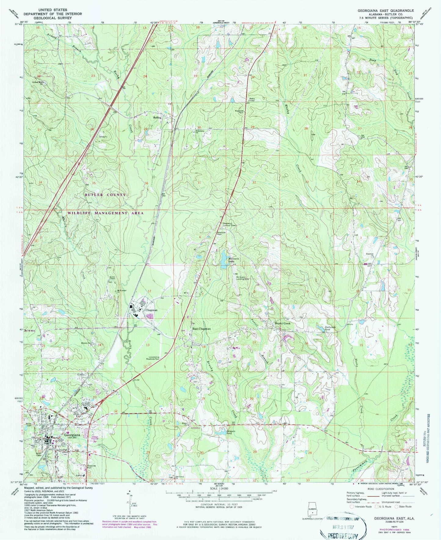
Classic USGS Georgiana East Alabama 7.5'x7.5' Topo Map
Couldn't load pickup availability
Historical USGS topographic quad map of Georgiana East in the state of Alabama. Map scale may vary for some years, but is generally around 1:24,000. Print size is approximately 24" x 27"
This quadrangle is in the following counties: Butler.
The map contains contour lines, roads, rivers, towns, and lakes. Printed on high-quality waterproof paper with UV fade-resistant inks, and shipped rolled.
Contains the following named places: Antioch West Cemetery, Antioch West Church, Arnold Branch, Bethel Church, Boiling Church, Bolling, Bolling School, Brushey Creek Cemetery, Brushy Creek, Brushy Creek Church, Brushy Creek School, Chapman, Chapman Church, Chapman Depot, Chapman Division, Chapman Lookout Tower, Chapman Post Office, Chapman School, East Chapman, East Chapman Church, East Chapman School, First Baptist Church, First United Methodist Church, Friendship Church, Georgiana, Georgiana Church of Christ, Georgiana High School, Georgiana Hospital, Georgiana Police Department, Georgiana Post Office, Georgiana Volunteer Fire Department, Green-Moore Church, Greenmore School, Hickory Grove Church, Hopewell Cemetery, Hopewell Church, Kenzie Chapel, Locomotive Roadside Park, Martin Creek, Mashy Creek, McGowin Dam, McGowin Field, McGowin Lake, Milner Cemetery, Mount Pleasant Church, Oak Grove Cemetery, Oak Grove Church, Oak Grove School, Oakwood Cemetery, Powell Branch, R L Austin High School, Rose Library, Skippers Pond, Stallworth Pond, Town of Georgiana, Union Cemetery, Union Church, Wildfork