MyTopo
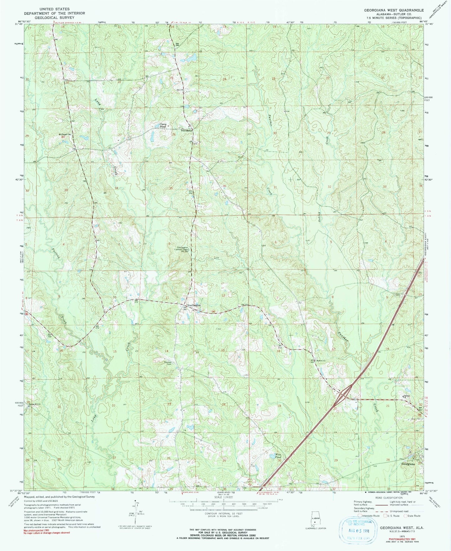
Classic USGS Georgiana West Alabama 7.5'x7.5' Topo Map
Couldn't load pickup availability
Historical USGS topographic quad map of Georgiana West in the state of Alabama. Map scale may vary for some years, but is generally around 1:24,000. Print size is approximately 24" x 27"
This quadrangle is in the following counties: Butler.
The map contains contour lines, roads, rivers, towns, and lakes. Printed on high-quality waterproof paper with UV fade-resistant inks, and shipped rolled.
Contains the following named places: Beacon, Calvary Church, Casey Pond, Ebenezer Cemetery, Ebenezer Missionary Baptist Church, Furlong Creek, Morrow Church, Mount Pisgah Cemetery, Mount Pisgah Church, Mount Pisgah School, Oaklog Creek, Providence, Providence Church, Spring Hill Church, Stamps Cemetery, Starlington, Starlington Church, Starlington Lookout Tower, Starlington Volunteer Fire Department, W O Blackmon Dam, Wise Pond, ZIP Code: 36033