MyTopo
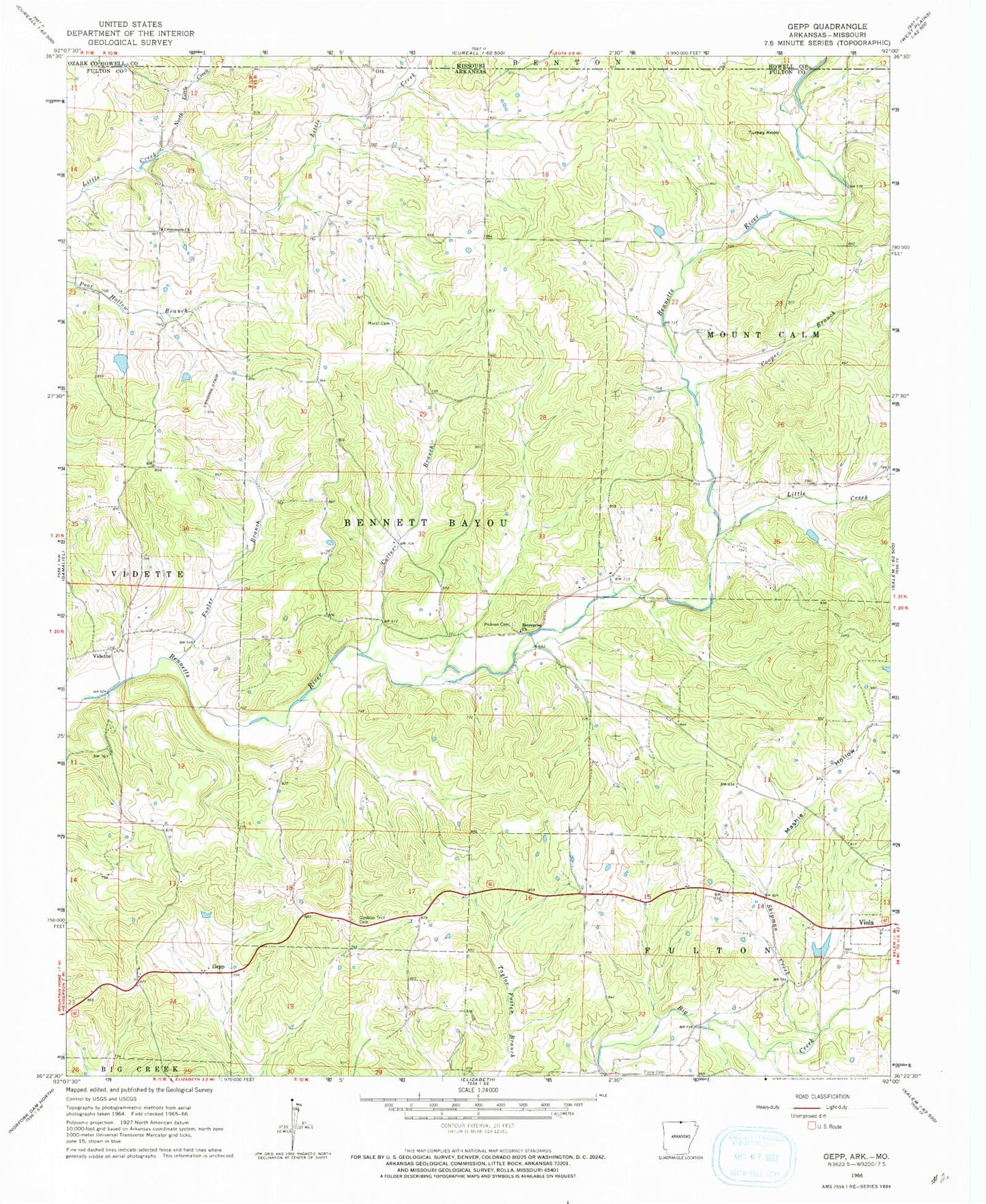
Classic USGS Gepp Arkansas 7.5'x7.5' Topo Map
Couldn't load pickup availability
Historical USGS topographic quad map of Gepp in the states of Arkansas, Missouri. Map scale may vary for some years, but is generally around 1:24,000. Print size is approximately 24" x 27"
This quadrangle is in the following counties: Fulton, Howell, Ozark.
The map contains contour lines, roads, rivers, towns, and lakes. Printed on high-quality waterproof paper with UV fade-resistant inks, and shipped rolled.
Contains the following named places: Argosy, Bailey Branch, Cooper Branch, Cotter Branch, Crossroads Church, East Arkansas Council Boy Scouts Lake, Enterprise Church, Flora Cemetery, Foster Branch, Gepp, Gepp Post Office, Gepp Volunteer Fire Department, Gobbler Trot Cemetery, Heldebrend Lake, Heldebrend Lake Dam, Hurst Cemetery, Lake Bertie, Lake Bertie Dam, Little Creek, Mashie Hollow, North Little Creek, Ott, Pickren Hall, Pickren Hall Cemetery, Pine Trail Reservation Lake Dam, Shipman Creek, Township of Bayou, Township of Bennett Bayou, Township of Vidette, Turkey Knob, Vidette, ZIP Code: 72538