MyTopo
Classic USGS Germania Wisconsin 7.5'x7.5' Topo Map
Couldn't load pickup availability
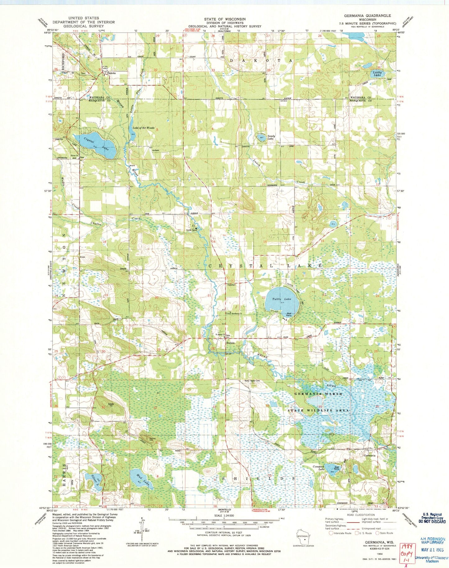
Historical USGS topographic quad map of Germania in the state of Wisconsin. Typical map scale is 1:24,000, but may vary for certain years, if available. Print size: 24" x 27"
This quadrangle is in the following counties: Marquette, Waushara.
The map contains contour lines, roads, rivers, towns, and lakes. Printed on high-quality waterproof paper with UV fade-resistant inks, and shipped rolled.
Contains the following named places: Budsin, Chaffee Creek, Comstock Lake, Crystal Lake, Dakota, Germania, Germania Marsh State Wildlife Area, Little Pine Creek, Lucky Lake, Matz Tagatz Cemetery, Mud Lake, Sandy Lake, Silver Lake, Stone Church, Stone Hill, Tuttle Lake, United Brethren Church, Wedde Creek, Town of Crystal Lake, Lang G 781.4 Dam, Little Pine Pond 20, Wilcox E1423 Dam, Germania 2wp1344 Dam, 155 Reservoir, Wilcox G2982 Dam, Saint Johns Church, Lake of the Woods, Emmanuel Evangelical Crystal Lake Cemetery, Saint Johns Lutheran Cemetery, Saint Paul Lutheran Cemetery, Comstock Bog-Meadow State Natural Area, Germania Wet Prairie State Natural Area, Mount Pisgah, Mud Lake, Needham Pond