MyTopo
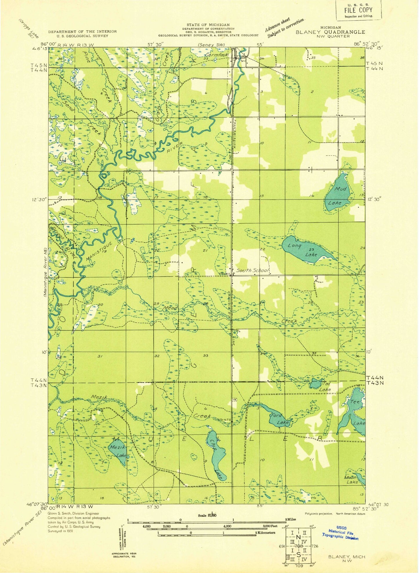
Classic USGS Germfask Michigan 7.5'x7.5' Topo Map
Couldn't load pickup availability
Historical USGS topographic quad map of Germfask in the state of Michigan. Map scale may vary for some years, but is generally around 1:24,000. Print size is approximately 24" x 27"
This quadrangle is in the following counties: Schoolcraft.
The map contains contour lines, roads, rivers, towns, and lakes. Printed on high-quality waterproof paper with UV fade-resistant inks, and shipped rolled.
Contains the following named places: A Pool, Big Cedar Campground, Blaney Cemetery, Chip Lake, Driggs River, Ford Lake, Germfask, Germfask Cemetery, Germfask Church, Germfask Post Office, Germfask Station, Germfask United Methodist Church, Grace Church, Grays Creek, Kennedy Lake, Lower Goose Pen Pool, Mead Creek, Mead Creek Campground, Mezik Lake, Old Germfask Cemetery, Pine Creek, Sand Creek, Stewart Lake, T Pool, Tad Creek, Tad Lake, Tee Lake, Township of Germfask, Upper Goose Pen Pool, ZIP Code: 49836